| Piú votate - A Tribute To Mars Global Surveyor |

South_Polar_Features-Defrosting_Dunes-2005_06-PCF-LXTT.jpgDefrosting Dunes (Natural Colors; credits for the additional process. and color.: Dr Paolo C. Fienga - Lunexit Team)79 visitenessun commentoMareKromium
(8 voti)
|
|

Craters-Unnamed_Crater-South_Polar_Regions-PIA03921-PCF-LXTT.jpgUnnamed South Polar Defrosting Crater (Absolute Natural Colors; credits for the additional process. and color.: Dr Paolo C. Fienga - Lunar Explorer Italia)72 visitenessun commentoMareKromium
(8 voti)
|
|

Craters-Unnamed_Crater_with_Intra-crater_Dunes-M0700566-01.jpgIntra-Crater Dunes (EDM)66 visitenessun commento
(8 voti)
|
|
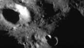
Phobos_from_Mgs-009.jpgPhobos, from MGS (Original NASA/MGS/MSSS Full Frame n. 3)65 visiteLett. E: il secondo (più piccolo, ma certo non meno inesplicabile) Monolito di Phobos.
Nota: nella parte superiore del frame sono visibili anche altri rilievi colonnari - riconoscibili a causa delle ombre assolutamente peculiari che proiettano in condizioni di illuminazione radente - ancora più piccoli.
Le "Colonne di Phobos" e le "Cuspidi di Blair": potrebbe esistere una connessione? Questi rilievi possono essere il frutto di processi geologici simili?
Che ne pensate?MareKromium
(8 voti)
|
|

Craters-Unnamed_Crater-North_Polar_Regions-MGS-1.jpgUnnamed Crater in the Northern Plains (Original NASA/MGS/MSSS b/w Frame)83 visitenessun commento
(8 voti)
|
|

Dunes-Ogygis_Region-MGS.jpgThe Dunes of Ogygis (Original NASA/MGS/MSSS b/w Frame)63 visiteCaption NASA originale:"This MGS-MOC image shows dark Sand Dunes, with a thin coating of Autumn Frost, in the Ogygis Regio, West of the Argyre Basin. The steepest Slopes on the Dunes (such as their "Slip Faces"), point toward the North-North/East (lower left), indicating that the Dominant Winds in the Region blow from the South-South/West (upper right)".
Location near: 50,4° South Lat. and 66,6° West Long.
Image width: ~3 Km (~1,9 mi)
Illumination from: upper left
Season: Southern Autumn
(8 voti)
|
|

Craters-Unnamed_Crater_with_Pedestal-MGS.jpgUNnamed "Pedestal Crater"64 visiteCaption NASA originale:"This MGS-MOC image shows a "pancake" or "pedestal" crater on the Martian Northern Plains. The rocky ejecta from the crater protected the underlying material from being stripped away by wind, leaving the ejecta standing higher than the surrounding terrain. The rocks in the ejecta are not too clearly seen today, especially at the 6 mt (~20 feet) per pixel scale of this image, in part because they have been covered up by later, mantling material".
Location near: 60,0° North; 265,6° West
Image width: ~3 Km (~1,9 mi)
Illumination from: lower left
Season: Northern Spring
(8 voti)
|
|

Aeolian_Features-Dust_Devil-MGS-00.jpgRunning Winds... (Original NASA/MGS/MSSS b/w Frame)65 visiteCaption NASA originale:"This MGS-MOC image shows a bright plain West of Schiaparelli Crater, which is host to several features, some of them long-lived and others that are transient. The circular features scattered somewhat randomly throughout the scene are impact craters, all of which are in a variety of states of degradation.
Toward the right (Dx - South-West) corner of the image, there is a small hill surrounded by ripples of windblown sediment, and near the center (a little to the left) of the image, there is an active DD casting a shadow to the east as it makes its way across the plain".
Location near: 5,9° South; 348,2° West
Image width: ~3 Km (~1,9 mi)
Illumination from: upper left
Season: Southern Autumn
(8 voti)
|
|

North_Polar_Features-Dunes-MGS-00.jpgNorth Polar Dunes (Original NASA/MGS/MSSS b/w Frame)64 visiteCaption NASA originale:"This MGS-MOC image shows dunes in the North Polar Region of Mars. In this Springtime view, the dunes are largely covered by frozen Carbon Dioxide (CO2) that was deposited during the Winter months in the Northern Hemisphere. Dark spots indicate areas where the frost has begun to either sublime away, acquire a roughened texture, or both".
Location near: 77,3° North; 95,4° West
Image width: ~3 Km (~1,9 mi)
Illumination from: lower left
Season: Northern Spring
(8 voti)
|
|

Craters-Unnamed_Craters-MGS.JPGMartian "Spectacles"! (Original NASA/MGS/MSSS b/w Frame)63 visiteCaption NASA originale:"This MGS-MOC image shows a pair of partially-buried impact craters which are being exhumed on a plain east of Hellas in the Promethei Terra Region Mars".
Location near: 45,5° South; 256,5° West
Image width: ~3 Km (~1,9 mi)
Illumination from: upper left
Season: Southern Autumn
Nota: "spectacles"---> occhiali
(8 voti)
|
|

Volcanic_Features-Collapse_Pit_Chain-Tharsis_Tolus-MGS.JPGCollapse Pit-Chain near Tharsis Tholus (Original NASA/MGS/MSSS b/w Frame)73 visiteCaption NASA originale:"This MGS-MOC mage shows a portion of a Chain of Collapse Pits on a Lava and Dust-covered Plain, North/West of Tharsis Tholus —one of the many volcanic constructs in the Tharsis Region of Mars.
Pit chains, such as this one, are associated with the collapse of surface materials into subsurface voids formed by faulting and expansion — or extension — of the bedrock".
Location near: 16,4° North Lat. and 92,6° West Long.
Image width: ~3 Km (~1,9 mi)
Illumination from: lower left
Season: Northern Winter
(8 voti)
|
|

Troughs-Olympica_Fossae-MGS-02.jpgThe Troughs of Olympica Fossae (2 - Original NASA/MGS/MSSS b/w Frame)75 visiteCaption originale:"This MGS-MOC image shows a complex pattern of intersecting and overlapping Troughs in the Olympica Fossae Region of Northern Tharsis. Some combination of Floods, Lava Flows and faulting/tectonic activity contributed to this scene, followed by mantling by dust. Dark Streaks on Slopes in the Troughs were formed by Dust Avalanches".
Location near: 24,8° North Lat. and 114,8° West Long.
Image width: ~3 Km (~1,9 mi)
Illumination from: lower left
Season: Northern Winter
(8 voti)
|
|
| 512 immagini su 43 pagina(e) |
 |
|
|
|
|
9 | |
|
|
|
|








