| Piú votate - A Tribute To Mars Global Surveyor |

Martian_Mountains-MGS-01.jpgCharitum Montes (Natural Colors; credits: NASA/MGS/MSSS)145 visiteCaption originale: "This is a perspective view of the Charitum Montes, the Mountain Range that bounds Southern Argyre Planitia, created by combining red and blue Mars Global Surveyor (MGS) Mars Orbiter Camera (MOC) wide angle images with topography from the MGS Mars Orbiter Laser Altimeter (MOLA). Carbon dioxide frost coats some of the hills, craters, and mountainsides in this southern springtime image. The picture is located near 57° South Lat. and 43°West Long. North is toward the top, South toward the bottom. Sunlight illuminates the scene from the upper left. The area shown is about 355 Km. A smaller portion of this image was previously released in July 2003 as "Frosty Mountains." 
(23 voti)
|
|

Phobos-Phobos_Monolith-00.jpgThe "Phobos' Monolith" (CTX Frame)308 visitenessun commento
(37 voti)
|
|

Martian_Limb-MGS-E23-00100_limb-00.jpgMartian Limb and Outer Space (Original NASA/MGS/MSSS b/w Frame)179 visitecaption originale: "The Mars Global Surveyor (MGS) Mars Orbiter Camera (MOC) red and blue wide angle cameras provide daily coverage of the Red Planet "from Limb to Limb." The "Limbs" are the edges of the Planet as seen to the West and East of the spacecraft. Depending on weather conditions, Clouds or Haze can sometimes be seen above the Limb. This picture was taken by the blue camera in December 2002. It is an oblique view looking Westward across heavily Cratered Terrain at High Southern Latitudes. A thin line of Haze, high in the Martian Atmosphere, can be seen above the Planet's Surface. The view of Craters in the foreground is enhanced by the presence of bright, winter-time CO2 Frost. The darkness above the Limb is outer space".
(30 voti)
|
|

Martian_Mountains-MGS-02.jpgCharitum Montes (Natural Colors; credits: NASA/MGS/MSSS)163 visitenessun commento
(30 voti)
|
|

Martian_Limb-MGS-E23-00100_limb-01.jpgMartian Limb, Clouds, Haze and Outer Space (Original NASA/MGS/MSSS b/w Frame)138 visiteCaption originale:"Mars Global Surveyor orbits the Red Planet 12 times each day. Half of each orbit is spent on the day side of Mars, which is where most Mars Orbiter Camera images are obtained because sunlight is required to illuminate the Surfaces being observed. However, on the night side of Mars, the wide angle cameras can see clouds and hazes above the sunward Martian Limb. This blue wide angle camera image, obtained on the night side of Mars on May 15, 2003, shows Clouds picking up the first sunlight before dawn near 55° North Latitude. The scene is illuminated by sunlight from the right. The Sun is actually on the other side of the Planet and has not yet risen over this Region. The dark area on the left side of the picture is the Martian Surface at night. The dark band on the right side is Outer Space. The bright features just right of center are the Clouds hanging above the Martian Limb over Mars' Northern Plains. North is up and the Spacecraft was moving Southward when the image was acquired".
(34 voti)
|
|

Thaumasia_Region-The_Electric_Dunes-05.jpgThe "Bright Dunes" of Thaumasia (CTX Frame - Enhanced Natural Colors; credits for the additional process. and color.: Dr Paolo C. Fienga - Lunexit Team)63 visiteLe "Dune Luminose" di Thaumasia: per una Scuola di Pensiero si tratta di tubazioni, un tempo interrate, le quali sono state poi riportate alla luce dalla combinazione di azioni geologiche (da un lato) e meteorologiche (dall'altro). Tubazioni metalliche i cui scopi sono un mistero che, probabilmente, è destinato a rimanere tale.
Per altri Ricercatori, invece, si potrebbe trattare di spezzoni visibili di tunnel traparenti i quali, sempre a causa del concorso fra azioni geologiche (sismi, subsidenze, fratture tettoniche etc.) ed azioni meteorologiche (piogge torrenziali, alluvioni, venti et sim.), sono "emersi" dalle profondità del Pianeta Rosso sino a rendersi, in parte, visibili.
Per altri ancora, infine, si potrebbe trattare delle strutture che reggevano i tunnels di cui sopra (diciamo gli scheletri di queste ipotetiche costruzioni).
Per la NASA, si tratta di "ripples", ossìa di dune costituite da sabbie rapprese e, nel tempo, divenute simili a rocce (ancorchè - relativamente - fragili).
L'ESA è d'accordo con questa costruzione ma - e diremmo "ovviamente" - nè la NASA, nè l'ESA spiegano il motivo di questa albedo così inusuale per delle strutture rocciose.
Noi, come Gruppo di Ricerca Indipendente, riteniamo che queste strutture sìano, di fatto, dei rilievi naturali. Il motivo della loro "luminosità", come Geologia e Razionalità ci suggeriscono, dovrebbe essere ricercato - prima di lasciarsi andare a teorizzazioni esotiche (e prive di fondamenta) - nella composizione di questi rilievi. Svariate aree di Marte "brillano" e, come Spirit stesso ha già evidenziato, la superficie di Marte è ricca di sali e di sostanze aventi una natura ed una struttura cristallina.
Forse, prima di pensare a "tubi" e "tunnel", varrebbe la pena di pensare anche a sali, quarzi, superfici vetrificate e - perchè no? - ghiaccio.
(9 voti)
|
|
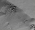
Craters-Lyell_Crater-00.jpgLyell Crater's Gullies (Original NASA/MGS/MSSS b/w Frame)71 visiteCaption originale:"This MGS-MOC image shows a suite of Gullies on a Scarp in Lyell Crater".
Location near: 69,7° South Lat. and 14,0° West Long.
Image width: ~3 Km (~1,9 mi)
Illumination from: upper left
Season: Southern Summer
(7 voti)
|
|

Craters-Lyell_Crater-01.jpgLyell Crater's Gullies (Natural Colors; credits for the additional process. and color.: Dr Paolo C. Fienga - Lunexit Team)201 visiteCaption originale:"This MGS-MOC image shows a suite of Gullies on a Scarp in Lyell Crater".
Location near: 69,7° South Lat. and 14,0° West Long.
Image width: ~3 Km (~1,9 mi)
Illumination from: upper left
Season: Southern SummerMareKromium
(5 voti)
|
|
| 512 immagini su 43 pagina(e) |
 |
|
|
|
|
|
|
|
|
43 |
|








