| Piú votate - A Tribute To Mars Global Surveyor |

Inca-City-AB107908.jpgA true "South Polar Oddity": Inca City (1)64 visiteDati contestuali di riferimento:
Longitude of image center: 64,63° West
Latitude of image center: 81,48° South
Scaled pixel width: 15,47 mt
Scaled image width: 31,88 Km
Scaled image height: 32,87 Km
Solar longitude (Ls): 246,89°
Local True Solar Time (M.L.T.): 12,90 (decimal hours) such as --> 12:54
Emission angle: 58,14°
Incidence angle: 58,59°
Phase angle: 25,53°
North azimuth: 250,10°
Sun azimuth: 238,48°
Spacecraft altitude: 3222,87 Km
Slant distance: 4167,30 Km
(4 voti)
|
|

Inca-City-M0306902-01.jpgA true "South Polar Oddity": Inca City (3 - False Colors)63 visiteThe Mars Global Surveyor (MGS) Mars Orbiter Camera (MOC) has provided new information about the "Inca City" ridges, though the camera's images still do not solve the mystery. The new information comes in the form of a MOC red wide angle context frame taken in Mid-Southern Spring (Image 1). The MOC image shows that the "Inca City" ridges, located at 82° South and about 67° West (293° East), are part of a larger circular structure that is about 86 Km (about 53 mi) across. It is possible that this pattern reflects an origin related to an ancient, eroded meteor impact crater that was filled-in, buried, then partially exhumed. In this case, the ridges might be the remains of filled-in fractures in the bedrock into which the crater formed, or filled-in cracks within the material that filled the crater. Or both explanations could be wrong. While the new MOC image shows that "Inca City" has a larger context as part of a circular form, it does not reveal the exact origin of these Striking and Unusual Martian Landforms.
(4 voti)
|
|

Phobos_from_MGS-004.jpgPhobos from Mars Global Surveyor (5)70 visitenessun commento
(4 voti)
|
|

Aeolian_Features-Dust_Devil-Argyre_Planitia.JPGDust Devil in Argyre Planitia (Original NASA/MGS/MSSS b/w Frame)73 visiteCaption NASA originale:"This MGS-MOC image shows Dust Plumes created by gusting winds on a Plain SouthWest of Argyre Planitia".
Location near: 67,0° South; 75,2° West
Image width: ~3 Km (~1,9 mi)
Illumination from: upper left
Season: Southern Autumn
(4 voti)
|
|

Craters-Unnamed_Fresh_Crater_in_Noctis_Labyrinthus-MGS.jpgFresh Crater (Original NASA/MGS/MSSS b/w Frame)65 visiteCaption NASA originale:"This MGS-MOC image shows a relatively Fresh Crater with dark, rayed Ejecta on an upland plain above one of the many depressions in the Eastern Labyrinthus Noctis Region. The presence of the dark rays emanating from the Crater suggests that the impact was a relatively recent event compared to other Craters of similar diameter in the scene. Over time, the dark Ejecta will fade and blend in with its surroundings, owing to settling of Dust from the Atmosphere".
Location near: 9,7° South Lat. and 94,8° West Long.
Image width: ~3 Km (~1,9 mi)
Illumination from: upper left
Season: Southern Summer
(4 voti)
|
|

Chaotic_Terrain-Aram_Chaos-R2200155-08.jpgThe "Many Faces" of Aram Chaos (9 - EDM n. 8 - Original NASA/MGS/MSSS b/w Frame)81 visiteE' del tutto ovvio, poi, che entrambe le costruzioni - sia quella del Dr Skipper, sia la nostra - potrebbero essere errate, poichè potrebbero non esistere acque superficiali su Marte: nè nella Regione di Aram Chaos, nè altrove.
Ed anche questa, in fondo, è un'ipotesi plausibile.
Che dire? Una sola cosa è certa: le immagini che riceviamo (cioè quelle cosiddette "pubbliche") sono inaffidabili, purtroppo. Talvolta qualcosa sembra sfuggire ai "censori", ma tante altre volte non si sa mai che cosa effettivamente si stia commentando.
La Verità? La Verità è un bene riservato a pochi. E la cosa più triste è che questi pochi sono individui che, di fatto, "paghiamo noi": con le nostre tasse, il nostro lavoro ed i nostri sacrifici.
E che cosa riceviamo in cambio? Oceani di panzane, informazioni distorte (quando va bene) o totalmente false negli altri casi. Immagini brutte e sfuocate (e magari importantissime) e dettagli splendidi (ma rifatti al pc o, se reali, completamente insignificanti).
(4 voti)
|
|

Chaotic_Terrain-Aram_Chaos-R2200155-07.jpgThe "Many Faces" of Aram Chaos (8 - EDM n. 7 - Original NASA/MGS/MSSS b/w Frame)77 visitePremesso e ribadito dunque che Marte è soggetto - ormai da secoli (noi diremmo sin dal momento in cui iniziarono le prime osservazioni dei suoi Canali) - ad un massiccio effetto-serra, come le foto della Residual Cap e delle Regioni Polari e Presso-Polari (nettamente recedenti) ci dimostrano (e come anche il Dr Skipper stesso ha evidenziato in altri suoi articoli ed investigazioni) - non ci pare esatto nè corretto teorizzare poi un qualcosa che va in diretta opposizione con quanto comunemente e scientemente ritenuto esatto (o, se non esatto, almeno "fortemente plausibile") e, di conseguenza, accettato.
Se Marte si sta davvero "scaldando", allora - con ogni probabilità - le sue (presunte) acque superficiali devono essere "acque emergenti".
Se invece si tratta di acque superficiali recedenti, allora Marte NON si sta riscaldando e l'effetto-serra è un'invenzione (come un'invenzione o una frode dovranno anche essere le immagini che ci mostrano le aree polari che recedono rapidamente di anno in anno).
(4 voti)
|
|
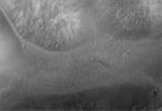
Chaotic_Terrain-Aram_Chaos-R2200155-02.jpgThe "Many Faces" of Aram Chaos (3 - EDM n. 2 - Original NASA/MGS/MSSS b/w Frame)75 visiteUna speculazione ulteriore del Dr Skipper è che una possibile forma di Civiltà Indigena Marziana stia cercando di "salvare il salvabile", ossìa - impiegando sistemi e tecnologie che non riusciamo a comprendere (nè a vedere) - stia tentando in tutti i modi di mantenere almeno un minimo di acque correnti sulla superficie di Marte.
"If so and there are actually extensive civilization populations on Mars, it may seem strange at first blush that so many of them appear to be so focused on water on such a generally arid planet to the point of even getting in the water that is left with their developments. On the other hand, if these populations have historically been part of this drying planetary reality for a very long time and have a historical memory base of more water plentiful times, it may be understandable that they may a bit compulsively try to preserve as much as possible a current semblance of the older loved conditions. Of course there may be other reasons as well"
(4 voti)
|
|
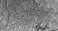
Landslides-Tithonium_Chasma-MGS-02.jpgHuge Landslide near Tithonium Chasma (Original NASA/MGS/MSSS b/w Frame)65 visiteCaption originale:"This MGS-MOC image shows a small portion of a large landslide deposit located on the floor of western Tithonium Chasma".
Location near: 4,3° South Lat. and 87,9° West Long.
Image width: ~3 Km (~1,9 mi)
Illumination from: lower left
Season: Southern Summer
(4 voti)
|
|

Channels-Inverted_Channels_in_Arabia_Terra-PIA03643-00.jpgInverted channels of Arabia Terra (1 - Original NASA/MGS/MSSS b/w Frame)68 visiteOriginal caption:"This MGS-MOC image shows a somewhat sinuous, nearly flat-topped Ridge, located in Eastern Arabia Terra. The ridgetop was once the Floor of a Valley, perhaps carved by running water. The Valley Floor, or material that covered the Floor, was more resistant to erosion than the surrounding rock into which the Valley was cut. Thus, over time, the Valley disappeared and its Floor was left standing high as a Ridge. Inverted Valleys are common on Mars, but they also occur on Earth".
Location near: 10,8° North Lat. and 313,2° West Long.
Image width: width: ~3 Km (~1,9 mi)
Illumination from: lower left
Season: Northern Winter
(4 voti)
|
|
Craters-Rabe_Crater-I-M0203079-01.jpgThe "Pitted" West Floor of Rabe Crater (2) - (Original NASA/MGS/MSSS b/w Frame)71 visitenessun commento
(4 voti)
|
|

Channels-Uzboi_Vallis-A-M1100709.jpgChannels's Network in Uzboi Vallis (1 - CTX Frame)73 visiteSe provate a riguardare le immagini ESA relative alla Sonda Huygens mentre scende verso la superficie di Titano, troverete senz'altro delle analogie con questo frame.
Quali?
Una fitta rete di "canali", per esempio. Una rete di canali in tutto e per tutto simile a quanto vediamo in questo frame, ripreso - come al solito - da un'altezza di circa 370 Km.
I "Canali di Titano" hanno fatto subito notizia e sia l'ESA, sia la NASA hanno immediatamente parlato di 'chiara analogia' fra Titano e la Terra, così come essa era ai suoi albori.
Questi "Canali", invece, non solo non hanno fatto notizia: essi non sono stati neppure visti!
Ma Voi ci credete a questa "miopìa planetaria"? Noi no. Noi pensiamo che sia più facile far viaggiare l'immaginazione delle persone (tenendole, nel contempo, tranquille...) allorchè si parla di Mondi lontani e, in apparenza, inospitali come Titano.
Quanto più le analogie con la Terra sono lontane ed improbabili, tanto più facile è evitare che vengano poste domande indiscrete...
(4 voti)
|
|
| 512 immagini su 43 pagina(e) |
 |
|
|
|
|
35 | |
|
|
|
|








