| Piú votate - A Tribute To Mars Global Surveyor |

Craters-Unnamed_Crater_in_Hellas_Planitia-1-MGS.jpgUnnamed Crater in Hellas Planitia (Absolute Natural Colors; credits for the additional process. and color.: Dr Paolo C. Fienga - Lunexit Team)225 visiteCaption NASA originale:"This MGS-MOC image shows a large crater that formed by meteor impact into the layered material in which the buried crater is encased. The layered rock, in this case, has a light tone similar to the sedimentary rocks being explored by the MER Opportunity, thousands of kilometers away in Sinus Meridiani".
Location near: 24,9° South; 299,3° West
Image width: ~3 Km (~1,9 mi)
Illumination from: upper left
Season: Southern Summer MareKromium
(4 voti)
|
|

Vastitas_Borealis-M0303289.jpgClouds over Vastitas Borealis242 visiteLongitude of image center: 28,49° West
Latitude of image center: 66,63° North
Scaled pixel width: 267,40 meters
Scaled image width: 130,20 Km
Scaled image height: 114,41 Km
Solar Longitude (Ls): 172,30°
Local True Solar Time: 14,29 decimal hours
Emission Angle: 3,68°
Incidence Angle: 67,74°
Phase Angle: 65,30°
North Azimuth: 96,31°
Sun Azimuth: 313,92°
Spacecraft Altitude: 427,87 Km
Slant Distance: 428,66 KmMareKromium
(4 voti)
|
|

Vastitas_Borealis-M0301821.jpgVastitas Borealis258 visiteLongitude of image center: 29,58° West
Latitude of image center: 66,50° North
Scaled pixel width: 267,54 meters
Scaled image width: 130,27 Km
Scaled image height: 114,38 Km
Solar Longitude (Ls): 168,37°
Local True Solar Time: 14,28 decimal hours
Emission Angle: 3,69°
Incidence Angle: 66,00°
Phase Angle: 63,52°
North Azimuth: 96,29°
Sun Azimuth: 314,23°
Spacecraft Altitude: 428,08 Km
Slant Distance: 428,87 KmMareKromium
(4 voti)
|
|

Vastitas_Borealis-M0306119-1.jpgVastitas Borealis263 visiteLongitude of image center: 28,26° West
Latitude of image center: 71,68° North
Scaled pixel width: 268,68 meters
Scaled image width: 130,88 Km
Scaled image height: 114,11 Km
Solar Longitude (Ls): 180,32°
Local True Solar Time: 14,19 decimal hours
Emission Angle: 3,74°
Incidence Angle: 74,85°
Phase Angle: 72,45°
North Azimuth: 97,87°
Sun Azimuth: 312,21°
Spacecraft Altitude: 430,20 Km
Slant Distance: 431,01 KmMareKromium
(4 voti)
|
|

Vastitas_Borealis-M0307443.jpgVastitas Borealis (Absolute Natural Colors; credits for the additional process. and color.: Dr Paolo C. Fienga - Lunexit Team)232 visiteLongitude of image center: 26,70° West
Latitude of image center: 68,76° North
Scaled pixel width: 1068,74 meters
Scaled image width: 633,33 Km
Scaled image height: 426,66 Km
Solar Longitude (Ls): 184,40°
Local True Solar Time: 14,19 decimal hours
Emission Angle: 0,51°
Incidence Angle: 74,18°
Phase Angle: 73,86°
North Azimuth: 97,77°
Sun Azimuth: 312,39°
Spacecraft Altitude: 429,32 Km
Slant Distance: 429,33 KmMareKromium
(4 voti)
|
|

Vastitas_Borealis-M0307444.jpgVastitas Borealis (Absolute Natural Colors; credits for the additional process. and color.: Dr Paolo C. Fienga - Lunexit Team)232 visiteLongitude of image center: 27,88° West
Latitude of image center: 68,70° North
Scaled pixel width: 1080,62 meters
Scaled image width: 649,17 Km
Scaled image height: 426,91 Km
Solar Longitude (Ls): 184,40°
Local True Solar Time: 14,11 decimal hours
Emission Angle: 3,35°
Incidence Angle: 73,89°
Phase Angle: 76,19°
North Azimuth: 98,87°
Sun Azimuth: 312,30°
Spacecraft Altitude: 429,32 Km
Slant Distance: 429,97 KmMareKromium
(4 voti)
|
|

North_Polar_Cap-M0303936-PCF-LXTT.jpgFrame M0303936 - The North Polar Cap (Natural Colors; credits for the additional process. and color.: Dr Paolo C. Fienga - Lunexit Team)238 visitenessun commentoMareKromium
(4 voti)
|
|

Volcanic_Features-Lava_Flows-Olympus_Mons-MGS-PCF-LXTT.jpgOlympus' Lava Flows (Absolute Natural Colors; credits for the additional process. and color.: Dr Paolo C. Fienga - Lunexit Team)435 visitenessun commentoMareKromium
(4 voti)
|
|

Tithonium_Chasma-MGS-PCF-LXTT-1.jpgHuge Landslide in Tithonium Chasma (Natural Colors; credits for the additional process. and color.: Dr Paolo C. Fienga - Lunexit Team)295 visiteCaption NASA originale:"This MGS-MOC image shows a landslide that occurred off of a steep slope in Tithonium Chasma, part of the vast Valles Marineris Trough System".
Location near: 4,8° South Lat.; 84,6° West Long.
Image width: ~3 Km (~1,9 mi)
Illumination from: upper left
Season: Southern AutumnMareKromium
(4 voti)
|
|

Tithonium_Chasma-MGS-PCF-LXTT-2.jpgTithonium Chasma (Natural Colors; credits for the additional process. and color.: Dr Paolo C. Fienga - Lunexit Team)269 visitenessun commentoMareKromium
(4 voti)
|
|
Tharsis_Montes-MGS1.jpgJust clouds and fogs over Tharsis?74 visiteUno spettacolare frame Mars Global Surveyor, inviatoci dall'Amico e Partner, Dr Alessio Feltri, ci offre una spettacolare visione di "fumi" che sovrastano la Provincia Vulcanica di Tharsis.
Secondo la NASA si tratta di nuvole (prevalentemente costituite da vapore acqueo) e nebbie. E noi diciamo che "può darsi", anzi: è molto probabile che sia così.
Ma ora osservate questa immagine e mettetela in correlazione al recente frame Mars Express che sembrava rappresentare uno spettacolare pennacchio sollevatosi da una delle caldere del vulcano Arsia Mons (diciamo "sembrava" poichè, a parte il Gruppo Lunexit, NESSUN ALTRO si è pronunciato sull'evento!).
Siamo davvero certi che quanto si vede in questo frame sìano solo nuvole e nebbie?
Siamo davvero certi che la Provincia Vulcanica di Tharsis sia "inerte"?
Osservate attentamente la forma delle "nebbie" che sovrastano e circondano i diversi camini vulcanici ripresi e poi provate a rispondere a questa "semplice" domanda: che cosa stiamo guardando?...MareKromium
(4 voti)
|
|
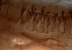
Terra_Cimmeria-Gullies-PIA02919-3.jpgGullies in Terra Cimmeria (Natural Colors; credits for the additional process. and color.: Dr Paolo C. Fienga - Lunar Explorer Italia)72 visiteCaption originale NASA:"This MGS-MOC image shows two suites of gullies within a single impact crater in the Terra Cimmeria Region. The gullies near the top of the image are located on the northern wall of the crater, while the lower suite resides on a lower bench in the crater's northern wall complex. Gully erosion has cut into the layered rock exposed on the crater wall. Water may have been involved in their formation".
Location near: 38,2° South; 190,6° West
Image width: ~3 Km (~1,9 mi)
Illumination from: upper left
Season: Southern SummerMareKromium
(4 voti)
|
|
| 512 immagini su 43 pagina(e) |
 |
|
|
|
|
34 | |
|
|
|
|








