| Piú votate - A Tribute To Mars Global Surveyor |

Terra_Cimmeria-Gullies-PIA02919-1.jpgGullies in Terra Cimmeria (Original RAW Frame)68 visiteCaption originale NASA:"This MGS-MOC image shows two suites of gullies within a single impact crater in the Terra Cimmeria Region. The gullies near the top of the image are located on the northern wall of the crater, while the lower suite resides on a lower bench in the crater's northern wall complex. Gully erosion has cut into the layered rock exposed on the crater wall. Water may have been involved in their formation".
Location near: 38,2° South; 190,6° West
Image width: ~3 Km (~1,9 mi)
Illumination from: upper left
Season: Southern Summer
(5 voti)
|
|

Clouds-South_Polar_Regions-PIA02694-1.jpgThick Clouds over the South Pole (Original NASA/MGS/MSSS b/w Frame)70 visiteThese clouds occurred near the South Polar Cap at the end of Southern Summer.
Image information: VIS instrument;
Latitude: - 80,3° North;
Longitude: 84,9° East;
Resolution: 17 meter/pixel.
(5 voti)
|
|
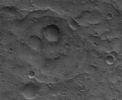
Craters-Unnamed_Crater_in_Terra_Sabaea-01.jpgBuried Crater in Terra Sabaea (Original NASA/MGS/MSSS b/w Frame)69 visiteCaption originale:"This MGS-MOC image shows a 1,5 mt (~5 feet) per pixel view of a subdued circular feature which is probably an ancient Impact Crater that was buried and only partially exhumed (a common occurrence on Mars)".
Location near: 21,9° South Lat. and 338,6° West Long.
Image width: ~3 Km (~1,9 mi)
Illumination from: upper left
Season: Southern Summer
(5 voti)
|
|

Chaotic_Terrain-Aram_Chaos-R2200155-10.jpgThe "Many Faces" of Aram Chaos (11 - EDM n. 10 - Original NASA/MGS/MSSS b/w Frame)96 visitenessun commento
(5 voti)
|
|

Chaotic_Terrain-Aram_Chaos-R2200155-06.jpgThe "Many Faces" of Aram Chaos (7 - EDM n. 6 - Original NASA/MGS/MSSS b/w Frame)89 visiteChe quanto appare nelle immagini MGS di Aram Chaos (e non serve stare a fare chissà quali ingrandimenti ed elaborazioni per cogliere un'infinità di stranezze e di possibili - ed effettive - evidenze della presenza di acque di superficie) sia incredibile e fortemente in contrasto con quanto viene ufficialmente asserito, è dato ovvio ed evidente.
Ciò che - a nostro parere - è meno evidente è un'eventuale presenza di strutture artificiali nella Regione (che non riusciamo assolutamente a vedere, neppure nelle elaborazioni operate dal Dr Skipper stesso); ciò che non ci convince è il fatto secondo cui Aram Chaos, al pari di altre Regioni di Marte, presenti "acque superficiali recedenti". Secondo noi, dati alla mano (e considerato il riscaldamento globale che è certamente in atto su Marte - un greenhouse effect davvero smodato), se davvero le acque superficiali ci sono, allora dovrebbero essere "emergenti" e NON recedenti.
(5 voti)
|
|

Chaotic_Terrain-Aram_Chaos-R2200155-04.jpgThe "Many Faces" of Aram Chaos (5 - EDM n. 4 - Original NASA/MGS/MSSS b/w Frame)80 visiteUn punto focale - e che ci vede in perfetta sintonìa con il Dr Skipper - attiene l'orrenda manipolazione distorsiva (o "tampering") che viene fatta sulle immagini MGS (o meglio: su tutte le immagini in arrivo dallo Spazio).
Una manipolazione sulle cui reali origini e motivazioni non vale davvero la pena parlarne ora e qui.
"The accumulative evidence that I've seen indicates that the suspicious rounded and oval mounts possibly represents at least indirectly different life equally dependent on this surface water resource but which adopted a different survival strategy. They do not locate on slopes or grades but in more level terrain shallow water pools or where the ground is extra water saturated for a sustained period and then form these large elevated forms. Their plentiful numbers here in Aram Chaos but smaller size relative to some that I've seen may suggest that the shrinking water conditions in Aram Chaos is a relatively more recent phenomena as opposed to a even more ancient scenario"
(5 voti)
|
|

Chaotic_Terrain-Aram_Chaos-R2200155-01.jpgThe "Many Faces" of Aram Chaos (2 - EDM n. 1 - Original NASA/MGS/MSSS b/w Frame)84 visiteIl Dr Skipper, per quanto attiene la Regione di Aram Chaos, ritiene di aver individuato (e secondo noi ha ragione) delle aree le quali ci mostrano la presenza di acque superficiali: prevalentemente si tratta di laghi e piccoli fiumi.
Egli dice che, a suo parere, queste aree rappresentano solo un modesto residuo di quelle che, un tempo, circolavano sulla superficie di Marte e che comuque anche queste acque stanno - di fatto - recedendo.
O meglio: esse stanno avviandosi a rinforzare quello che è già il sistema acquifero Marziano. Un sistema fatto di acque correnti e che, come già in molti credono (anche alla NASA...) è prevalentemente - diremmo al 95% - sotterraneo.
"I suspect that water poured into this Aram Chaos depression over a very long period of time saturating it and the subterranean ground systems under it with water. Then came along the current general long lasting dry period producing the remnants of an old very rough uneven lake bed bottom where shallow water still flows down elevated uneven portions of the chaotic terrain accumulating in the lowest catch basin areas you seen here. The cracked plate evidence seen in my first image in the right split screen in the southern part of Aram Chaos is probably washed in and compacted bottom old lake bed sediment collections in more elevated terrain there that has eventually drained dry into the lower areas and the sediment has cracked like great dry mud flats in the process"
(5 voti)
|
|

South_Polar_Features-Spiders-00.jpgSpiderland (Original NASA/MGS/MSSS b/w Frame)67 visiteCaption originale:"This MGS-MOC image shows an area adjacent to the South Polar Residual Cap that hosts several intricate fracture networks. Each network consists of multiple fractures radiating from a central location. Their origin is not understood - some investigators have speculated that these are sites of release of carbon dioxide from beneath the ground, but this explanation seems inadequate to explain all attributes of the features.
MOC images have shown that these features have not been changing from year to year during the course of the MGS mission".
Location near: 87,1° South Lat. and 234,1° West Long.
Image width: ~3 Km (~1,9 mi)
Illumination from: upper left
Season: Southern Summer
(5 voti)
|
|

South_Polar_Regions-Hills_and_Knobs.jpgHills, Knobs and Buried Craters in the South Polar Region (Original NASA/MGS/MSSS b/w Frame)71 visiteOriginal caption:"This MGS-MOC image shows a Summer scene from the South Polar Region of Mars. The circular feature in the North-East (upper right) corner of the image is an old meteor impact crater that has been partially filled and buried. The cone-shaped hill that occurs within the crater on its East (right) side is a remnant of material that once covered and completely buried the crater. Perhaps beneath the surfaces in the rest of the image there are other craters that have been filled and buried such that we cannot know, from an image, that they ever existed. The theme of filled, buried, and exhumed craters is one that repeats itself —over and over again — all over Mars".
Location near: 80,3° South Lat. and 286,1° West Long.
Image width: ~3 Km (~1,9 mi)
Illumination from: upper left
Season: Southern Summer
(5 voti)
|
|

Craters-Unnamed_Crater_Field_in_Ares_Vallis-MGS.JPGSecondary Craters' Field in Ares Vallis (Original NASA/MGS/MSSS b/w Frame)70 visiteOriginal caption:"This MGS-MOC image shows a Field of Secondary Craters located on the Plains located North of Ares Vallis, roughly 30 or 35 Km (such as about 19–22 miles) North-East of the Mars Pathfinder LS. These Craters did not form directly by individual meteor impacts: they resulted from the impact of material ejected from a much larger meteor impact that might have occurred somewhere to the South of the Region".
Nota: per i professionisti di Scienze Planetarie, suggeriamo di portare il frame sino al full-size e quindi esaminare, campionando, almeno 10/12 crateri secondari agendo sull'intera area ripresa. Noi lo abbiamo fatto e le forme che abbiamo individuate NON supportano - a nostro parere - la caption NASA. In particolare: se questa zona è effettivamente ricoperta da crateri secondari, allora dovremmo ipotizzare, dopo aver valutato le diverse angolazioni dei rilievi, che questi ejecta sono arrivati da almeno 2 (se non 3) impatti diversi e sensibilmente distanziati nel tempo.
L.N.: 19.9° N and 33,3° W
(5 voti)
|
|

Craters-Becquerel_Crater-Layers-00.jpgBeautiful Layers inside Becquerel Crater (Original NASA/MGS/MSSS b/w Frame)71 visiteOriginal caption:"This MGS-MOC image shows light-toned, layered, Sedimentary Rock Outcrops in Becquerel Crater , located in the Western Arabia Terra Region. The Crater may once have hosted a lake, into which these sediments were deposited. Although the fine, detailed layering in Becquerel was not known until the MGS-MOC first began to image these materials in 1999, the presence of a grossly-layered, light-toned feature was known from Viking orbiter images and was speculated from those data to possibly represent evidence for the presence of a former lake".
Location near: 21,5° North Lat. and 8,2° West Long.
Image width: ~3 Km (~1,9 mi)
Season: Northern Winter
(5 voti)
|
|
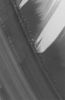
North_Polar_Regions-Unusual_Landscape-MGS-1.jpgIndecipherable North Polar Landscape (Original NASA/MGS/MSSS b/w Frame)64 visiteOriginal caption:"This MGS-MOC image shows a slope on which layered materials are exposed by erosion in the North Polar Region of Mars. Wind streaks are also evident in this Summertime scene.
The layers that make up the material beneath the ice of the North Polar Residual Cap are typically considered to be a mixture of some amount of dust and ice, but the proportions of these constituents are not known".
Location near: 82,6° N; 298,1° W
Image width: ~3 Km (~1,9 mi)
Illumination from: lower left
Season: Northern Summer
(5 voti)
|
|
| 512 immagini su 43 pagina(e) |
 |
|
|
|
|
29 | |
|
|
|
|








