| Piú votate - A Tribute To Mars Global Surveyor |

Acidalia_Planitia-Unusual_Landforms-M0300102-PCF-LXTT-03.jpgUnusual Landforms in Acidalia Planitia (EDM n.3 - Enhanced Absolute Natural Colors; credits for the additional process. and color.: Dr Paolo C. Fienga - Lunexit Team)158 visitenessun commentoMareKromium
(5 voti)
|
|

North_Polar_Cap-M0105362-PCF-LXTT.jpgFrame M0105362 - The North Polar Cap (Natural Colors; credits for the additional process. and color.: Dr Paolo C. Fienga - Lunexit Team)246 visitenessun commentoMareKromium
(5 voti)
|
|

Vastitas_Borealis-M0002208.jpgVastitas Borealis235 visiteLongitude of image center: 28,18° West
Latitude of image center: 71,71° North
Scaled pixel width: 268,77 meters
Scaled image width: 130,92 Km
Scaled image height: 114,09 Km
Solar Longitude (Ls): 124,16°
Local True Solar Time: 13,96 decimal hours
Emission Angle: 3,67°
Incidence Angle: 53,85°
Phase Angle: 51,48°
North Azimuth: 97,90°
Sun Azimuth: 312,72°
Spacecraft Altitude: 430,41 Km
Slant Distance: 431,19 KmMareKromium
(5 voti)
|
|
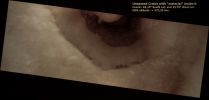
Craters-Unnamed_Crater-AB107707-00-PCF-LXTT.jpgUnnamed Crater with wide Dunefield (Absolute Natural Colors; credits for the additional process. and color.: Dr Paolo C. Fienga - Lunexit Team)101 visitenessun commentoMareKromium
(5 voti)
|
|
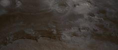
Chaotic_Terrain-Iani_Chaos-MGS.jpgFeatures of Iani Chaos (Absolute Natural Colors; credits for the additional process. and color.: Dr Paolo C. Fienga - Lunexit Team)112 visitenessun commentoMareKromium
(5 voti)
|
|

South_Polar_Regions-PIA04162.jpgDefrosting South Polar Region (Absolute Natural Colors; credits for the additional process. and color.: Dr Paolo C. Fienga - Lunexit Team)130 visiteOriginal caption:"This MGS-MOC image shows varied springtime patterns formed in defrosting, seasonal carbon dioxide frost in the South Polar Region of Mars. The feature sporting an outline of dark spots and an interior of smaller, closely-spaced dark spots and dark-outlined polygons is a patch of windblown or wind-eroded sand that was covered by carbon dioxide frost during the previous autumn and winter. The fainter, larger polygon pattern on either side of the patch of defrosting sand is formed in the substrate upon which the sand patch is sitting. Polygonal forms such as these might indicate the presence of ice below the surface".
Location near: 79,6°S; 125,0°W
Image width: width: ~3 Km (~1,9 mi)
Illumination from: upper left
Season: Southern SpringMareKromium
(5 voti)
|
|
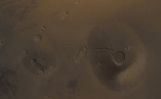
Volcanoes-Ceraunius_Tholus-MGS.jpgCeraunius, from atop (possible Natural Colors; credits: Dr Paolo C. Fienga - Lunexit Team)79 visitenessun commentoMareKromium
(5 voti)
|
|
![South_Polar_Regions-South_Pole-MGS-mg90s000[1]-PCF-LXTT-1.jpg](albums/userpics/10060/small_South_Polar_Regions-South_Pole-MGS-mg90s000%5B1%5D-PCF-LXTT-1.jpg "Nome del file=South_Polar_Regions-South_Pole-MGS-mg90s000[1]-PCF-LXTT-1.jpg
Dimensione del file=48KiB
Dimensioni=1062x1000
Aggiunta il=Ago 09, 2009")
South_Polar_Regions-South_Pole-MGS-mg90s000[1]-PCF-LXTT-1.jpgMartian South Pole and South Polar Regions, from MGS (Darkened Natural Colors; credits for the additional process. and color.: Dr Paolo C. Fienga - Lunexit Team)69 visitenessun commentoMareKromium
(5 voti)
|
|

South_Polar_Storm-PIA11982.jpgSouth Polar Dust Storm77 visiteCaption NASA:"This nearly global mosaic of observations made by the Mars Color Imager on NASA's Mars Reconnaissance Orbiter on April 2, 2009, shows billowing clouds of dust being lifted into the Atmosphere by a storm near the edge of the Seasonal Polar Cap of Southern Mars.
The season on Southern Mars is late Spring. Late Southern Spring and early Southern Summer are a peak time of the Martian year for major Dust Storms.
Atmospheric haze due to suspended dust from recent storm activity is evident elsewhere on the Planet, including the Skies over Mars rovers Opportunity (MER-B) and Spirit (MER-A).
Black areas in the mosaic are the result of data drops or high angle roll maneuvers by the Orbiter that limit the camera's view of the Planet.
Equally-spaced blurry areas that run from South-to-North (bottom-to-top) result from the high off-nadir viewing geometry, a product of the spacecraft's low-orbit.
Malin Space Science Systems, San Diego, provided and operates the Mars Color Imager. NASA's Jet Propulsion Laboratory, a division of the California Institute of Technology in Pasadena, manages the Mars Reconnaissance Orbiter for NASA's Science Mission Directorate, Washington. Lockheed Martin Space Systems, Denver, is the prime contractor for the project and built the Spacecraft".MareKromium
(5 voti)
|
|

Hellas_Planitia-MGS~0.jpgFeatures of Hellas Planitia: the "Martian Freeways" (Saturated Absolute Natural Colors; credits for the additional process. and color: Dr Paolo C. Fienga - Lunexit Team)69 visiteCaption NASA originale:"This MGS-MOC image shows an example of the extremely odd, seemingly scrambled layered rocks exposed by erosion near the deepest part of the deepest basin on Mars: Hellas. This pattern of eroded, and perhaps deformed layers was once exposed to the martian surface, then buried, and more recently exposed again. The story behind these layers is not really understood; some members of the MOC team have — for nearly 9 years now —taken to calling these features, "taffy-pull terrain".
Location near: 43,1° South; 307,3° West
Image width: ~3 Km (~1,9 mi)
Illumination from: upper left
Season: Southern Spring
Nota Lunexit: immagini come questa, a parte la loro intrinseca bellezza e la grande suggestione che riescono ad infondere in chi le guarda, hanno un Valore immenso.
Tuttavia, di quando in quando, qualche pseudo-scienziato dice che le immagini in arrivo dallo Spazio (TUTTE le immagini, senza eccezioni) sono "sostanzialmente inutili a fini di ricerca scientifica".
Noi non comprendiamo la ratio di questa frase che - onestamente - è tanto "ad effetto", quanto vuota e stupida; però una cosa ci va di dirla: forse le immagini in arrivo dallo Spazio "non servono" alla Ricerca Scientifica. Forse.
Ma CERTAMENTE non servono alla predetta Ricerca degli pseudo-scienziati (probabilmente dei ricercatori universitari falliti o fallendi) che, quando gli "gira", proferiscono impunemente (dall'alto della loro stratosferica ignoranza) simili assurdità.
Vere e proprie bestemmie, insomma, specie se si pensa a QUANTE VITE e QUANTI SOLDI sono costate e costano le "scientificamente inutili" immagini che ci arrivano dal resto del Sistema Solare.
Morale: certa gente dovrebbe solo tacere, rivoltarsi nel proprio guano e vergognarsi.MareKromium
(5 voti)
|
|
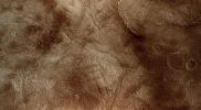
Hellas_Planitia-MGS~1.jpgValley in Hellas Planitia (Absolute Natural Colors; credits for the additional process. and color.: Dr Paolo C. Fienga - Lunexit Team) 68 visiteCaption originale:"This MGS-MOC image shows a valley which has become partially-filled with material. It is located West of Hellas Planitia. The valley, entering the scene from the East (lower side), turns toward the South-West (upper right) and splits to form a "V". Partially-filled depressions are common throughout the scene, including the circular feature near the top of the image.
In each such case, the filling material is probably the remains of a material that once covered the entire scene".
Location near: 48,4° South; 318,1° West
Image width: ~3 Km (~1,9 mi)
Illumination from: upper left
Season: Southern SummerMareKromium
(5 voti)
|
|
Craters-Hellespontus_Crater-1-M0201817Det.jpgFrost on the dunes of Hellespontus Crater (Natural Colors; credits for the additional process. and color.: Dr Paolo C. Fienga - Lunar Explorer Italia)70 visitenessun commentoMareKromium
(5 voti)
|
|
| 512 immagini su 43 pagina(e) |
 |
|
|
|
|
26 | |
|
|
|
|








