| Piú votate - A Tribute To Mars Global Surveyor |
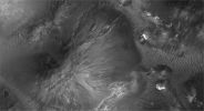
Chaotic_Terrain-Aram_Chaos-R2200155-03.jpgThe "Many Faces" of Aram Chaos (4 - EDM n. 3 - Original NASA/MGS/MSSS b/w Frame)82 visiteIl Dr Skipper, da Ricercatore equilibrato quale è, non sembra optare in maniera netta e decisa (come invece fa il Prof. Hoagland e la sua Scuola) verso l'ipotesi "artificiale e tecnologica" di alcuni degli stranissimi rilievi di Aram Chaos, ma la possibilità - più o meno remota - che qualcuno o qualcosa stia cercando di preservare qualche frammento del "Marte che fu" non è da buttar via aprioristicamente.
Ciò su cui Skipper sembra essere davvero certo, invece, è lo status attuale di Aram Chaos: un tempo un grande lago, oggi un'area soggetta a desertificazione e progressivo inaridimento.
"The older more ancient ecology was no doubt one of a lake in this crater depression. The more recent ecology then is one of a gradually drying old lake bed with diminishing shallow water flowing down many elevated slopes and grades in this generally rough uneven terrain accumulating in the bottom lowest depression catch basin areas. I suspect that some kind of life as represented by the ridge form evidence has followed the receding shallow water flows spreading down the slopes and grades in this shrinking water environment. The orientation of the ridge form evidence many parallel ridges identifies the direction of the shallow water flow down between the ridges as what ever life this represents attempts to follow and husband this gradually diminishing natural resource"
(6 voti)
|
|

Chaotic_Terrain-Aram_Chaos-R1501664-00.jpgThe "Many Faces" of Aram Chaos (1 - Original NASA/MGS/MSSS CTX b/w Frame)86 visiteVi avevamo già parlato, in passato, degli studi fatti da un tale Dr Joseph Skipper sia sulla Luna che su Marte. Si trattava - e si tratta - di analisi fotografiche seguite da analisi (giustamente) speculative sul "che cosa si veda effettivamente" in tanti frames NASA.
RinviandoVi al Sito del Dr Skipper per la lettura di tutta la sua (notevole e ben argomentata) teorizzazione - www.marsanomalyresearch.com - abbiamo deciso di proporVi nelle nostre pagine una "summa" di una sua inchiesta, prendendo ad esempio le spettacolari immagini di una porzione della enigmatica Regione Marziana conosciuta come Aram Chaos.
E' evidente che su alcuni dati ed aspetti siamo in accordo con lui; per altri dati ed aspetti, no: ma questo fa parte della Umana Natura, non credete?
Caption originale:"MOC red wide-angle context image R22-00156 -
Local True Solar Time: 14:35 (approx)
Emission angle: 18.05°
Incidence angle: 43.52°
Phase angle: 35.00°
Spacecraft altitude: 388,48 Km
Slant distance: 406,36 Km
(6 voti)
|
|

Craters-Terby_Crater-02.jpgThe Sedimentary Layers of Terby Crater (2 - Original NASA/MGS/MSSS b/w Frame)72 visitenessun commento
(6 voti)
|
|

Chaotic_Terrain-Eos_Chaos-00.jpgFeatures of Eos Chaos: Circular Butte (Original NASA/MGS/MSSS b/w Frame - 1)70 visiteOriginal caption:"This MGS-MOC image shows light-toned, Layered Rock Outcrops in Eos Chaos, located near the East end of the Valles Marineris Trough System. The Outcrops occur in the form of a distinct, circular Butte (image 1) and a high Slope (image 2). The rocks might be sedimentary rocks, similar to those found elsewhere exposed in the Valles Marineris System and the Chaotic Terrain to the East of the Region".
Location near: 12,9° South Lat. and 49,5° West Long.
Image width: ~3 Km (~1,9 mi)
Illumination from: lower left
Season: Southern Summer
(6 voti)
|
|

Volcanic_Features-Lava_or_Mud_Flows-00.jpgControversial Features of Zephyria Planum (Original NASA/MGS/MSSS b/w Frame)67 visiteOriginal caption:"This MGS-MOC image shows a portion of a shallow Channel carved in the Plains of the Zephyria Region of Mars. This feature might be the result of the passing of either extremely fluid Lava or, perhaps, Mud".
Location near: 5,1° North Lat. and 203,7° West Long.
Image width: ~3 Km (~1.9 mi)
Season: Northern Winter
(6 voti)
|
|

Craters-Airy_Crater-The_Prime_Meridian-0.JPGMars' Prime Meridian, such as: Longitude "0" (1 - Original NASA/MGS/MSSS CTX b/w Frame)88 visiteOn Earth, the Longitude of the Royal Observatory in Greenwich, England is defined as the "Prime Meridian" or the 0 point of Longitude. Locations on Earth are measured in degrees East or West from this position.
The Prime Meridian was defined by an International Agreement in 1884 as the position of the Transit Circle: a large telescope located in the Observatory's Meridian Building. The Transit Circle was built by Sir George Biddell Airy, the 7th Astronomer Royal, in 1850. While visual observations with Transit were the basis of navigation until the space age, it is interesting to note that the current definition of the Prime Meridian is in reference to orbiting satellites and Very Long Baseline Interferometry (VLBI) measurements of distant radio sources such as quasars.
However, said "International Reference Meridian" is now about 100 mt East of the Transit Circle at Greenwich.
For Mars, the Prime Meridian was first defined by German astronomers W. Beer and J. H. Mädler in 1830-32.
(6 voti)
|
|

Meridiani_Planum_Region-PIA03650~0.jpgUnusual Landform in Meridiani Planum (Original NASA/MGS/MSSS b/w Frame)69 visiteOriginal caption:"This MGS-MOC image shows exposures of light-toned, layered, Sedimentary Rock among dark-surfaced plains in Northern Sinus Meridiani. The circular feature in the South-East (lower right) corner of the image is a wedding-cake-like tower of Sedimentary Rocks".
Location near: 2,9° North Lat. and 359,9° West Long.
Image width: width: ~3 Km (~1,9 mi)
Illumination from: lower left
Season: Northern Winter
Nota: una "torre", piuttosto regolare nelle forme e presumibilmente costituita da rocce sedimentarie stratificate ed erose dal vento (e se ci pensate solo un attimo non Vi sarà difficile realizzare quanto rara possa essere una simile configurazione) viene liquidata come "torre-tipo-torta-matrimoniale". Non fraintendeteci: lo sappiamo che la banalizzazione fa parte del più recente stile NASA ma, alle volte, dopo gli assurdi nomi dati alle rocce Marziane, dopo la Hamburger-Nebula e dopo la torre a torta, ci domandiamo quali sìano mai le reali idee ed impressioni dei Signori che si occupano di questa Materia.
(6 voti)
|
|

Isidis_Planitia.jpgMartian "Cat-paw" print - Isidis Planitia (Original NASA-MGS-MSSS b/w Frame) 74 visiteOriginal caption:"This MGS-MOC image shows a mesa in North-Eastern Isidis Planitia. The mesa might be a remnant of terrain that once more extensively covered the Region".
Location near: 20,3° North and 267,7° West
Image width: ~3 Km (~1,9 mi)
Illumination from: lower left
Season: Northern Winter
Nota: il titolo che abbiamo dato al frame è giustificato dalla formazione craterica visibile sulla mesa la quale ci ricorda, in maniera quasi perfetta, l'impronta di un felino sulla sabbia.
(6 voti)
|
|

Volcanic_Features-Collapse_Pit-PIA06416.jpgCollapse Pit in Tractus Fossae (Original NASA/MGS/MSSS b/w Frame)80 visiteOriginal Caption:"This MGS-MOC image shows a 1,5 meters (5 feet) per pixel view of a large Collapse Pit in the Tractus Fossae portion of the Tharsis Region of Mars. Such collapses usually occur along faults formed by expansion and pulling apart of the Planet's Upper Crust".
Location near: 22,5° North Lat. and 101,4° West Long.
Image width: width: ~3 Km (~1,9 mi)
Illumination from: lower left
Season: Northern Autumn
(6 voti)
|
|

Craters-Eberswalde_Crater-4-PIA04293_fig3.jpgEberswalde Crater and Delta (Sub-meter-per-pixel cPROTO - detail mgnf)73 visiteOriginal caption:"Even with the roll only targeted observation technique, it took more than one Earth year to build up a complete mosaic of images of the delta. In the meantime, the first data showing the deltaic landforms were archived and released to the public and scientific community, long before the MOC Team's analysis and mosaic were complete. Some scientists began independent analyses of the landform at that time. The initial analysis and announcement of the feature was finally published in November 2003.
The Eberswalde delta provides the first clear, 'smoking gun' evidence that some valleys on Mars experienced persistent flow of a liquid with the physical properties of water over an extended period of time, as do rivers on Earth. In addition, because the delta today is "lithified" - that is, hardened to form rock - it provided the first unambiguous evidence that some martian sedimentary rocks were deposited in a liquid (presumably, water) environment. The presence of meandering channels, a cut-off meander, and crisscrossing channels at different elevations (one above the other), provided the clear geologic evidence for these interpretations".
(6 voti)
|
|

Craters-Eberswalde_Crater-2-PIA04293_fig2.jpgEberswalde Crater and Delta in HR81 visiteOriginal caption:"Additional images from MOC provide some context and show a nearby portion of the fossil delta's inverted channels at a spatial scale of 1,5 mt (about 5 feet) per pixel. The relative positions of these 3 images are indicated in a mosaic image of the entire delta - picture (1). The first MOC narrow angle images of some of the landforms in the delta were acquired in 2000, during the MGS primary mission, but those pictures did not show very well the unambiguous inverted channel forms. Not until the second Earth year of the orbiter's extended mission were the deltaic features recognized in MOC images obtained in March and June of 2002.
Following the initial observations in 2002, the MOC Team began a systematic effort to map the entire Eberswalde Crater delta. Most of this imaging required slewing the whole spacecraft in a technique called "roll only targeted observation" so that it pointed the camera toward the feature. In this way, the camera team was able to build up a mosaic of the delta much more quickly than would have been the case if the team had simply relied upon chance crossing of the delta by the orbiter's usual ground track. This technique was not employed during Mars Global Surveyor's primary mission, except in the search for Mars Polar Lander, but became a routine part of the tool kit during the extended mission".
(6 voti)
|
|

Meridiani_Planum-Tepe-2005_09.jpg"Tepe" in Sinus Meridiani (Original NASA/MGS/MSSS b/w Frame)77 visiteOriginal caption:"This MGS-MOC image shows a lonely, light-toned Butte (----> collina "a ceppo") composed of Sedimentary Rock in Northern Sinus Meridiani. The dark landscape that surrounds the Butte was once covered by the same rocks that make up this lonely remnant".
Location near: 2,5° North Lat. and 4,2° West Long.
Image width: ~3 Km (~1,9 mi)
Illumination from: lower left
Season: Northern Autumn
(6 voti)
|
|
| 512 immagini su 43 pagina(e) |
 |
|
|
|
|
21 | |
|
|
|
|








