| Piú votate - A Tribute To Mars Global Surveyor |

Craters-Spallanzani_Crater-MGS-00.JPGLayered "Mesa" inside Spallanzani Crater (Original NASA/MGS/MSSS b/w Frame)69 visiteCaption NASA originale:"This MGS-MOC image shows a layered, light-toned Mesa among other Layered Materials exposed in a mound that covers much of the Floor of Spallanzani Crater".
Location near: 58,3° South Lat. and 273,9° West Long.
Image width: ~3 Km (~1,9 mi)
Illumination from: upper left
Season: Southern Summer 
(7 voti)
|
|

Controversial_Features-The_Villa-AB108405-SF-05.jpgUnusual Squared Structure on Mars (6)85 visiteChe altro dire? La ricostruzione del Dr Mc Cann, sebbene - ripetiamo - un pò forzata (l'immagine originale è stata ottenuta da un'altezza davvero considerevole e quindi noi andremmo cauti nell'ipotizzare l'esistenza di water reservoirs, canali artificiali e quant'altro, però...Però non si può mai dire.
La Verità su "che cosa ci sia effettivamente sulla Superficie di Marte", i Signori della NASA (e dell'ESA), a nostro (e non solo nostro, per fortuna) modo di vedere, se la stanno tenendo assai ben stretta e ben nascosta (tristemente nascosta...) ed in uno scenario come questo, così complesso e così controverso e "top secret", può allora anche darsi che, in fondo, Mc Cann abbia ragione...
Voi che dite?!?
(7 voti)
|
|

Controversial_Features-The_Villa-AB108405-SF-00.jpgUnusual Squared Structure on Mars (1)123 visiteUn grandissimo complimento all'Amico Lettore Lorenzo Leone il quale ha individuato, all'interno di un frame già di per sè complesso da studiare in ragione delle peculiari caratteristiche superficiali della Regione ripresa (Candor Chasma), una possibile Anomalìa di Superficie (da lui stesso battezzata "Villa").
L'Anomalìa in questione si risolve in (almeno) due basamenti squadrati i quali, nel sovrapporsi, sembrano formare una vera e propria (e diremmo molto avvenieristica) costruzione. La porzione superiore dell'edificio, per altro, sembra denotare l'esistenza di un'apertura a forma circolare su di essa, così ricordandoci sia un possibile "osservatorio", sia un "reservoir" (e cioè un raccoglitore e contenitore di acque piovane a cielo aperto). Come ovvio tutte le nostre congetture sono puramente speculative, ma un piccolo - ed importantissimo - dato di fatto ci sembra inconfutabile: la superficie del Pianeta Rosso ha già evidenziato e continua ad evidenziare rilievi superficiali anomali ed assolutamente...
(7 voti)
|
|
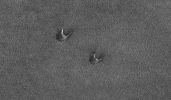
North_Polar_Regions-Dunes.jpgNorth Polar Dunes (Original NASA/MGS/MSSS b/w Frame)103 visiteCaption originale:"This MGS-MOC image shows two "Barchan Dunes" in the North Polar Region of Mars. The orientation of the Dunes, with the steep faces pointed toward the South-East, indicates that the winds responsible for their formation blew from the North-West. At the time this image was acquired by MOC, the dunes and surrounding plains were covered by seasonal carbon dioxide frost".
Location near: 73,8° North Lat. an 40,8° West Long.
Image width: ~3 Km (~1,9 mi)
Illumination from: lower left
Season: Northern Winter
(7 voti)
|
|

Craters-Unnamed_Crater_in_Terra_Sabaea-02.jpgUnnamed Crater in Terra Sabaea (Original NASA/MGS/MSSS b/w Frame)81 visiteCaption originale:"This MGS-MOC image shows a 1,5 mt (~5 feet) per pixel view of an Impact Crater that is approximately 3 Km (about 9840 ft) in diameter. It is located in South-Western Terra Sabaea".
Location near: 21,9° South Lat. and 338,6° West Long.
Image width: ~3 km (~1,9 mi)
Illumination from: upper left
Season: Southern Summer
(7 voti)
|
|
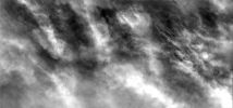
Clouds-South_Polar_Regions-PIA02182-1.jpgThick Clouds over the South Pole (Original NASA/MGS/MSSS b/w Frame)72 visiteCaption originale:"In this image the Martian Surface is completely hidden from view by thick clouds. The thickness of the clouds indicates the dust is a major component of the clouds. Images like this one can provide vital information about the atmosphere and climate of Mars today. This image was collected during late Summer near the South Pole".
Image information: VIS instrument;
Latitude: - 69,9° N;
Longitude: 235,3° E;
Resolution: 17 meter/pixel.
(7 voti)
|
|

Controversial_Features-The_D_M_Pyramid-01.gifThe D&M Pyramid (High-Def-3D)133 visiteSe i 3D relativi alla "Faccia di Marte" hanno demolito - a nostro parere - le speculazioni relative ad una possibile artificialità del rilievo, altrettanto non si può dire per la "Piramide D&M". Anche in questo caso la tecnica del 3D ci dà un aiuto per muoverci verso la comprensione, ma si tratta di un aiuto davvero modesto.
La Piramide D&M "sembra" - ripetiamo "sembra" - se si guarda alla sua base (versante Nord-Ovest) avere una qualche sorta di squadratura, ma questo indizio è davvero troppo precario ed inconcludente per spingerci verso una congettura di artificialità. Precarietà ed inconcludenza che si palesano molto chiaramente quando andiamo a verificare i lati Nord-Est epoi l'intero versante Sud, laddove la presunta "squadratura" cede il posto ad un diegno del tutto irregolare ed indefinibile.
Comunque, proprio in virtù di quanto appare nella porzione Nord-Ovest della pseudo-collina, lasciamo la porta aperta a qualche ulteriore analisi speculativa e, nel frattempo, aspettiamo nuove immagini...
(7 voti)
|
|

Phobos_from_MGS-003.jpgPhobos from Mars Global Surveyor (4 - HD)203 visitenessun commento
(7 voti)
|
|

Craters-Eberswalde_Crater-1-PIA04293_modest.jpgEberswalde Crater and Delta in HR80 visiteOriginal caption:"Scientifically, perhaps the most important result from use of the MOC on NASA's MGS during that spacecraft's extended mission has been the discovery and documentation of a 'fossil delta'. The feature is located in a crater northeast of Holden Crater, near 24,0° South Latitude and 33,7° West Longitude. Since the announcement of the discovery of the delta in November 2003, the International Astronomical Union has provided a provisional name (pending final approval) for the crater in which the landforms occur.
The crater has been named Eberswalde (a German town).
This image offers a HR view of a portion of the fossil delta than any seen earlier. North is up. At the bottom of the frame, the image includes the north end of a looping, inverted, meandering channel. The image covers an area of about 3 by 3 Km (about 1,9x1,9 miles). It was produced using a technique called "compensated pitch and roll targeted observation," in which the rotation rate of the spacecraft is adjusted to match the ground speed under the camera. At full resolution, this map-projected image is at 50 centimeters (20 inches) per pixel".
(7 voti)
|
|

Craters-Holden_Crater-3-M0302733.jpgHolden Crater floor near intersection with Uzboi Vallis67 visitenessun commento
(7 voti)
|
|
Aeolian_Features-Windstreaks-Becquerel_Crater-M0702802-00.jpgWindstreaks inside Becquerel Crater (Original NASA/MGS/MSSS b/w Frame)93 visitenessun commento
(7 voti)
|
|

Volcanoes-Small_Volcano_in_Jovis_Fpssae-1-2005_07.jpgLost in the Dust: a small Volcano in Jovis Fossae (Original NASA/MGS/MSSS b/w Frame)70 visiteCaption NASA originale:"This MGS-MOC image shows a small, dust-covered, volcano in the Jovis Fossae region of Mars.
While Mars is known for its extremely large volcanoes, such as Olympus Mons, many small volcanoes also occur on the Red Planet, particularly in the Tharsis Region. This small volcano is a good example of those.
It was originally found by members of the MGS Mars Orbiter Laser Altimeter (MOLA) team during the MGS primary mission.
The volcano is old and cratered. Its surface is mantled by dust and its caldera (summit depression) has some dust-covered wind ripples on its floor".
Location near: 20,7° North and 111,3° West
Image width: ~3 Km (~1,9 mi)
Illumination from: lower left
Season: Northern Autumn
(7 voti)
|
|
| 512 immagini su 43 pagina(e) |
 |
|
|
|
|
15 | |
|
|
|
|








