| Piú viste - A Tribute To Mars Global Surveyor |

Thaumasia_Region-The_Electric_Dunes-05.jpgThe "Bright Dunes" of Thaumasia (CTX Frame - Enhanced Natural Colors; credits for the additional process. and color.: Dr Paolo C. Fienga - Lunexit Team)63 visiteLe "Dune Luminose" di Thaumasia: per una Scuola di Pensiero si tratta di tubazioni, un tempo interrate, le quali sono state poi riportate alla luce dalla combinazione di azioni geologiche (da un lato) e meteorologiche (dall'altro). Tubazioni metalliche i cui scopi sono un mistero che, probabilmente, è destinato a rimanere tale.
Per altri Ricercatori, invece, si potrebbe trattare di spezzoni visibili di tunnel traparenti i quali, sempre a causa del concorso fra azioni geologiche (sismi, subsidenze, fratture tettoniche etc.) ed azioni meteorologiche (piogge torrenziali, alluvioni, venti et sim.), sono "emersi" dalle profondità del Pianeta Rosso sino a rendersi, in parte, visibili.
Per altri ancora, infine, si potrebbe trattare delle strutture che reggevano i tunnels di cui sopra (diciamo gli scheletri di queste ipotetiche costruzioni).
Per la NASA, si tratta di "ripples", ossìa di dune costituite da sabbie rapprese e, nel tempo, divenute simili a rocce (ancorchè - relativamente - fragili).
L'ESA è d'accordo con questa costruzione ma - e diremmo "ovviamente" - nè la NASA, nè l'ESA spiegano il motivo di questa albedo così inusuale per delle strutture rocciose.
Noi, come Gruppo di Ricerca Indipendente, riteniamo che queste strutture sìano, di fatto, dei rilievi naturali. Il motivo della loro "luminosità", come Geologia e Razionalità ci suggeriscono, dovrebbe essere ricercato - prima di lasciarsi andare a teorizzazioni esotiche (e prive di fondamenta) - nella composizione di questi rilievi. Svariate aree di Marte "brillano" e, come Spirit stesso ha già evidenziato, la superficie di Marte è ricca di sali e di sostanze aventi una natura ed una struttura cristallina.
Forse, prima di pensare a "tubi" e "tunnel", varrebbe la pena di pensare anche a sali, quarzi, superfici vetrificate e - perchè no? - ghiaccio.
|
|
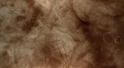
Thaumasia_Region-The_Electric_Dunes-06.jpgThe "Bright Dunes" of Thaumasia (EDM n.1 - Enhanced Natural Colors; credits for the additional process. and color.: Dr Paolo C. Fienga - Lunexit Team)63 visitenessun commento
|
|

Inca-City-M0306902-01.jpgA true "South Polar Oddity": Inca City (3 - False Colors)63 visiteThe Mars Global Surveyor (MGS) Mars Orbiter Camera (MOC) has provided new information about the "Inca City" ridges, though the camera's images still do not solve the mystery. The new information comes in the form of a MOC red wide angle context frame taken in Mid-Southern Spring (Image 1). The MOC image shows that the "Inca City" ridges, located at 82° South and about 67° West (293° East), are part of a larger circular structure that is about 86 Km (about 53 mi) across. It is possible that this pattern reflects an origin related to an ancient, eroded meteor impact crater that was filled-in, buried, then partially exhumed. In this case, the ridges might be the remains of filled-in fractures in the bedrock into which the crater formed, or filled-in cracks within the material that filled the crater. Or both explanations could be wrong. While the new MOC image shows that "Inca City" has a larger context as part of a circular form, it does not reveal the exact origin of these Striking and Unusual Martian Landforms.
|
|

Layers-Sinus_Meridiani-MGS-PCF-LXTT.jpgWe see the Island; we don't see the Sea... (Natural Colors; credits for the additional process. and color.: Dr Paolo C. Fienga - Lunar Explorer Italia)63 visiteCaption originale:"This MGS-MOC image shows layered, sedimentary rock exposures in the Sinus Meridiani Region".
Location near: 4,8° N; 1,2° W
Image width: ~1 Km (~0,6 mi)
Illumination from: lower left
Season: Northern Autumn
Nota: titolo dell'immagine assolutamente autoesplicativo. Non ci sembra difficile vedere, infatti (ed a parte l'asciutto commentino NASA), quello che rimane di un'isola e delle stratificazioni che hanno segnato il lento ritrarsi delle acque dai suoi dintorni. Dunque la domanda è: dov'è andata a finire il lago (o il fiume o l'oceano) che la circondava?MareKromium
|
|
Hellas_Planitia-MGS~1.jpgValley in Hellas Planitia (Absolute Natural Colors; credits for the additional process. and color.: Dr Paolo C. Fienga - Lunexit Team) 63 visiteCaption originale:"This MGS-MOC image shows a valley which has become partially-filled with material. It is located West of Hellas Planitia. The valley, entering the scene from the East (lower side), turns toward the South-West (upper right) and splits to form a "V". Partially-filled depressions are common throughout the scene, including the circular feature near the top of the image.
In each such case, the filling material is probably the remains of a material that once covered the entire scene".
Location near: 48,4° South; 318,1° West
Image width: ~3 Km (~1,9 mi)
Illumination from: upper left
Season: Southern SummerMareKromium
|
|

Craters-Wirtz_Crater-MGS~0.jpgThe Dunes of Wirtz Crater (Natural Colors; credits for the additioonal process. and color.: Dr Paolo C. Fienga - Lunexit Team)63 visitenessun commentoMareKromium
|
|

Volcanic_Features-Pits-PIA03196.jpgAscraeus Mons (possible Natural Colors; credits: Dr Paolo C. Fienga - Lunexit Team)63 visitenessun commentoMareKromium
|
|

Volcanic_Features-Lava_or_Mud_Flows-00.jpgControversial Features of Zephyria Planum (Original NASA/MGS/MSSS b/w Frame)62 visiteOriginal caption:"This MGS-MOC image shows a portion of a shallow Channel carved in the Plains of the Zephyria Region of Mars. This feature might be the result of the passing of either extremely fluid Lava or, perhaps, Mud".
Location near: 5,1° North Lat. and 203,7° West Long.
Image width: ~3 Km (~1.9 mi)
Season: Northern Winter
|
|
| 512 immagini su 43 pagina(e) |
 |
|
|
|
|
|
|
|
|
43 |
|








