| Piú viste - A Tribute To Mars Global Surveyor |

Craters-Unnamed_Crater_with_Gullies-MGS-0.jpgUnnamed Crater with Gullies (Original NASA/MGS/MSSS b/w Frame)71 visiteCaption NASA originale:"This MGS-MOC image shows gullies and cracked and stressed gully apron deposits in a South mid-Latitude crater. Gullies can also be seen in the deep shadow on the North wall of the crater. These gullies might have formed by the erosive action of liquid water, sometime in the not-too-distant martian past".
Location near: 36,7° South; 206,2° West
Image width: ~3 Km (~1,9 mi)
Illumination from: upper left
Season: Southern Autumn
Nota: attenzione a quello che la NASA ha scritto in sede di commento: adesso il passato al quale fare riferimento per pensare ad acqua che scorre "allo stato liquido" su Marte non è più remoto (un miliardo di anni o giù di lì); adesso questo passato è "...not too distant..." e cioè "passato prossimo". RicordateVi, in futuro, di quello che stiamo scrivendo da mesi: un frame dopo l'altro ed una parola dopo l'altra, la NASA si sta (lentamente ma) costantemente ridefinendo in chiave possibilista molte delle proprie posizioni (da anni più che consolidate) su molti aspetti/enigmi del Pianeta Rosso.
A quando l'ammissione di una "forma vitale" attuale, magari sotterranea?!?...
|
|

Phobos_from_MGS-004.jpgPhobos from Mars Global Surveyor (5)71 visitenessun commento
|
|
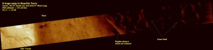
Noachis_Terra-M1501427-PCF-LXTT-00.jpgNoachis Panorama (CTX Frame - Enhanced and Darkened Natural Colors; credits for the additional process. and color.: Dr Paolo C. Fienga - Lunexit Team)71 visitenessun commento
|
|

Craters-Unnamed_Crater-S16-01-140-03.jpgFresh Crater near Ulysses Patera (Natural Colors; credits: NASA/MGS/MSSS)71 visiteCaption NASA originale:"Ths frame has been colorized using a look-up table derived from the Colors of Mars as seen by the Mars Reconnaissance Orbiter’s High Resolution Imaging Science Experiment (HiRISE) camera".MareKromium
|
|

Chaotic_Terrain-Aram_Chaos-S0100839-PCF-LXTT-00.jpgUnusual Surface Features in Aram Chaos (CTX Frame - False Colors)71 visiteIl "punto interrogativo" indica - come da commento/segnalazione di un nostro Amico Lettore (il Sig. Pietro Camin) - un dettaglio superficiale apparentemente anomalo la cui forma ricorda, sebbene vagamente, quella di un triangolo isoscele che giace coricato su un fianco (in accordo, come ovvio, al punto di vista dell'Osservatore).
Si tratta, forse, di una "Struttura Artificiale"?
Ebbene la risposta ad un simile interrogativo e sulla base di un frame orbitale ottenuto da oltre 300 Km di altitudine (lo sapete bene) è impossibile (e, questo ci teniamo a sottolinearlo, solo chi tira brutalmente ad indovinare - o specula sulla credulità popolare - potrebbe rispondere manifestando certezze a tal riguardo).
Tuttavia, dato che il Sig. Camin ha legittimamente manifestato un dubbio il quale, a ben guardare, si "posiziona" (anche fisicamente) su una Regione (quella di Aram Chaos) che è in sè ricca di Rilievi Superficiali "curiosi", abbiamo deciso di fare un piccolo sforzo investigativo e quindi proporre e proporVi, in totale umiltà e senza pretesa alcuna di fornire "certezze", NON UNO, MA ALTRI TRE possibili Rilievi Superficiali Anomali presenti nei pressi del rilivo segnalato dal Sig. Pietro Camin (che ringraziamo per lo spunto).
Ed ora osservate il detail-mgnf che segue...MareKromium
|
|

Craters-Unnamed_Crater_with_Dunefield_and_Windstreak-PIA07508-PCF-LXTT.jpgImpact Crater and Windstreak (Saturated Natural Colors; credits for the additional process. and color.: Dr Paolo C. Fienga - Lunar Explorer Italia)71 visiteCaption NASA:"This MGS-MOC image shows a 1,2-Km-diameter North mid-latitude crater with a bright wind streak".
Location near: 30,8° North Lat. and 131,8° West Long.
Image width: ~3 Km (~1,9 mi)
Illumination from: lower left
Season: Northern SummerMareKromium
|
|

Channels-Auqakuh_Vallis-MGS-PCF-LXTT.jpgAuqakuh Vallis: "Old Riverbed" or "Windblown Ripples"? (Natural Colors; credits for the additional process. and color.: Dr Paolo C. Fienga - Lunar Explorer Italia)71 visiteCaption NASA originale:"This MGS-MOC image shows windblown ripples on the floor of Auqakuh Vallis.
The light-toned area, running diagonally across the scene from South-West to North-East, may be dust that has accumulated in the bottom of the valley and on top of the ripples".
Location near: 31,3° North; 299,3° West
Image width: ~3 Km (~1,9 mi)
Illumination from: lower left
Season: Northern SpringMareKromium
|
|

Craters-Benedictus_XVI-PIA07838.jpgImpact Crater with frost deposits (Benedictus XVI Crater - Original NASA/JPL/MSSS b/w Frame)70 visiteLocation near: 37,5° South Lat. and 222,1° West Long.
Image width: ~3 Km (~1,9 mi)
Illumination from: upper left
Season: Southern Winter
Lunar Explorer Italia, in passato, ha spesso 'battezzato' crateri e rilievi Marziani i quali - ufficialmente - non hanno nome, usando un pizzico di fantasia e cercando di rimanere rispettosa della tradizione Astronomica e Scientifica in materia di nomenclatura. Oggi, 19 Aprile 2005, abbiamo pubblicato la foto di questo "frosty crater", anch'esso senza nome.
Ebbene, anche se la Scienza e la Fede sono Entità profondamente diverse (e sovente in disaccordo, come la Storia ci insegna e racconta) e sebbene Lunar Explorer Italia sia un'Associazione laica in tutto e per tutto, riteniamo giusto rendere omaggio in qualche modo al Nuovo Pontefice della Santa Romana Ecclesia e quindi battezziamo questo imponente rilievo Marziano con il nome di "Benedetto Decimo-Sesto".
|
|

Candor_Chasma-PIA03954.jpgLandforms in Candor Chasma (Original NASA/MGS/MSSS b/w Frame)70 visiteCaption NASA originale:"This MGS-MOC image shows dark, windblown sand and an eroded slope of massively-bedded, light-toned, sedimentary rock. These landforms are located in east/central Candor Chasma".
Location near: 6,8°S; 71,7°W
Image width: ~3 Km (~1,9 mi)
Illumination from: upper left
Season: Southern Spring
|
|

South_Polar_Regions-M0903484-00.jpgFeatures of the South Polar Regions (Original NASA/MGS/MSSS CTX b/w Frame)70 visitenessun commento
|
|

South_Polar_Regions-Hills_and_Knobs.jpgHills, Knobs and Buried Craters in the South Polar Region (Original NASA/MGS/MSSS b/w Frame)70 visiteOriginal caption:"This MGS-MOC image shows a Summer scene from the South Polar Region of Mars. The circular feature in the North-East (upper right) corner of the image is an old meteor impact crater that has been partially filled and buried. The cone-shaped hill that occurs within the crater on its East (right) side is a remnant of material that once covered and completely buried the crater. Perhaps beneath the surfaces in the rest of the image there are other craters that have been filled and buried such that we cannot know, from an image, that they ever existed. The theme of filled, buried, and exhumed craters is one that repeats itself —over and over again — all over Mars".
Location near: 80,3° South Lat. and 286,1° West Long.
Image width: ~3 Km (~1,9 mi)
Illumination from: upper left
Season: Southern Summer
|
|

Dunes-Noachis_Terra-00.jpgDark Dunes in Noachis Terra (Original NASA/JPL/MSSS b/w Frame)70 visiteCaption originale:"This MGS-MOC image shows Dark Sand Dunes and relatively small, light-toned, windblown Ripples on the Floor of an Unnamed Crater located in central Noachis Terra".
Location near: 50,0° South Lat. and 353,7° West Long.
Image width: ~3 Km (~1,9 mi)
Illumination from: upper left
Season: Southern Autumn
|
|
| 512 immagini su 43 pagina(e) |
 |
|
|
|
|
32 | |
|
|
|
|








