| Piú viste - A Tribute To Mars Global Surveyor |
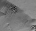
Craters-Lyell_Crater-00.jpgLyell Crater's Gullies (Original NASA/MGS/MSSS b/w Frame)74 visiteCaption originale:"This MGS-MOC image shows a suite of Gullies on a Scarp in Lyell Crater".
Location near: 69,7° South Lat. and 14,0° West Long.
Image width: ~3 Km (~1,9 mi)
Illumination from: upper left
Season: Southern Summer
|
|

Chaotic_Terrain-Aram_Chaos-R2200155-05.jpgThe "Many Faces" of Aram Chaos (6 - EDM n. 5 - Original NASA/MGS/MSSS b/w Frame)74 visiteDunque: manipolazione delle immagini spinta sino a livelli estremi; Aram Chaos è una Regione di Marte su cui ancora scorrono, sia pure in misura minima, acque superficiali; questa Regione, al pari di altre, si è in parte - e recentemente - stabilizzata (climatologicamente e geologicamente) ma è ancora soggetta ad un generale processo di desertificazione, con costante perdita delle acque superficiali le quali vengono "ingoiate" da Marte a vantaggio della sua "rete idrica sotterranea".
Questi - e scusateci se siamo stati troppo sommari - ci sembrano essere i punti nodali della costruzione del Dr Skipper su Aram Chaos.
"If what we are seeing of these elevated mounts in this poor resolution imaging as released to us is mostly real visual evidence as opposed to evidence mostly obscured and/or created by image tampering, then we may be looking at camouflaged fortified elevated but partially underground civilization places. The nozzle shooting spray evidence in Report #029 suggests that there may be artificiality and possibly advanced technology associated with this mount evidence capable of not only capitalizing on this ground water rich environment but influencing and modifying this environment through technology as well"
|
|

South_Polar_Features-Residual_Cap.JPGSouth Polar "Shoreline" (Original NASA/MGS/MSSS b/w Frame)74 visiteCaption NASA originale:"This MGS-MOC image shows the very edge of the South Polar Residual Cap of Mars. The bright areas, which appear somewhat like pieces of sliced "Swiss cheese", are composed mainly of frozen Carbon Dioxide. The Scarps around the edges of the Carbon Dioxide mesas have been retreating at a rate of roughly 3 mt (~3 yards) per Martian Year; in this case, exposing a darker surface that lies below".
Location near: 85,4° South; 88,6° West
Image width: ~3 km (~1,9 mi)
Illumination from: upper left
Season: Southern Summer
|
|
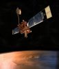
00-A-Mars_Global_Surveyor.jpgMars Global Surveyor74 visiteMars Global Surveyor was launched in 1996 on a mission designed to study Mars from orbit for two years. It accomplished many important discoveries during nine years in orbit. On Nov. 2, 2006, the spacecraft transmitted information that one of its arrays (---> pannelli) was not pivoting (--> ruotando) as commanded.
Loss of signal from the MGS Orbiter began on the following orbit.
Mars Global Surveyor has operated longer at Mars than any other spacecraft in history and for more than four times as long as the prime mission originally planned.
NASA has recently formed an internal review board to look more in-depth into why NASA's Mars Global Surveyor went silent in November 2006 and recommend any processes or procedures that could increase safety for other spacecraft.
|
|

Channels-Uzboi_Vallis-A-M1100709.jpgChannels's Network in Uzboi Vallis (1 - CTX Frame)73 visiteSe provate a riguardare le immagini ESA relative alla Sonda Huygens mentre scende verso la superficie di Titano, troverete senz'altro delle analogie con questo frame.
Quali?
Una fitta rete di "canali", per esempio. Una rete di canali in tutto e per tutto simile a quanto vediamo in questo frame, ripreso - come al solito - da un'altezza di circa 370 Km.
I "Canali di Titano" hanno fatto subito notizia e sia l'ESA, sia la NASA hanno immediatamente parlato di 'chiara analogia' fra Titano e la Terra, così come essa era ai suoi albori.
Questi "Canali", invece, non solo non hanno fatto notizia: essi non sono stati neppure visti!
Ma Voi ci credete a questa "miopìa planetaria"? Noi no. Noi pensiamo che sia più facile far viaggiare l'immaginazione delle persone (tenendole, nel contempo, tranquille...) allorchè si parla di Mondi lontani e, in apparenza, inospitali come Titano.
Quanto più le analogie con la Terra sono lontane ed improbabili, tanto più facile è evitare che vengano poste domande indiscrete...
|
|

Aeolian_Features-Dust_Devil-Argyre_Planitia.JPGDust Devil in Argyre Planitia (Original NASA/MGS/MSSS b/w Frame)73 visiteCaption NASA originale:"This MGS-MOC image shows Dust Plumes created by gusting winds on a Plain SouthWest of Argyre Planitia".
Location near: 67,0° South; 75,2° West
Image width: ~3 Km (~1,9 mi)
Illumination from: upper left
Season: Southern Autumn
|
|

Aeolian_Features-Windstreak-MGS.JPGWindstreak in Cyane Fossae73 visiteCaption NASA originale:"This MGS-MOC image shows a light-toned wind streak created in the lee — such as the downwind side — of an impact crater in the Cyane Fossae Region of Mars. Winds blowing from the bottom (South) toward the top (North) swept this scene clean of fine, bright dust except for the dust that had accumulated in a few protected areas such as that in the lee of this crater".
Location near: 42,0° North; 125,8° West
Image width: ~3 Km (~1,9 mi)
Illumination from: lower left
Season: Northern Spring
|
|
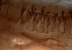
Terra_Cimmeria-Gullies-PIA02919-3.jpgGullies in Terra Cimmeria (Natural Colors; credits for the additional process. and color.: Dr Paolo C. Fienga - Lunar Explorer Italia)73 visiteCaption originale NASA:"This MGS-MOC image shows two suites of gullies within a single impact crater in the Terra Cimmeria Region. The gullies near the top of the image are located on the northern wall of the crater, while the lower suite resides on a lower bench in the crater's northern wall complex. Gully erosion has cut into the layered rock exposed on the crater wall. Water may have been involved in their formation".
Location near: 38,2° South; 190,6° West
Image width: ~3 Km (~1,9 mi)
Illumination from: upper left
Season: Southern SummerMareKromium
|
|

Volcanic_Features-Collapse_Pit-2003_07_12.jpgCollapse Pit in Tractus Fossae (Original NASA/MGS/MSSS b/w Frame)72 visiteCaption NASA originale:"Extensional faulting, wherein some fraction of the Martian Crust is pulled apart and Faults are formed where the Bedrock breaks, has also led to formation of Collapse Pits in the Tractus Fossae Region. This MGS-MOC image shows one such pit and the layered bedrock exposed in its walls. Dark Streaks on the Slopes of the Pit result from Avalanches of dry, fine-grained debris (probably Dust, as these streaks are only found in the dust-mantled regions of Mars).
This Pit is located near 23,5° North Lat. and 103,8° West Long. Sunlight illuminates the scene from the lower left".
|
|

Lycus_Sulci_Region-PIA07889.jpgSmall Mountain in Lycus Sulci (Original NASA/MGS/MSSS b/w Frame)72 visiteCaption NASA originale:"This MGS-MOC image shows a small Mountain in the Lycus Sulci Region, located North/West of the Olympus Mons Volcano. Dark Streaks, probably caused by avalanching and flow of extremely dry Dust, have formed on the Mountain's Slopes. The various ridged and grooved textures in this scene were formed by Wind Erosion".
Location near: 22,6° North Lat. and 145,5° West Long.
Image width: ~3 Km (~1,9 mi)
Illumination from: lower left
Season: Northern Summer
Nota: la forma (solo vagamente) squadrata della base di questa piccola montagna di Lycus Sulci non tragga in inganno i cercatori di resti di antiche costruzioni (piramidi & sim.) sulla superficie del Pianeta Rosso: nonostante il Prof. Hoagland ed altri Ricercatori nati e cresciuti sulla sua scia la pensino diversamente, tantissimi rilievi Marziani (ripresi da altezze variabili fra i 280 ed i 330 Km di quota) mostrano i 'segni di (apparenti) squadrature'.
|
|

Volcanoes-Small_Volcano_in_Jovis_Fpssae-1-2005_07.jpgLost in the Dust: a small Volcano in Jovis Fossae (Original NASA/MGS/MSSS b/w Frame)72 visiteCaption NASA originale:"This MGS-MOC image shows a small, dust-covered, volcano in the Jovis Fossae region of Mars.
While Mars is known for its extremely large volcanoes, such as Olympus Mons, many small volcanoes also occur on the Red Planet, particularly in the Tharsis Region. This small volcano is a good example of those.
It was originally found by members of the MGS Mars Orbiter Laser Altimeter (MOLA) team during the MGS primary mission.
The volcano is old and cratered. Its surface is mantled by dust and its caldera (summit depression) has some dust-covered wind ripples on its floor".
Location near: 20,7° North and 111,3° West
Image width: ~3 Km (~1,9 mi)
Illumination from: lower left
Season: Northern Autumn
|
|
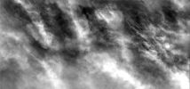
Clouds-South_Polar_Regions-PIA02182-1.jpgThick Clouds over the South Pole (Original NASA/MGS/MSSS b/w Frame)72 visiteCaption originale:"In this image the Martian Surface is completely hidden from view by thick clouds. The thickness of the clouds indicates the dust is a major component of the clouds. Images like this one can provide vital information about the atmosphere and climate of Mars today. This image was collected during late Summer near the South Pole".
Image information: VIS instrument;
Latitude: - 69,9° N;
Longitude: 235,3° E;
Resolution: 17 meter/pixel.
|
|
| 512 immagini su 43 pagina(e) |
 |
|
|
|
|
30 | |
|
|
|
|








