| Piú viste - A Tribute To Mars Global Surveyor |

Craters-Unnamed_Defrosting_Crater-PIA03921-00.jpgUnnamed Defrosting Crater (Original NASA/MGS/MSSS b/w Frame)81 visiteCaption NASA originale:"This MGS-MOC image shows a Surface in the South Polar Region, covered by CO2 Frost. In this springtime scene, the Frost has begun to sublime so that Sandy Surfaces exhibit an abundance of Dark Spots. The circular depression is probably the remains of an Impact Crater. In summer, the Spotted Surfaces in this image would be darker than their surroundings, because they are patches of Windblown Sand".
Location near: 67,6° South Lat. and 254,3° West Long.
Image width: ~3 Km (~1,9) mi
Illumination from: upper left
Season: Southern Spring
|
|

Clouds-Chasma_Australe-M0904026-01.jpgClouds over Chasma Australe (Original NASA/MGS/MSSS b/w Frame - EDM)81 visiteQuesta immagine è stata ottenuta dalla Sonda MGS quando si trovava ad un'altitudine di circa 370 Km; l'ora locale del rilievo ripreso segna le 16 circa, MLT.
|
|

Craters-Eberswalde_Crater-2-PIA04293_fig2.jpgEberswalde Crater and Delta in HR81 visiteOriginal caption:"Additional images from MOC provide some context and show a nearby portion of the fossil delta's inverted channels at a spatial scale of 1,5 mt (about 5 feet) per pixel. The relative positions of these 3 images are indicated in a mosaic image of the entire delta - picture (1). The first MOC narrow angle images of some of the landforms in the delta were acquired in 2000, during the MGS primary mission, but those pictures did not show very well the unambiguous inverted channel forms. Not until the second Earth year of the orbiter's extended mission were the deltaic features recognized in MOC images obtained in March and June of 2002.
Following the initial observations in 2002, the MOC Team began a systematic effort to map the entire Eberswalde Crater delta. Most of this imaging required slewing the whole spacecraft in a technique called "roll only targeted observation" so that it pointed the camera toward the feature. In this way, the camera team was able to build up a mosaic of the delta much more quickly than would have been the case if the team had simply relied upon chance crossing of the delta by the orbiter's usual ground track. This technique was not employed during Mars Global Surveyor's primary mission, except in the search for Mars Polar Lander, but became a routine part of the tool kit during the extended mission".
|
|

Craters-Eberswalde_Crater-5-PIA04293_fig3.jpgEberswalde Crater and Delta (Sub-meter-per-pixel cPROTO - detail mgnf)81 visiteOriginal caption:"After the sediments were deposited to form the delta, the material was further buried by other materials - probably sediments - that are no longer present. The entire package of buried material became cemented and hardened to form rock. Later, erosive processes - such as wind - stripped away the overlying rock, re-exposing the delta. Now preserved essentially as a fossil, the former floors of channels in the delta became inverted, to form ridges, by erosion. Channels can be inverted by erosion on both Earth and Mars. Usually this happens when the channel floor, or the material filling the channel, is harder to erode than the surrounding material into which the channel was cut. In some cases, the channels on Earth and Mars have been filled by lava to make them more resistant to erosion. In the case of Eberswalde, there are no lava flows; instead, the channel floors may have been rendered resistant to erosion either by being better-cemented than the surrounding material, or composed of coarser-grained sediment (such as sand and gravel as opposed to silt), or both".
|
|

Chaotic_Terrain-Aram_Chaos-R2200155-04.jpgThe "Many Faces" of Aram Chaos (5 - EDM n. 4 - Original NASA/MGS/MSSS b/w Frame)81 visiteUn punto focale - e che ci vede in perfetta sintonìa con il Dr Skipper - attiene l'orrenda manipolazione distorsiva (o "tampering") che viene fatta sulle immagini MGS (o meglio: su tutte le immagini in arrivo dallo Spazio).
Una manipolazione sulle cui reali origini e motivazioni non vale davvero la pena parlarne ora e qui.
"The accumulative evidence that I've seen indicates that the suspicious rounded and oval mounts possibly represents at least indirectly different life equally dependent on this surface water resource but which adopted a different survival strategy. They do not locate on slopes or grades but in more level terrain shallow water pools or where the ground is extra water saturated for a sustained period and then form these large elevated forms. Their plentiful numbers here in Aram Chaos but smaller size relative to some that I've seen may suggest that the shrinking water conditions in Aram Chaos is a relatively more recent phenomena as opposed to a even more ancient scenario"
|
|

Controversial_Features-The_Villa-AB108405-SF-03.JPGUnusual Squared Structure on Mars (4)81 visiteMa lasciamo ora che sia il Dr Mc Cann a dirci la sua:"...This image (si riferisce al frame precedente) shows a sheer cliff with a very large ledge in its midst. On that ledge is a large two story structure, the first floor walls of which are facing camera and in shadow. The second floor is a well defined SQUARE and is turned at a precise 45° angle to the first floor. CENTERED in the midst of the roof of that squared second floor is an abrupt, sharp circle..a "landing pad" as for helicopters atop tall buildings and on decks of ships. UP and to the RIGHT of the building structure there is a culvert/conduit or PIPE with an open top which comes forth out of the upper cliff face. There is a fluid streaming from the end of the "U" shaped pipe and is blurred as it falls down to the ledge. The fluid hits the ledge and erodes a wavy channel to the edge of that ledge and then cascades down the lower cliff face to disperse in a deltaic pattern on a talus cone..." (continua)
|
|

Dunes-S20-00165d-_acquired_july_2006-_11-8-06-A.jpgDark Dunefield? (Original NASA/MGS/MSSS b/w Frame)81 visiteA nostro parere la "chiazza scura" che ci è stata segnalata dal Dr Barca e che caratterizza un'ampia porzione di questo frame non è un'ombra, bensì - dopo aver operato alcune comparazioni visive con altri frames similari - un "affioramento" di un qualche tipo (una "macchia" della superficie - simile ai "seeps" - che può essere indice della presenza di idrocarburi affioranti o, più spesso, dell'esposizione del suolo post evaporazione di ghiacci superfciali o sublimazione di ghiacci di CO2); da non escludersi la possibilità che si tratti di un reticolato - non risolvibile con questa bassa definizione - di Dark Dunes (insomma: un Dunefield a bassa albedo).
Le uniche ombre significative ed oggettivamente visibili dalle varie Sonde che orbitano attorno a Marte sono quelle di Deimos e Phobos, quando producono una Eclissi Solare. Tuttavia, esaminando qualche frames relativo ad Eclissi viste dall'orbita, si può notare che quando le lune di Marte proiettano ombra sulla Superficie del Pianeta, l'effetto visivo è molto diverso da quello che vediamo in questo frame.
|
|

South_Polar_Features-01.jpgSouth Polar "River-like" Surface Features? (RAW Natural Colors; credits for the additional process. and color.: Dr Paolo C. Fienga - Lunexit Team)81 visitenessun commentoMareKromium
|
|

North_Polar_Features-Chasma_Boreale-PIA07195-01-PCF-LXTT.jpgFeatures of Chasma Boreale (Natural Colors; credits for the additional process. and color.: Dr Paolo C. Fienga - Lunexit Team) 81 visitenessun commentoMareKromium
|
|

Craters-Unnamed_Concentric_Craters-M2100005.jpgConcentric Craters (Original NASA/MGS/MSSS b/w Frame)80 visiteCrateri all'interno di crateri o 'crateri concentrici': si tratta di un fenomeno decisamente raro ed inusuale, ma non (ovviamente) impossibile. Questa Stranezza Marziana non la annoveriamo fra le Anomalie in senso stretto, bensì fra le - semplici - "rarità" che la Natura è capace di creare.
|
|
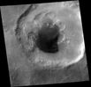
Craters-Rabe_Crater-I-M0203079-00.jpgThe "Pitted" West Floor of Rabe Crater - The Area (1) - (Original NASA/MGS/MSSS b/w Frame)80 visiteImage ID (picno): M02-03078
Image start time: 1999-06-22 - T04:56:09.09 SCET
Image width: 1024 pixels
Image height: 3200 pixels
Line integration time: 0,7231 millisec
Pixel aspect ratio: 1,60
Compression type: MOC-PRED-X-5
Longitude of image center: 326,11°W
Latitude of image center: 44,24°S
Scaled pixel width: 2,77 mt
Scaled image width: 2,85 Km
Scaled image height: 14,4 Km
Solar Longitude (Ls): 158,39°
Local True Solar Time: 14,80 decimal hours (such as--->14:48 MLT)
Emission angle: 0,26°
Incidence angle: 65,43°
Phase angle: 65,36°
North azimuth: 94,16°
Sun azimuth: 47,45°
Spacecraft altitude: 371,30 Km
Slant (--->inclinazione) distance: 371,30 Km
|
|

South_Polar_Features-South_Polar_Cap-PIA04287.jpgThe South Pole of Mars (Original NASA/MGS/MSSS b/ Frame)80 visiteOn 8 September 2005 (UT), the MGS-MOC resumed imaging of Mars after a nearly 2-week hiatus to recover the spacecraft from a glitch that put MGS into a protective "safe mode". The MOC was turned on during MGS orbit 29053, while the spacecraft was flying across day side of the Planet. MOC then resumed taking pictures on the next orbit. Shown here is a portion of the first picture acquired following MOC turn-on. The image shows a view of the Martian South Polar Region, as it appeared on September 8, 2005. The image was taken by MOC's red wide angle camera. In this case, the spacecraft began imaging Mars as it passed across the southern terminator, at the bottom of the image. MGS then flew southward, over the Polar Cap, then northward toward the Equator. The Equatorial Region is further north than the area shown here. The equatorial region is further north than the area shown here. The image not only provided the MOC team a confirmation that MOC imaging has resumed, this particular image, in the map-projected form shown here, is being used by the team to assist in setting the exposures for MOC narrow angle camera images that will be acquired from the south polar region over the next several days.
|
|
| 512 immagini su 43 pagina(e) |
 |
|
|
|
|
26 | |
|
|
|
|








