| Piú viste - Imagination |
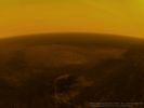
Huygens-Down-08.jpgHuygens' Descent to Titan: 25 Km from the Surface (credits: R. Pascal)80 visiteThe altitude, where Huygens' view of the Surface became distinctly clearer, was surprisingly low with respect to the atmosphere model.
Only about 10% of the Sunlight that is present at the Outer Atmosphere of Titan reaches the surface at the end.
Nota Lunexit: ed è proprio per il suddetto motivo che questa (comunque bellissima) sequenza di immagini è, a nostro parere, completamente errata dal punto di vista della luminosità dell'ambiente.MareKromium
|
|

Huygens-Down-06.jpgHuygens' Descent to Titan: 40 Km from the Surface (credits: R. Pascal)80 visiteThis view represents the Adiri Region, as seen from an altitude of about 40 Km, but with the Sun in the West.MareKromium
|
|

The_American_Eagle-SOL1041-2N218780428EFFAS81P0700R0M1.jpgImagination: the American Eagle - Sol 104179 visiteDue frames dedicati alla "umana capacità" di compiere associazioni logiche basate sull'esperienza (in questo caso visiva) e, conseguentemente, di vedere "cose che hanno un senso umano e compiuto" (ad es.: profili, facce, sentinelle e manufatti vari) laddove c'é solo la Natura e la nostra - a volte sfrenata - Immaginazione...
|
|

Venus-Lightning-2.jpgVenusian Lightnings78 visiteCaption ESA:"The magnetometer (MAG) on board ESA’s Venus Express detected wave signals that show evidence of lightning in the atmosphere".MareKromium
|
|

Hellas_Basin.jpgHellas Basin78 visiteCaption NASA:"What created this unusual terrain on Mars?
The floors of several Mid-Latitude craters in Hellas Basin on Mars appear unusually grooved, flat, and shallow. New radar images from the Mars Reconnaissance Orbiter bolster an exciting hypothesis: huge glaciers of buried ice. Evidence indicates that such glaciers cover an area larger than a city and extend as much as a kilometer deep.
The ice would have been kept from evaporating into the thin Martian air by a covering of dirt. If true, this would indicate the largest volume of water ice outside of the Martian Poles, much larger than the frozen puddles recently discovered by the Phoenix Lander.
Such lake-sized ice blocks located so close to the Martian Equator might make a good drinking reservoir for future astronauts exploring Mars.
How the glaciers originally formed remains a mystery" (...).
Nota Lunexit: ATTENZIONE! Questa immagine - per bella e dettagliata che sembri o che sia - NON E' UNA FOTOGRAFIA! Essa è il risultato finale di un complesso mix di immagini reali le quali sono state riprese ed assemblate e quindi riprocessate digitalmente (vedasi, per maggiori informazioni, il "Solar System Visualization Project"). Un'opera fantastica e meritoria ed un risultato indubbiamente suggestivo ma...Questa immagine NON E' rappresentativa di una realtà specifica.
Essa è solo la ricostruzione digitale di una realtà specifica (il Bacino di Hellas), il che non è esattamente la stessa cosa...MareKromium
|
|

OPP-SOL400-1P163689595EFF5000P2663L6M1.jpgLow Sun over Meridiani - Sol 40075 visitenessun commentoMareKromium
|
|

Titan-PIA11838.jpgRainy Day at Hotei Arcus74 visiteA short but fierce "gullywasher" rainstorm of Methane falls on the mountains surrounding the intriguing flows of Titan's Hotei Arcus in this artist's concept, based upon radar mapping data from the Cassini Spacecraft in orbit around Saturn.
Radar data show that the arc of Hotei is the boundary between rugged mountains to the South and East and a broad valley. Emerging from the mountains are several radar-bright channels that are likely now dry riverbeds that were carved by flowing Methane due to rainfall. Within the valley, the channels end near lobate (blobby) flows some 100 to 200 meters (300 to 600 feet) thick, which some scientists think could be slushy ice lava from cryovolcanoes.
These flows are portrayed here as the rough and elevated lighter tan areas in the foreground. It is possible that such phenomena could release Methane from beneath the surface, helping to explain how Titan's Atmosphere sustains its supply of Methane.
The area depicted is located at approximately 28° South Latitude and 78° West Longitude.MareKromium
|
|
Springtime_Fireflies.jpgSpringtime Fireflies (by Roberto Tremolada)74 visitenessun commentoMareKromium
|
|
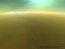
Huygens-Down-03.jpgHuygens' Descent to Titan: 90 Km from the Surface (credits: R. Pascal)72 visiteThe blue color of the sky slowly vanishes with decreasing distance to the Surface and is replaced by a brownish tint. Huygens is still above a layer of complex organic condensate haze, that prevents a clear view down to the Surface.MareKromium
|
|
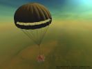
Huygens-Down-02.jpgHuygens' Descent to Titan: 100 Km from the Surface (credits: R. Pascal)72 visiteThe true color of Titan's Sky at this altitude is expected to be slighly less vivid than in this rendering, but should nevertheless come close to it. The transparency of the atmosphere would also be slightly lower to the naked eye. MareKromium
|
|
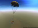
Huygens-Down-00.jpgHuygens' Descent to Titan: 115 Km from the Surface (credits: R. Pascal)71 visiteThe Huygens Probe just jettisoned its Main-parachute and is now hanging under the smaller Stabiliser-parachute. This Stabiliser-parachute will carry Huygens for the next two hours all the way down to the Surface of Titan. MareKromium
|
|

Huygens-Down-05.jpgHuygens' Descent to Titan: 70 Km from the Surface (credits: R. Pascal)71 visiteAt an altitude of about 70 Km above the Surface, Huygens is inside the layer of complex organic condensate haze. Below that layer, the view becomes clearer. MareKromium
|
|
| 93 immagini su 8 pagina(e) |
 |
|
|
|
6 | |
|








