| Risultati della ricerca nelle immagini - "Deposit" |

APOLLO_11_AS_11-45-6708a.JPGAS 11-45-6708 (a) - Glass Deposits97 visiteCrater bottom with prominent "glass deposits".MareKromium
|
|

Channels-Unnamed_Outflow_Channel-PIA00483.jpgOutflow Channel in South Nawka Vallis (possible Natural Colors; credits: Dr Paolo C. Fienga - Lunexit Team)79 visiteThis SAR image from the Southern portion of Navka (24,4-25,3° South Latitude and 338,5-340,5° East Longitude) is a mosaic of twelve Magellan orbits that covers approx. 180 Km (about 108 miles) in width and approx. 78 Km (about 47 miles) in length.
In the center of this image are two bright Deposits running North to South.
These Deposits outline an Outflow Channel that flowed from an about 60-Km diameter Crater that is to the South of the Channel itself. Inside the Outflow Channel and outlined by some so-called 'Bathtub Ring' Deposits are small Cones, most likely of volcanic origin.
At the end of the Outflow Channel, where one would expect the smallest particles to be deposited, are specular features which may represent Sand Dunes.
Seasat and space shuttle radar images of sand dunes on Earth also show specular reflections from smooth dune faces that are near-normal to the radar beam.
Other evidence for aeolian activity are the dark and bright Windstreaks running East to West and that formed behind the Cones. Notice how the wind changes direction from a South/East-North/West flow at the right of the image to an East-West flow at the eastern edge of the Outflow Channel.MareKromium
|
|
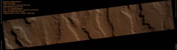
ESP_018471_1420_RED_abrowse.jpgElectris Region (Natural Colors; credits for the additional process. and color.: Dr Paolo C. Fienga - Lunexit Team)88 visitenessun commentoMareKromium
|
|

ESP_020334_2065_RED_abrowse-PCF-LXTT-00.jpgErosional Deposit in Eastern Arabia Terra (CTX Frame - Natural Colors; credits for the additional process. and color.: Dr Paolo C. Fienga - Lunexit Team)147 visitenessun commentoMareKromium
|
|

ESP_020334_2065_RED_abrowse-PCF-LXTT-01.jpgErosional Deposit in Eastern Arabia Terra (EDM - Natural Colors; credits for the additional process. and color.: Dr Paolo C. Fienga - Lunexit Team)159 visitenessun commentoMareKromium
|
|
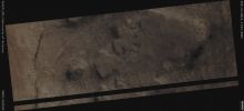
ESP_023803_1345_RED_abrowse.jpgClay-bearing Layered Deposit located within an Unnamed Crater, North of Proctor Crater (Absolute Natural Colors; credits for the additoonal process. and color.: Dr Paolo C. Fienga - Lunexit Team)233 visiteMars Local Time: 14:19 (Early Afternoon)
Coord. (centered): 45,4° South Lat. and 28,0° East Long.
Spacecraft altitude: 253,0 Km (such as about 158,1 miles)
Original image scale range: 25,3 cm/pixel (with 1 x 1 binning) so objects ~ 76 cm across are resolved
Map projected scale: 25 cm/pixel
Map projection: EQUIRECTANGULAR
Emission Angle: 6,5°
Sun-Mars-Spacecraft (or "Phase") Angle: 55,9°
Solar Incidence Angle: 51° (meaning that the Sun is about 39° above the Local Horizon)
Solar Longitude: 350,2° (Northern Winter)
Credits: NASA/JPL/University of Arizona
Additional process. and coloring: Dr Paolo C. Fienga - Lunar Explorer ItaliaMareKromium
|
|
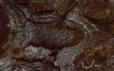
Juventae_Chasma-PIA12489.jpgBright Layered Deposits near Juventae Chasma (Natural Colors; credits: Dr Paolo C. Fienga - Lunexit Team)69 visiteThis view shows color variations in bright Layered Deposits on a plateau near Juventae Chasma in the Valles Marineris egion of Mars. A brown mantle covers portions of the bright deposits. The view covers an area about of 1,2 Km (three-fourths of a mile) across.
The image comes from an observation made by the High Resolution Imaging Science Experiment (HiRISE) camera on NASA's Mars Reconnaissance Orbiter on May 2, 2007.
Researchers have found that these bright Layered Deposits contain Opaline Silica and Iron Sulfates, consistent with low-temperature, acidic aqueous alteration of basaltic materials. They conclude that aqueous activity affected this plateau after formation of the nearby canyons. Although the source of water and sediment remains uncertain, the strong correlation between fluvial landforms and bright Layered Deposits in this Region argues for sustained precipitation, surface runoff, and fluvial deposition occurring during Mars' Hesperian Era on the plateaus adjacent to Valles Marineris and along portions of the canyon walls.
This image is one product from HiRISE observation PSP_003579_1755, centered at 4,7° South Lat. and 296,4 East Long.MareKromium
|
|
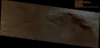
Juventae_Chasma-PIA13278.jpgLayered Hill in Juventae Chasma (Natural Colors; credits: Dr Paolo C. Fienga - Lunexit Team)70 visitenessun commentoMareKromium
|
|

North_Polar_Features-Layers-PIA18238-PCF-LXTT-IPF.jpgNorth Polar Layers with "Unconformities" (Absolute Natural Colors; credits for the additional process. and color.: Dr Paolo C. Fienga/Lunar Explorer Italia/Italian Planetary Foundation)111 visiteIn this VIS image, taken by the NASA - Mars Odyssey Orbiter on March, 3rd, 2014, and during its 54.206th orbit around the Red Planet, we can see a small portion of the so-called North Polar Layered Deposits (or "NPLD", for short), which - according to the data collected so far and duly examined by Planetary Scientists - are (mostly) made of Water-Ice.
Latitude (centered): 79,8759° North
Longitude (centered): 339,4930° East
Instrument: VIS
This image (which is a crop taken from an Original Mars Odyssey Orbiter b/w and Map-Projected frame published on the NASA - Planetary Photojournal with the ID n. PIA 18240) has been additionally processed, magnified to aid the visibility of the details, contrast enhanced, Gamma corrected and then colorized in Absolute Natural Colors (such as the colors that a human eye would actually perceive if someone were onboard the NASA - Mars Odyssey Orbiter and then looked down, towards the Surface of Mars), by using an original technique created - and, in time, dramatically improved - by the Lunar Explorer Italia Team.MareKromium
|
|
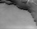
North_Polar_Features-North_Polar_Margin-PIA08705-1.jpgThe North Polar "Margin" (1 - Original NASA/JPL/ASU b/w Frame)66 visiteImage information: VIS instrument;
Latitude: 81,1° North;
Longitude: 299,2° East:
Resolution: 20 meter/pixel.
|
|
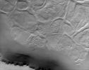
North_Polar_Features-North_Polar_Margin-PIA08705-2.jpgThe North Polar "Margin" (2 - Original NASA/JPL/ASU b/w Frame)71 visiteImage information: VIS instrument;
Latitude: 81,1° North;
Longitude: 299,2° East:
Resolution: 20 meter/pixel.
|
|

North_Polar_Features-North_Polar_Scarp-MGS-01.jpgNorth Polar Panorama (Absolute Natural Colors; credits for the additional process. and color.: Dr Paolo C. Fienga - Lunexit Team)185 visiteCaption NASA originale:"This MGS-MOC image shows a steep slope in the North Polar Region of Mars. The stripes indicate an exposure of layered material; the variations in brightness among the stripes are the result of varying amounts and textures on seasonal Carbon Dioxide (CO2) frost. At the time the image was acquired - such as in June 2006 -, the Carbon Dioxide frost was beginning to sublime way, leaving a variety of different patterns in frost distribution".
Location near: 85,2° North Lat. and 122,7° West Long.
Image width: ~3 Km (~1,9 mi)
Illumination from: lower left
Season: Northern Spring MareKromium
|
|
| 57 immagini su 5 pagina(e) |
1 |
 |
|
|








