| |
| Risultati della ricerca nelle immagini - "C" |
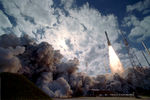
00-New_Horizon.jpgLet's go to Pluto!!!91 visiteDestination: Pluto. The New Horizons spacecraft roared off its launch pad at Cape Canaveral in Florida, USA, last week toward adventures in the distant Solar System. The craft is one of the fastest spaceships ever launched by humans, having passed the Moon only 9 hours (!) after launch and is on track to buzz Jupiter in early 2007.
Even traveling over 75.000 Km per hour, the New Horizons craft will not arrive at Pluto until 2015.
Pluto is the only remaining planet that has never been visited by a spacecraft or photographed up close. After Pluto, the robot spaceship will visit one or more Kuiper Belt Objects orbiting the Sun even further out than Pluto.
In the picture, the New Horizons craft launches into space atop a powerful Atlas V rocket.
|
|
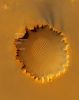
00-VictoriafromMRO.jpgVictoria Crater, from MRO (natural colors)212 visiteQuesto (spettacolare) frame lo potete trovare, in "Approximate True Colors", anche sui Siti NASA dedicati alle Missioni Mars Reconnaissance Orbiter, Opportunity e sul NASA Planetary Photojournal.
Noi, dopo aver valutato le immagini a colori della Regione di Meridiani (sia ottenute dal suolo, sia orbitali), abbiamo concluso che questo frame è stato elaborato non solo in falsi colori, ma "a tavolino", usando un Programma tipo "Paint" o "Photoshop".
Ciò premesso, abbiamo prima decolorizzato il frame NASA Originale e quindi lo abbiamo raffinato e ricolorizzato usando un nostro modestissimo software.
Risultato (che potrete verificare Voi stessi avendo solo un pizzico di pazienza e quindi ponendo a confronto il frame "NASA Originale" con questo): la densità cromatica del frame elaborato da noi è finalmente omogenea (con colori credibili e congrui rispetto ai colori visibili "dal suolo") ed il frame, qualora sottoposto a stretching, non si sgrana (come invece accade al frame NASA Originale).
Attenzione: noi non stiamo dicendo che "siamo più bravi" della NASA! Stiamo solo dicendo che la NASA, per motivi che preferiamo non commentare, "pasticcia" il suo stesso lavoro.
Pensateci sopra...MareKromium
|
|
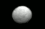
000-1-Ceres.gifCeres on sight (GIF-Movie)164 visiteIt is the largest asteroid in the asteroid belt - what secrets does it hold? To find out, NASA has sent the robotic Dawn Spacecraft to explore and map this cryptic 1,000-Km wide world: Ceres. Orbiting between Mars and Jupiter, 1-Ceres is officially categorized as a dwarf planet but has never been imaged in detail.
Featured here is a 20-frame video that rivals the best images of Ceres ever taken by the Hubble Space Telescope. The video shows enough surface definition to discern its 9-hour rotation period.
On target to reach 1-Ceres in early March, Dawn will match speeds and attempt to orbit this previously unexplored body, taking images and data that may help humanity better understand not only the nature and history of Ceres but also the early history of our entire Solar System.MareKromium
|
|

000-Clementine.gif000 - Clementine105 visiteDescription
Clementine was a joint project between the Ballistic Missile Defense Organization (BMDO, nee the Strategic Defense Initiative Organization, or SDIO) and NASA. The objective of the mission was to test sensors and spacecraft components under extended exposure to the space environment and to make scientific observations of the Moon and the near-Earth asteroid 1620 Geographos. The Geographos observations were not made due to a malfunction in the spacecraft. The lunar observations made included imaging at various wavelengths in the visible as well as in ultraviolet and infrared, laser ranging altimetry, gravimetry, and charged particle measurements. These observations were for the purposes of obtaining multi-spectral imaging the entire lunar surface, assessing the surface mineralogy of the Moon and obtaining altimetry from 60N to 60S latitude and gravity data for the near side. There were also plans to image and determine the size, shape, rotational characteristics, surface properties, and cratering statistics of Geographos. Clementine carried 7 distinct experiments on-board: a UV/Visible Camera, a Near Infrared Camera, a Long Wavelength Infrared Camera, a High Resolution Camera, two Star Tracker Cameras, a Laser Altimeter, and a Charged Particle Telescope. The S-band transmitter was used for communications, tracking, and the gravimetry experiment.
Spacecraft and Subsystems
The spacecraft was an octagonal prism 1.88 meters high and 1.14 m across with two solar panels protruding on opposite sides parallel to the axis of the prism. A high-gain fixed dish antenna was at one end of the prism, and the 489 N thruster at the other end. The sensor openings were all located together on one of the eight panels, 90 degrees from the solar panels, and protected in flight by a single sensor cover. The spacecraft propulsion system consisted of a nonpropellant hydrazine system for attitude control and a bipropellant nitrogen tetraoxide and monomethyl hydrazine system for the maneuvers in space. The bipropellant system had a total capability of about 1900 m/s with about 550 m/s required for lunar insertion and 540 m/s for lunar departure. Attitude control was achieved with 12 small attitude control jets, two star tracker cameras, and two inertial measurement units. The spacecraft was three-axis stabilized in lunar orbit via reaction wheels with a precision of 0.05 Deg. in control and 0.03 Deg. in knowledge. Power was provided by gimbaled, single axis, GaAs/Ge solar panels which charged a 15 amp-hour, 47-w hr/Kg Nihau (Ni-H) common pressure vessel battery. Spacecraft data processing was performed using a MIL-STD-1750A computer (1.7 million instructions per second) for savemode, attitude control, and housekeeping operations, a RISC 32-bit processor (18 million ips) for image processing and autonomous operations, and an image compression system provided by the French Space Agency CNES. A data handling unit sequenced the cameras, operated the image compression system, and directed the data flow. Data was stored in a 2 Gbit dynamic solid state data recorder.
Mission Profile
The mission had two phases. After two Earth flybys, lunar insertion was achieved approximately one month after launch. Lunar mapping took place over approximately two months, in two parts. The first part consisted of a five hour elliptical polar orbit with a periapsis of about 400 Km at 30 degrees south latitude and an apoapsis of 8300 Km. Each orbit consisted of an 80 minute lunar mapping phase near periapsis and 139 minutes of downlink at apoapsis. After one month of mapping the orbit was rotated to a periapsis at 30 degrees north latitude, where it remained for one more month. This allowed global imaging and altimetry coverage from 60 degrees south to 60 degrees north, over a total of 300 orbits. After a lunar/Earth transfer and two more Earth flybys, the spacecraft was to head for Geographos, arriving three months later for a flyby, with a nominal approach closer than 100 Km. Unfortunately, on May 7, 1994, after the first Earth transfer orbit, a malfunction aboard the craft caused one of the attitude control thrusters to fire for 11 minutes, using up its fuel supply and causing Clementine to spin at 80 rpm. Under these conditions, the asteroid flyby could not yield useful results, so the spacecraft was put into a geocentric orbit passing through the Van Allen radiation belts to test the various components on board. The mission ended in June 1994 when the power level onboard dropped to a point where the telemetry from the spacecraft was no longer intelligible.
|
|
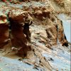
000-OPP-SOL1095-MF-LXT.jpgVictoria's Capes - Sol 1095 (Hi-Def3-D - credits and Copyright: Dr M. Faccin and Lunar Explorer Italia)117 visiteUna "Nuova Visione" di Marte, Made by Lunexit: si tratta di frames processati tridimensionalmente, ma adottando una tecnica ed un processing totalmente innovativi.
Confrontate queste "Visioni di Marte" con i 3D "Standard" NASA e...Vedrete la differenza, e CHE differenza!
Questa tecnica di elaborazione delle immagini (sviluppata da Marco Faccin e Gianluigi Barca, sotto Copyright Lunar Explorer Italia) è il primo passo verso la creazione di frames tridimensionali a colori (non più il "solito" blu/verde e rosso) e ad altissima definizione. Frames che permetteranno a chiunque li guardi (ed anche a persone che hanno problemi di vista) di mettere - letteralmente - gli occhi ed il naso "all'interno del paesaggio ripreso".
Ed ora (e per il momento), indossate gli "occhialini" e...in un istante Vi ritroverete DENTRO e AD UN PASSO dal margine e dai Promontori di Victoria Crater!
MareKromium
|
|

000-SOL166.jpgIs There Life On Mars?93 visiteIs there Life on Mars? Questa domanda, che è anche il titolo di un grande (e datato!) successo di David Bowie (...o "l'Uomo che cadde sulla Terra", come dicono molti dei suoi Fans...), non può, a questo punto della Storia di Lunar Explorer Italia, non diventare oggetto di una Galleria ad hoc.
Curata dal Dr Gianluigi Barca (Presidente di Lunexit, Sez. Liguria e Piamonte) e dal Dr Marco Faccin (Tecnico dell'Immagine e Ricercatore Senior), con la collaborazione del Dr Paolo C. Fienga (Presidente di Lunexit, Direz. Generale), questa Galleria mostrerà un quantitativo - riteniamo - impressionante di frames Spirit ed Opportunity che, una volta processati usando la Tecnica che abbiamo battezzato "Superdefinizione" e, talvolta, ulteriormente elaborati attraverso il Processo - Made by Lunexit - conosciuto come "MULTISPECTRUM", Vi mostreranno Marte come - REALMENTE - non lo avevate MAI visto prima.
La Superdefinizione, una Tecnica "semi-artigianale" di Elaborazione delle immagini originariamente adottata dalla NASA per migliorare la qualità visiva dei primi frames "Marziani" (siamo nel periodo delle Missioni Viking e Pathfinder), è stata ridisegnata nelle sue linee essenziali (e quindi, in un certo senso, "reinventata" per meglio servire i nostri scopi) dal Dr Marco Faccin ed è poi anche stata ulteriomente raffinata dal Dr Gianluigi Barca.
Ad essa, talvolta (ed al sussistere delle necessarie condizioni), potrà anche essere aggiunto il MULTISPECTRUM Processing il quale conferirà all'immagine nella sua versione "definitiva" le caratteristiche di colorazione e texture necessarie affinchè quanto ripreso possa essere visto dal Lettore "con Occhi Marziani" (ossìa il Lettore vedrà il Paesaggio di Marte ed i suoi dettagli "come se si trovasse in loco").
A tal riguardo - e per ottenere il massimo realismo - il processing addizionale alla Superdefinizione (ergo il MULTISPECTRUM Processing) considera, per ogni frame pubblicato, l'Ora Locale di Scatto (la quale, insieme alla Stagione in corso ed alla Opacità Atmosferica del momento - se conosciuta - diventa una funzione essenziale per stabilire le condizioni effettive di illuminazione del particolare ripreso).
Attraverso questo Lavoro (che non è "facile" nemmeno in teoria - figurateVi in pratica...) siamo giunti ad evidenziare dei particolari, in fondo ricorrenti in tutte le immagini, ma DECISAMENTE più evidenti nei frames ottenuti attraverso il Microscopic Imager di cui sono dotati entrambi i Rover, i quali, pur se non possono rispondere in maniera definitiva al nostro Quesito Origianale, certo lasceranno tanti LEGITTIMI dubbi agli Interpreti e, in ogni caso, aiuteranno (o, almeno, questo è quanto speriamo...) i Ricercatori e gli Appassionati di Marte & Dintorni a "VEDERE" cose che la NASA non si è mai neppure (pubblicamente, come ovvio...) sognata di mostrare.
Dunque Buon Viaggio e, che dite? Is There Life On Mars?!?...MareKromium
|
|

0002.jpgMartian "Roswell"? (ctx frame - High-Def-3D; credits: Dr M. Faccin & Lunar Explorer Italia)180 visiteIl rilievo superficiale anomalo che andremo a visionare adesso è, almeno a parer nostro, il più "curioso" fra tutti quelli sino ad ora identificati.
La ripresa avviene da quasi 300 Km di altitudine e, nella versione ad Altissima Definizione del frame che Vi proponiamo, l'Oggetto che ha attratto l'attenzione del nostro Marco Faccin si manifesta come una sorta di disco - in un frame successivo Vi dimostreremo che si tratta di un cerchio quasi perfetto - il quale, tuttavia, non mostra alcuna apparenza metallica ma, al contrario, condivide la texture ed il colore dell'ambiente ad esso circostante.
Sarà a causa di una sorta di "camouflage"?!? Forse. O forse no. A seguito delle analisi che abbiamo svolto (basandoci, come ovvio, su quanto mostrato dai frames in nostro possesso e quindi contestualizzando il dettaglio) la nostra impressione è che stiamo osservando una "componente" del suolo. Un qualcosa che accede alla superficie e ne condivide la texture ed il colore ma che, nel contempo, si distacca e si distingue da essa, differenziandosi.
Non è un cratere, naturalmente (altrimenti il dettaglio non sarebbe in questa sezione) e, come vedrete nei details mgnf che seguono, si tratta effettivamente di un disco roccioso (?), leggermente inclinato sul piano del suo orizzonte locale (l'inclinazione si nota anche nel frame bidimensionale in quanto ha generato una piccola ombra).
L'origine e gli scopi - ammesso che ne esistano - di una siffatta Surface Feature, sono sconosciuti.MareKromium
|
|
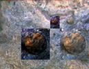
0003.jpgMartian "Roswell"? (edm - false colors; High-Def-3D; credits: Dr M. Faccin & Lunar Explorer Italia)184 visiteNel dettaglio magnificato ed in falsi colori, la condivisione della texture fra il rilievo anomalo e la superficie a cui esso accede appare in tutta la sua evidenza.
Ed è per questo motivo che si è sviluppata in noi l'idea per cui questa bizzarra Surface Feature potrebbe anche essere l'espressione visibile di un qualche tipo di forma vitale (esotica, come ovvio) indigena.
L'unica "certezza" (si fa per dire...) che Vi possiamo offrire attiene il posizionamento del dettaglio: NON SI TRATTA, infatti, di una depressione del suolo, bensì di un rilievo che si solleva - solo da un suo lato - dalla superficie.
Il resto, lo sapete, può essere solo speculazione (informata, certo, ma sempre speculazione).MareKromium
|
|
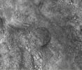
0004.JPGMartian "Roswell"? (edm - High-Def-3D; credits: Dr M. Faccin & Lunar Explorer Italia)142 visitenessun commentoMareKromium
|
|
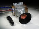
0008-Phoenix-Mike.jpgOne, Two, Three...TESTING!66 visiteThe unmistakable presence of a microphone, next to one of the cameras equipped with the Phoenix Probe, suggests even more interesting scenarios: the Friends of Pasadena don't just want photographs and "cooking" experiments (assuming they can be done, sooner or later...): they also want "sounds" from Mars!
What kind? Perhaps the wind... Maybe other things too.
The Lunexit STAFF's intuition when, years ago, we thought the idea of ​​an "Audio-File" from Mars might even be a good idea.
And if it is, then Phoenix does NOT have exclusive rights to the sound... Believe me!MareKromium
|
|

001.jpgSpace-(Heat)-Shields - The "Space-Wreck" on the edge of Bonneville Crater405 visite"Qual è colui che grande inganno ascolta
che li sia fatto, e poi se ne rammarca,
fecesi Flegiàs ne l'ira accolta".
(DANTE ALIGHIERI, La Divina Commedia, Inferno - Canto VIII)
Tra i tanti enigmi marziani che Lunar Explorer Italia tenta di portare alla Vostra attenzione, uno dei più intriganti è lo strano “oggetto” fotografato da Spirit sul bordo del Cratere Bonneville ed identificato - dalla versione ufficiale NASA - come l’Heat-Shield (Scudo Termico) utilizzato dalla Sonda Spirit durante la discesa sul pianeta.
Per verificare l’attendibilità di questa versione proviamo ad esaminare la questione non tanto sul piano scientifico, quanto su quello tipico dei processi di “intelligence”.
1 - L’OGGETTO
In questa prima immagine possiamo vedere la "forma incriminata" così come appare nella maggioranza delle fotografie fornite dalla NASA.
Un aspetto sconcertante è che l’oggetto ripreso nell’arco di diversi giorni presenta visibili modificazioni, non spiegabili con la semplice variazione dei filtri delle fotocamere, come si può verificare in questa sequenza 3D ordinata cronologicamente, ripresa da un articolo della mia rubrica su Space Freedom http://www.margheritacampaniolo.it/Feltri/Int18.gif.
|
|
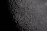
0018-Hertzprung_Basin_Rim.jpgVavilov Crater Along the Hertzsprung Basin Rim92 visiteart002e012093 (April 6, 2026) - Hertzsprung Basin comes into view with its distinctive two concentric rings of mountains, revealing the scale of this ancient impact structure.
Near the lower left, Vavilov crater (identified by its Central Peak) stands out, a feature often described by the Artemis II crew during their Lunar Fly-By.MareKromium
|
|
| 7618 immagini su 635 pagina(e) |
1 |
 |
|
|
|
|
|
|
|
|
|
|
|








