| Piú votate - Mariner, Viking & MGS's Maps & Mars in the '70s |
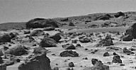
ZM-Viking2-Rocks_5-Viking_Frame-2005112122712_Mars_Dunes_Stereo_Anomaly.gifUnusual Movement in the Dunes (GIF-Movie; credits: Sig. "Manny")147 visiteOgni promessa è debito: ecco quindi il bellissimo (ed assai intrigante) GIF-Movie realizzato dal Sig. Manny, il quale ci mostra che anche dalle parti del Viking Lander n. 2, "qualcosa" si muoveva tra rocce e dune.
Una prova ulteriore (sebbene, purtroppo, ad affidabilità relativa a causa della scarsissima qualità dei frames impiegati - ma per noi va bene lo stesso), del fatto che, nonostante il silenzio dei Ragazzi di Pasadena, il muto scetticismo del Gotha Mondiale degli "Esperti" di Scienze Planetarie ed Eso-Biologia e l'indifferenza (unita ad ilarità vera e propria) dei vecchi (o vecchissimi...) guitti da laboratorio (o da Osservatorio Astronomico) di "casa nostra", sulla Superficie del Pianeta Rosso sono AGEVOLMENTE RISCONTRABILI e VERIFICABILI DEI MOVIMENTI.
Movimenti, sia detto con chiarezza, che non sono indici necessari della presenza/esistenza di Entità Biologiche o Bio-magnetiche Locali (in realtà ci potrebbero essere altre spiegazioni, altrettanto valide - ma che, per adesso, ci teniamo in tasca...), ma che COMUNQUE ESISTONO e, a nostro modo di vedere, andrebbero, se non altro, STUDIATI con un minimo di serietà e di attenzione.
Una serietà ed attenzione che, eccezion fatta per Lunar Explorer Italia e qualche altro sparuto Ricercatore Solitario, onestamente non riusciamo a vedere.
Complimenti, sinceri e di cuore, al Sig. "Manny", per aver fornito un eccellente tassello ulteriore al mosaico che Lunar Explorer Italia sta costruendo da anni. MareKromium
(6 voti)
|
|

N-Mariner6-02_enn_06.jpgMars from Mariner 6: Martian Landscape70 visitenessun commento
(6 voti)
|
|
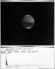
N-Mariner6-01_cof_15d.jpgMars from Mariner 6: approaching Mars75 visiteLa distanza da cui questa spettacolare immagine è stata ripresa è di poco superiore ad 1 MKM.
Vi suggeriamo di notare l'incredibile ampiezza del Polo Sud e quindi di paragonare questo frame con altri frames similari ottenuti negli Anni '90 e quindi con le immagini MGS (o MRO o anche - sebbene trattasi di immagini inattendibili - Mars Express) che rappresentano la medesima Regione.
Le conclusioni primarie ed interlocutorie - ma comunque significative - le lasciamo a Voi.
(6 voti)
|
|

N-Mariner4-68.jpgGlobal Sand&Dust-storm from Mariner 4 (natural colors)77 visitenessun commento
(6 voti)
|
|

ZD-E-Viking1-p4041b.jpgThe South-western horizon of Viking 1 (2)115 visiteCaption NASA originale:"Almost certainly this is the upraised rim of an impact crater, about 500 mt in diameter and 2,5 Km distant. Part of the far side of the central cavity can be discerned toward the left, particularly in picture n. (3)".
(6 voti)
|
|

ZE-I-Viking1-p135b.jpgColor snap-shots from Viking 1 (5)89 visitenessun commento
(6 voti)
|
|

ZE-I-Viking1-p133c.jpgColor snap-shots from Viking 1 (3)86 visite"...The scene has a reddish or orangeish cast. Figure (2) is constructed by incorporating data from an accompanying IR picture and using the spacecraft's test charts, in this way accounting for out of band contributions and atmospheric colorations.
The scene is shown as it might appear "on Earth". For example, if you could pick up one of the boulders and transport it to your back yard, this is the color you would observe. Note that, relative to figure (1), the reddish tint is subdued, replaced with a brown hue.
Figure (3) shows the scene as it would appear "on Mars". The yellowish cast of Sunlight filtering through the atmospheric dust imparts a similar yellowish hue to the entire scene".
(6 voti)
|
|

QB-VikingOne-PIA08616-00.jpgViking One: the Landing Site, 30 years after the landing... (1)109 visiteCaption NASA originale:"Viking 1 landed 30 years ago, on July 20, 1976. It was the first U.S. landing on Mars and a very exciting time for Mars Exploration. Since that time, 4 additional Spacecrafts have successfully landed on Mars and conducted their science investigations. Today, new missions to the Martian Surface are in the works, with landings expected in 2008 (Phoenix) and 2010 (Mars Science Laboratory).
The Viking 1 Lander is difficult to see in MGS-MOC images. The Western Chryse Planitia Landing Site is often obscured by dust hazes and occasional storms, especially during Northern Winter, which would otherwise be the best time to look for the Lander from orbit because the Sun casts longer shadows in Winter.
When the atmosphere is clearest, in portions of the Spring and Summer, the Sun is higher in the sky as seen from MGS's orbit. The spacecraft always passes over the Landing Site Region around 2 p.m. in the afternoon".
(6 voti)
|
|

ZE-I-Viking1-p140a-PCF-LXTT.jpgThe "Golden Plain" (Absolute Natural Colors; credits for the additional process. and color.: Dr Paolo C. Fienga - Lunexit Team)273 visiteThe Viking 1 Lander touched down in Western Chryse Planitia at 11:53:06 UT (such as 16:13 M.L.T. - Middle Afternoon). Approximately 22 Kg of propellants were left at landing.MareKromium
(5 voti)
|
|

ZE-I-Viking1-Oppy-2.jpgMartian Clouds, from Viking 1 until "Oppy" (an Image-Mosaic by Dr M. Faccin)90 visitenessun commentoMareKromium
(5 voti)
|
|

ZE-I-Viking1-vl1_12b069-3.jpgLight and long Ice-Cloud over Chrise Planitia (Natural Colors; credits: Dr M. Faccin - Lunexit Team)77 visitenessun commentoMareKromium
(5 voti)
|
|

O-Mariner9-72-Pollack_Crater_and_White-Rock.jpgPollack Crater and "White Rock" from Mariner 9 (RAW Frame - credits: NASA)73 visite"...It was interesting to browse through the Mariner 9 data set to locate these images, because evidently the Mariner 9 Team wasn't sure to make of these strange bright deposits.
The first one I posted was described as "white rock" in a comment on the image, and that name has stuck. But another image's descriptive comment read "curious ice patches".
Another totally misidentified not only the nature but the location of the photo, describing it as "Polar Cap".
Comments on images of other places in the Mariner 9 Catalog generally reflect the fact that Mars had not yet been systematically surveyed by an orbiter, so the scientists often weren't quite sure what they were looking at, and even when it was clear there were craters, those craters had mostly not yet been named.
I came across comments like "peculiar filametary structure" and "possible craters" and "streaky detail" and "cloud?" and "multitude of surface detail" and "odd fork-shaped bright pattern."
It's fun to browse through that table and imagine surveying Mars, with a spacecraft stationed at the Planet for the first time, made all the more dramatic by its initial obscuration by a dust storm that slowly cleared.
Mariner 9 is one of the more challenging data sets to work with because it's just so old. However, everything you need to access it, find images, view them, and convert them to more familiar formats is readily available online. First of all, the data itself can be found by browsing the data volumes at the PDS Imaging Node, and you can learn a little bit about the data at the National Space Science Data Center. To figure out what's what and to try to track down images of specific areas, you can download this spreadsheet (XLS format, zipped, 7.5 MB) containing an index to all the images.
The images are all in a format that won't be familiar to most of you, but like most spacecraft data you can convert a folder full of images to PNG format using my favorite amateur-produced software, Björn Jónsson's IMG2PNG. However, if you're only working with a couple of images, I'd recommend a different amateur-produced piece of software for converting the images, Piotr Masek's MarinerView, because MarinerView can be used to correct the Mariner 9 images (one at a time) for the little white specks of noise that are spattered across every one.
I'm slowly working on tracking down images of "White Rock" taken by every mission. First Mariner 9, then the Viking orbiters, then Mars Global Surveyor's MOC, then Mars Odyssey THEMIS, then Mars Express HRSC, and, finally, I should be able to produce Mars Reconnaissance Orbiter views from three different instruments: HiRISE, CTX, and CRISM. Stay tuned for further installments...".
Emily Lakdawalla (Planetary Society)MareKromium
(5 voti)
|
|
| 115 immagini su 10 pagina(e) |
 |
|
|
|
|
7 | |
|
|








