| Piú votate - From Ashes to Eternity: the Phoenix Mars Mission |

PHOE-SOL009-lg_2964.jpgIce or Salt? - Sol 9 (MULTISPECTRUM; credits: Lunexit)66 visitenessun commentoMareKromium
(6 voti)
|
|

PHOE-SOL005-PIA10735.jpgArctic Panorama (MULTISPECTRUM; credits: Lunexit)87 visiteNotizia dell'ultima ora: malfunzionamento di alcuni circuiti del Phoenix Lander. Il Sito NASA dedicato è, al momento, non raggiungibile.
Ricerca di "Interesse e Pathos" o "Problema Reale Grave"? Pubblicheremo le novità non appena possibile.
Caption NASA:"This view is compiled of images from Phoenix's Stereo Surface Imager (SSI) camera that were taken on Soles 1 and 3. The top portion has been stretched eight fold to show details of features in the background. Phoenix's Parachute, Backshell, Heat-Shield, and Impact Site can also be seen".MareKromium
(6 voti)
|
|

PHOE-SOL003-PIA10720.jpgPhoenix Color Targets65 visiteCaption NASA:"These images of 3 Phoenix Color Targets were taken on Soles 1 and 2 by the Surface Stereo Imager (SSI) on board the Phoenix Lander. The bottom target was imaged in approximate color (SSI's red, green, and blue filters: 600, 530, and 480 nanometers), while the others were imaged with an infrared filter (750 nanometers).
All of them will be imaged many times over the mission to monitor the color calibration of the camera. The two at the top show grains 2 to 3 millimeters in size that were likely lifted to the Phoenix deck during landing. Each of the large color chips on each target contains a strong magnet to protect the interior material from Mars' Magnetic Dust".MareKromium
(6 voti)
|
|

PHOE-SOL003-lg_532-533-534.jpgPhoenix in True Colors! - Sol 3 (credits: Dr Gianluigi Barca)74 visitenessun commentoMareKromium
(6 voti)
|
|

PHOE-SOL000-PSP_008579_9020.jpgThe Descent of Phoenix, from MRO - Sol 0 (MULTISPECTRUM; credits: Lunexit)70 visiteCaption NASA:"MRO's HiRISE camera acquired this dramatic oblique image of Phoenix descending on its parachute. Shown here is a a wider view of the full image, showing a 10 Km diameter crater informally called “Heimdall,” and an improved full-resolution image of the parachute and lander (in the inset).
Although it appears that Phoenix is descending into the crater, it is actually about 20 Km in front of it. It is difficult to believe that it is in front of the crater because it is so much smaller, but in reality it is, and that's a good thing because landing on the steep rocky slopes of the crater would have been far too exciting (or risky).
Images from the lander clearly show that it sits on a flat plain, although the rim of Heimdall may be visible on the horizon. Given the position and pointing angle of MRO, Phoenix is at about 13 Km above the surface, just a few seconds after the parachute opened.
This improved image shows some details of the parachute, including the gap between upper and lower sections. At the time of this observation, MRO had an orbital altitude of 310 Km, traveling at a ground velocity of 3,4 Km/second, and a distance of 760 Km to the Phoenix lander.
The image was rotated to a position that seems approximately parallel to the horizon based on the elongation of Heimdall Crater, but this is not exact. Thus, although Phoenix appears to hang from the parachute at an angle, as if swaying in the wind, the exact geometry has not yet been determined. The parachute image is very sharp as its apparent motion was straight down the HiRISE TDI (Time Delay Integration) columns. However, the surface of Mars was moving at an angle to the TDI columns, and thus is smeared by a few pixels, although the smear is not apparent at the reduced scale of the image shown here.
The Sun is almost directly behind HiRISE, so the parachute should be casting a shadow onto the slope of the Crater, but we cannot determine which of many dark spots is the shadow until a detailed geometric analysis has been completed". MareKromium
(6 voti)
|
|

PHOE-SOL002-lg_438-439-2.jpgThe soil of Vastitas Borealis - Sol 2 (Natural Colors + MULTISPECTRUM; credits: Dr Gianluigi Barca & Lunexit)78 visitenessun commentoMareKromium
(6 voti)
|
|

PHOE-SOL001-PIA10690.jpgVastitas Borealis - Sol 1 (Approximate True Colors; credits: NASA/JPL-Caltech/University of Arizona )68 visiteVisto?!?...Le "colorizzazioni" NASA? Prevedibili. Sempre prevedibili.
Prevedibili in maniera quasi sconcertante: dai cieli "rosati" (che abbiamo già visto sopra Gusev Crater e, sebbene più raramente, sopra Meridiani Planum) al terreno pallidamente arancio-giallo. E questa è la prima immagine "colorata"! Chissà le altre...
Caption NASA:"This image, one of the first captured by NASA's Phoenix Mars Lander, shows the vast plains of the northern polar region of Mars. The flat landscape is strewn with tiny pebbles and shows polygonal cracking, a pattern seen widely in Martian high latitudes and also observed in permafrost terrains on Earth. The polygonal cracking is believed to have resulted from seasonal freezing and thawing of surface ice.
Phoenix touched down on the Red Planet at 4:53 p.m. Pacific Time (7:53 p.m. Eastern Time), May 25, 2008, in an arctic region called Vastitas Borealis, at 68° North Latitude and 234° East Longitude.
This is an approximate-color image taken shortly after landing by the spacecraft's Surface Stereo Imager, inferred from two color filters, a violet, 450-nanometer filter and an infrared, 750-nanometer filter".MareKromium
(6 voti)
|
|

PHOE-SOL001-N-230118-false_color_postcard-001.jpgVastitas Borealis - Sol 1 (Natural Colors + MULTISPECTRUM; credits: Dr Gianluigi Barca & Lunexit)66 visitenessun commentoMareKromium
(6 voti)
|
|

PHOE-SOL001-P-lg_431.jpgOne "Leg" and "Landing Pad" of Phoenix - Sol 1 (Natural Colors + MULTISPECTRUM; credits: Dr M. Faccin & Lunexit)69 visitenessun commentoMareKromium
(6 voti)
|
|

PHOE-SOL001-M-Photocomposite-01.jpgThe Surface of Vastitas and the Sky above - Sol 1 (Photocomposite; True Colors + MULTISPECTRUM; credits: Dr M. Faccin & Lunexit)73 visiteUna splendida immagine, ad oggi - e LETTERALMENTE! - Unica al Mondo. Un Grazie davvero infinito al Dr Faccin, al Dr Barca (che sta già operando su altri frames Phoenix) ed a tutti coloro che leggono le nostre pagine.MareKromium
(6 voti)
|
|

D-Vastitas-PIA10634.jpgPhoenix Landing Site, from MRO68 visiteNASA's Phoenix Mars Lander is scheduled to land on the Martian Northern Plains near 68° North Lat. and 127° West Long. on May 25, 2008. In preparation for the landing, NASA's Mars Reconnaissance Orbiter has been monitoring weather in the Region around the Landing Site. On April 20, 2008, the orbiter's Mars Color Imager camera captured this view of a large region of Northern Mars that includes the landing target area in the lower right quadrant.
This version of the image indicates the location of the landing ellipse, about 100 Km(approx. 60 miles) long. The Context Camera on the MRO took an image of the Landing Area at the same time the Mars Color Imager took this image.
A dot within the Landing Ellipse marks the location of two active DD visible in the Context Camera image, PIA10633.
When the Mars Color Imager acquired this image, the season in Mars' Northern Hemisphere was late Spring. A few weeks earlier, the Phoenix Landing Site was still covered with seasonal frost left over from the previous winter.MareKromium
(6 voti)
|
|
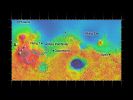
C-Phonix_Others.jpgPhoenix will not be alone on Mars...67 visitenessun commentoMareKromium
(6 voti)
|
|
| 399 immagini su 34 pagina(e) |
 |
|
|
|
|
16 | |
|
|
|
|








