| |

| Piú viste - From Ashes to Eternity: the Phoenix Mars Mission |

PHOE-SOL151-lg42476-42509-42510-2.jpgFrost... - Sol 151 (Superdefinition and natural colors; credits: Dr G. Barca)69 visitenessun commentoMareKromium
|
|

PHOE-SOL151-PIA11725.jpgOne Last Look at the Martian Arctic - Sol 151 (False Colors, according to NASA)69 visiteCaption NASA:"This is a false color image of the Martian Terrain and rock called "Winkies" (rock "Quadlings" in foreground) taken by the Surface Stereo Imager camera on NASA's Phoenix Mars Lander on Sol 151 of the Mission (Oct. 27, 2008).
This frosty image is among the last taken by the Lander before the Mission's final communications on Nov. 2, 2008".MareKromium
|
|
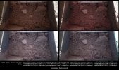
PHOE-SOL009-MF-LXTT.jpgVastitas' Icy Terrain - Sol 9 (an Image-Mosaic in Natural and Enhanced Natural Colors by Marco Faccin - Lunexit Team)69 visitenessun commentoMareKromium
|
|

E-PIA10633.jpgDust Devils and Frozen Craters at Phoenix Landing Site (MULTISPECTRUM; credits: Lunexit)68 visiteNASA's Phoenix Mars Lander is scheduled to land on the Martian Northern Plains near 68° North Lat. and 127° West Long. on May 25, 2008. In preparation for the landing, NASA's Mars Reconnaissance Orbiter has been monitoring weather in the Region around the Landing Site.
On April 20, 2008, the orbiter's Context Camera captured this view showing two active DD within the Phoenix Landing Ellipse.
This is a subframe covering an area about 26 Km (approx. 16 miles) on each side (...). It shows two Dust Devils and their shadows. Based on measurement of the shadows cast by the DD, one of the vortices towered about 590 meters (about 1930 feet) with a dust plume extending 920 meters (about 3020 feet) above the surface. The other reached about 390 meters (1280 feet) high, with a dust plume extending to 790 meters (2590 feet). The resolution here is 6 meters (19,7 feet) per pixel.
When the Context Camera acquired this image, the season in Mars' Northern Hemisphere was late Spring. A few weeks earlier, the Phoenix Landing Site was still covered with seasonal frost left over from the previous Winter. White patches in small craters near the center of the picture are areas where the Winter frost remained, even as late as April 20, 2008.
As Spring gives way to Summer, DD are likely to occur more frequently, as local temperatures rise. These two DD observed in late April are among the first of the season. The cameras on the Phoenix Lander might be able to spot additional Dust Devils after the spacecraft arrives, as the Mars Exploration Rover Spirit has been able to do at its Southern Hemisphere Landing Site.
Dust Devils are whirling vortices that have picked up dust from the ground. Such vortices can occur even when no dust is present, but then they are not visible to the cameras onboard the Mars Reconnaissance Orbiter. Such vortices commonly form as hot air rises from the surface on an otherwise generally calm day with little or no breeze. Dust Devils will travel across the surface on the gentle breezes that do occur. Sometimes, DD have been observed by cameras orbiting Mars to create streaks on the ground as they disrupt and pick up dust, though no streaks are observed in this image.
The Mars Orbiter Camera onboard NASA's Mars Global Surveyor orbiter observed Dust Devils — and streaks created by them — throughout its 1997 to 2006 mission. During that time, scientists at Malin Space Science Systems observed more than 12.000 active Dust Devils. They were seen over the full range of elevations and nearly all latitudes on Mars. Dust Devil Streaks were found in Mars Orbiter Camera images as far North as the edge of the North Polar Residual Cap and the dune fields that surround the Region.
However, the northernmost active DD captured by that camera was at 62,2° North Latitude, which is further South than the Phoenix Landing Site.
Another camera on the Mars Reconnaissance Orbiter, the Mars Color Imager, captured a simultaneous, wider-field, color view of the area included in this Context Camera image. That view can be seen at PIA10634.MareKromium
|
|

PHOE-SOL001-lg_437.jpgThe soil of Vastitas Borealis - Sol 1 (Natural Colors + MULTISPECTRUM; credits: Lunexit)68 visiteImmagine ottenuta alle 17:12:26 Mars Local Solar Time.MareKromium
|
|

PHOE-SOL001-N-P-Pstcd.jpgVastitas Borealis - Sol 1 (RAW Color Data; credits: Dr Gianluigi Barca)68 visiteAnche questa splendida elaborazione in colori RAW, realizzata dall'ottimo Dr Gianluigi Barca finirà con l'assomigliare molto - a nostro parere - alle elaborazioni NASA in "false" ed "approximate true colors".
Staremo a vedere... MareKromium
|
|

PHOE-SOL002-lg_509.jpgBack-Shell or Heat-Shield? - Sol 2 (MULTISPECTRUM; credits: Lunexit)68 visiteMareKromium
|
|

PHOE-SOL000-PSP_008579_9020.jpgThe Descent of Phoenix, from MRO - Sol 0 (MULTISPECTRUM; credits: Lunexit)68 visiteCaption NASA:"MRO's HiRISE camera acquired this dramatic oblique image of Phoenix descending on its parachute. Shown here is a a wider view of the full image, showing a 10 Km diameter crater informally called “Heimdall,” and an improved full-resolution image of the parachute and lander (in the inset).
Although it appears that Phoenix is descending into the crater, it is actually about 20 Km in front of it. It is difficult to believe that it is in front of the crater because it is so much smaller, but in reality it is, and that's a good thing because landing on the steep rocky slopes of the crater would have been far too exciting (or risky).
Images from the lander clearly show that it sits on a flat plain, although the rim of Heimdall may be visible on the horizon. Given the position and pointing angle of MRO, Phoenix is at about 13 Km above the surface, just a few seconds after the parachute opened.
This improved image shows some details of the parachute, including the gap between upper and lower sections. At the time of this observation, MRO had an orbital altitude of 310 Km, traveling at a ground velocity of 3,4 Km/second, and a distance of 760 Km to the Phoenix lander.
The image was rotated to a position that seems approximately parallel to the horizon based on the elongation of Heimdall Crater, but this is not exact. Thus, although Phoenix appears to hang from the parachute at an angle, as if swaying in the wind, the exact geometry has not yet been determined. The parachute image is very sharp as its apparent motion was straight down the HiRISE TDI (Time Delay Integration) columns. However, the surface of Mars was moving at an angle to the TDI columns, and thus is smeared by a few pixels, although the smear is not apparent at the reduced scale of the image shown here.
The Sun is almost directly behind HiRISE, so the parachute should be casting a shadow onto the slope of the Crater, but we cannot determine which of many dark spots is the shadow until a detailed geometric analysis has been completed". MareKromium
|
|

PHOE-SOL003-lg_766-1.jpgSlightly Over-exposed... - Sol 3 (Superdefinition + MULTISPECTRUM; credits: Dr M. Faccin & Lunexit)68 visiteL'immagine, come Voi stessi potete facilmente valutare, è leggermente sovraesposta. Ma sin qui, passi...La verità è che questo frame, prima dell'additional processing (riallineamento dei frames che formano la fotocomposizione incluso) il quale è stato posto in essere dal nostro eccezionale Dr Faccin, era praticamente inguardabile.
Qualcuno dei "vizi" in oggetto?
Lasciamo che sia lo stesso Marco a raccontarceli:"...sono intervenuto per tentare di migliorare la foto-composizione (collage) operata dalla Nasa. Se si guardano i frames originali - e specie i photo-composites -, non si può non notare che essi fanno semplicemente schifo. Ma "caspita" (!), dico: qui abbiamo dei frames che ci mostrano un altro Pianeta, che sono costati MILIONI DI DOLLARI, che potrebbero fornire indizi preziosissimi ed i Signori della NASA e della University of Arizona che fanno? Li incollano alla "come viene, viene": sommariamente. Male.
Allora, qui bisogna intendersi: la mia non è pignoleria fine a se stessa ma, in questi casi (visto il valore, Storico e Scientifico dei frames e valutati i costi per AVERE questi frames) un pò di precisione è ESSENZIALE.
Questa è ormai una questione di Professionalità...che manca! E che diavolo. E' come se portassi la mia macchina dal carozziere per una revisione e riverniciatura ed il lavoro venisse poi fatto - ripeto - "sommariamente"; alla "speriamo che non se ne accorga". Ma io me ne accorgo, ed a quel punto che faccio? Prendo per il collo il carrozziere e lo trito!
Ok, fine dello sfogo.
Lasciamo anche stare i "carrozzieri" (quelli che fanno il loro lavoro onestamente, intendo...), ma qui la verità va detta AD ALTA VOCE ED UNA VOLTA PER TUTTE: io (tutti noi) mi sento insultato e preso in giro da questa gente. Ma che cosa pensano? Che il "resto dell'Umanità" sia composto da fessi certificati?
Prova a notare: quando (ri)compongono i 3 frames RGB, neppure li allineano correttamente - infatti, se noti, la porzione superiore del frame è pateticamente fatta male.
La mia opinione? a Pasadena stanno davvero esagerando: stanno fornendo spazzatura al Mondo.
Ci danno da mangiare (sorry: da analizzare) gli scarti e pretendono che noi li si veda per pietanze sopraffine. Ma per favore!...".
Lo "sfogo" del Grande Marco Faccin è lo sfogo di tutti noi. E non è neppure uno sfogo "nuovo": pensate ai fotomosaici Apollo e Soujourner-Pathfinder (atroci); alle colorizzazioni psichedeliche Viking, Opportunity e Spirit (folli e brutte).
Il materiale che viene messo in Rete è, oltre che incompleto - quasi sempre -, pure rappresentativo dello "scarto dello scarto". Insomma: viene dato al Pubblico lo strettissimo indispensabile per non spingerlo a dire "quanti miliardi gettati via per nulla".
Ora, come Voi sapete bene, noi rispettiamo profondamente la NASA. Da sempre. E come scrivemmo in un articolo di qualche tempo fa, "...se la NASA non esistesse, bisognerebbe inventarla...". Tutto vero.
Noi rispettiamo l'Ente Spaziale più grande e più efficiente del Mondo, il quale ci permette di eseguire - ogni giorno - il nostro Lavoro di Ricercatori e Divulgatori.
Ma questo Rispetto ci farebbe piacere che venisse contraccambiato.
E si: perchè se la NASA e l'Esplorazione Spaziale hanno un "seguito", è (anche) grazie al Lavoro (ingrato e non retribuito) svolto da Istituti di Ricerca e di Divulgazione come il nostro.
E' (anche) grazie alla Passione, alla Curiosità ed all'Entusiasmo di decine di migliaia di "Space-Fans".
E' (anche) grazie al Lavoro - anch'esso ingrato e non retribuito - che MIGLIAIA di free-researchers ed anomaly hunters svolgono ogni giorno, 365 giorni l'anno.
Insomma: la NASA - e per questo noi non possiamo far altro che esserle GRATI - ci fornisce PREZIOSISSIMI SPUNTI ed ELEMENTI DI STUDIO tutti i giorni.
Ma, per favore, che non ci tratti da stupidi, perchè - ironicamente, anche grazie agli Amici di Pasadena - noi non lo siamo.
Amen.MareKromium
|
|
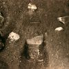
PHOE-SOL007-lg_1601.jpgThat's a "Scoop"! - Sol 7 (MULTISPECTRUM; credits: Lunexit)68 visiteJune 1, 2008 -- TUCSON, Arizona
NASA's Phoenix Mars Lander reached out and touched the Martian Soil for the first time on Saturday, May 31, the first step in a series of actions expected to bring soil and ice to the Lander's experiments.
The lander's Robotic Arm scoop left an impression that resembles a footprint at a place provisionally named Yeti in the King of Hearts target zone, away from the area that eventually will be sampled for evaluation.
The impression in the soil was captured by Phoenix's Stereo Surface Imager. Features and locations around the Phoenix lander are being named for fairy tale and mythological characters.
"This first touch allows us to utilize the Robotic Arm accurately. We are in a good situation for the upcoming sample acquisition and transfer," said David Spencer, Phoenix's surface mission manager from NASA's Jet Propulsion Laboratory in Pasadena, California.
Phoenix's Robotic Arm Camera also took a number of images of the "Snow Queen" site of what is believed to be exposed ice under the lander.
"What we see in the images is in agreement with the notion that it may be ice, and we suspect we will see the same thing in the digging area", said Uwe Keller, Robotic Arm Camera Lead Scientist from the Max Planck Institute for Solar System Research, Katlenburg-Lindau, Germany.MareKromium
|
|

PHOE-SOL007-PIA10742~0.jpgICE!!!!! - Sol 7 (True Colors + MULTISPECTRUM; credits: Dr Marco Faccin & Lunexit)68 visitenessun commentoMareKromium
|
|
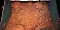
PHOE-SOL007-lg_1698.jpgUnbelievable!!!! - Sol 768 visiteAbbiamo notificato quest'oggi, alle ore 17:43 ed alle ore 17:45 CET, rispettivamente, le elaborazioni del Dr Faccin ai seguenti indirizzi NASA:
1) phxepo@lpl.arizona.edu <phxepo@lpl.arizona.edu> e
2) phx-webmaster@lpl.arizona.edu <phx-webmaster@lpl.arizona.edu>
Nessuna risposta a noi, come ovvio, ma pubblicazione, alle ore 20:20 CET (un caso più unico che raro di "solerzia") sul Sito Ufficiale Phoenix (http://phoenix.lpl.arizona.edu/), di questa elaborazione "NASA" del medesimo frame processato dal Dr Faccin, ma con un evidente shift cromatico.
Morale: non solo gli Amici di Pasadena sono arrivati "tardi", ma hanno pure copiato e cromaticamente "taroccato" la nostra elaborazione - che comunque era e rimane la PRIMA ELABORAZIONE A COLORI pubblicata sul WWW la quale rappresenta il ghiaccio di Vastitas Borealis.
Un nostro commento "al volo" ed "onesto" sul comportamento della NASA e del Max Planck Institute c/o University of Arizona? RIVOLTANTE!!!!
p.s.: esiste (ED E' VISIBILE!) una prova INCONFUTABILE che questa elaborazione è stata fatta sul frame colorizzato dal Dr Faccin. Sapreste individuarla?... Piccolo aiuto: "look up"!...MareKromium
|
|
| 399 immagini su 34 pagina(e) |
|
|
|
|
|
17 | |
|
|
|
|
|
|








