| Piú viste - From Ashes to Eternity: the Phoenix Mars Mission |

PHOE-SOL001-lg_398-003.jpgGood-Evening Phoenix! - Sol 1 (Natural Colors and MULTISPECTRUM; credits: Lunexit)70 visitenessun commentoMareKromium
|
|
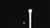
PHOE-SOL006-lg_1088.jpgObjects near the Sun? - Sol 670 visiteL'Effetto "Goccia" che viene provocato dal Sole - ripreso a fuoco diretto - è palesemente ovvio (un mero effetto di over-saturazione). Ma che cosa sono gli altri oggetti che appaiono nel frame?!?...
M.L.S.T.: 15:26:08
Camera elevation: 36,5227°
Azimuth: 241,593° MareKromium
|
|
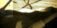
PHOE-SOL007-lg_2274-A.jpgIce on the Lander - Sol 7 (false colors; credits: Dr M. Faccin)70 visiteEsiste del "ghiaccio superficiale" (e frammisto a terriccio) sull'area di Landing della Sonda Phoenix? Beh, a giudicare da quanto si vede in questo frame e nei due detail mgnf che seguono (tutti realizzati dal Dr Faccin), la risposta non può che essere "SI". Certo che c'è ghiaccio.
I retrorazzi che hanno regalato una quieta discesa ed un soft-landing alla Sonda Phoenix hanno - a quanto pare - liquefatto un grande quantitativo di ghiaccio superficiale; lo hanno trasformato in vapore acqueo e questo, dopo aver "accarezzato" alcune componenti situate nella porzione inferiore del Lander, si è poi rapidamente ricongelato, lasciando quelle "bollicine" (una sorta di mini-escrescenze) che tanto bene si vedono in questi frames.
Dunque, se il discorso delle "Evidenze Oggettive" ha un senso, qui abbiamo un'altra Evidenza Oggettiva del fatto che la superficie di Vastitas (o, se non altro, quella della zona in cui è avvenuto il Landing di Phoenix) è effettivamente ricca di ghiaccio ANCHE superficiale. E perchè non lo si vede nei frames panoramici? Perchè è FRAMMISTO al terriccio di Vastitas!
Che dite? Vi piace la "teoria"? Chissà quanto ci metteranno gli Amici di Pasadena prima di avanzare questa ipotesi...
Complimenti e CONGRATULAZIONI, ancora una volta, al Dr Faccin!MareKromium
|
|
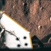
PHOE-SOL038-lg9711-9712-9713.jpgLooking Down... - Sol 38 (Superdefinition + MULTISPECTRUM; credits: Dr G. Barca & Lunexit)70 visitenessun commentoMareKromium
|
|
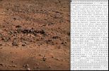
PHOE-SOL043-Exadecimal.jpgInteresting "Caption" - Sol 43 (natural colors; credits: Dr M. Faccin)70 visiteIn questo nuovo e spettacolare Lavoro del Dr Faccin abbiamo un frame in Colori Naturali davvero molto bello - e stupendamente definito - il quale è accompagnato da una "Caption" (ottenuta in esadecimale) che, almeno a nostro parere, suona piuttosto "criptica".
Curiosamente, infatti, a noi non sembra che esista correlazione fra quanto si vede nel frame (un outcrop che si troverà ad una decina/quindicina di metri dal Lander) e quanto si legge nella Caption "allegata" al frame, la quale fa riferimento ad un esperimento sulla conduttività - Conductivity Analyzer - di un campione di Suolo Marziano e ad una coppia di frames (un "before" ed un "after") correlati alla raccolta ed alla deposizione (forse sarebbe meglio dire "allocazione") del campione stesso.
Tale acquisizione di un "prima" e di un "dopo", in accordo alla Caption Esadecimale, sarebbe finalizzata ad evidenziare, mediante una comparazione delle immagini, la presenza (nel Campione?) di elementi (features) che POTREBBERO ESSERE DERIVATI DA FONTE NON MARZIANA - questo passaggio è così criptico che non ci sentiamo di commentarlo.
Curiosa la dizione "The sample illumination configuration was Special", la quale ci dice che l'illuminazione del campione con il gruppo luce di cui è dotato Phoenix è stata "Speciale" (non comprendiamo il senso di queste frasi, purtroppo, e quindi non ci sbilanciamo).MareKromium
|
|

PHOE-SOL046-rgblg_12495.jpgSunset - Sol 46 (Superdefinition + natural colors + MULTISPECTRUM; credits: Dr M. Faccin & Lunexit)70 visitenessun commentoMareKromium
|
|

PHOE-SOL094-PIA11060.gifIce Clouds over Vastitas - Sol 94 (GIF-Movie; credits: NASA)70 visiteClouds scoot across the Martian Sky in a movie clip consisting of 10 frames taken by the Surface Stereo Imager on NASA's Phoenix Mars Lander.
This clip accelerates the motion. The camera took these 10 frames over a 10-minute period from 14:52 to 15:02 M.LT. at the Phoenix Site during Sol 94 (Aug. 29), the 94th Martian day since landing.
Particles of water-ice make up these clouds, like ice-crystal cirrus clouds on Earth. Ice hazes have been common at the Phoenix site in recent days. The camera took these images as part of a campaign by the Phoenix team to see clouds and track winds. The view is toward slightly West of due South, so the clouds are moving Westward or West-NorthWestward.
The clouds are a dramatic visualization of the Martian Water Cycle. The water vapor comes off the North Pole during the peak of Summer. The Northern-Mars Summer has just passed its peak water-vapor abundance at the Phoenix Site. The atmospheric water is available to form into clouds, fog and frost, such as the Lander has been observing recently. MareKromium
|
|
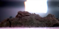
PHOE-SOL099-lg27005-27006-27007.jpgA "Scoop" of Vastitas - Sol 99 (Superdefinition and natural colors; credits: Dr G. Barca)70 visitenessun commentoMareKromium
|
|
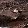
PHOE-SOL101-MF-LXT.jpgFrosty Rocks - Sol 101 (natural colors; credits: Dr M. Faccin)70 visitenessun commentoMareKromium
|
|
PHOE-SOL111-NASA-PIA11193.jpgIn Loving Memory...Six days after Lunexit! - Sol 111 (false colors; credits: NASA)70 visiteCome previsto dal Dr Faccin, ecco che - sebbene con 6 giorni di ritardo - è arrivata sul NASA Planetary Photojournal la scopiazzatura del frame da noi costruito in colori naturali e pubblicato il 18 Settembre u.s.
L'abbiamo detto un pò di volte, e lo ripetiamo: SIAMO ONORATI! Ma se, di quando in quando, la NASA desse a Lunexit quello che è di Lunexit...SAREMMO PIU' CONTENTI.
Null'altro da dire, purtroppo.MareKromium
|
|

PHOE-SOL132-lg38673-38674-38675-2.jpgThe "Trench" - Sol 132 (Superdefinition and possible True Colors; credits: Dr G. Barca)70 visitenessun commentoMareKromium
|
|

B-PIA09944.jpgFar-Northern Destination for Phoenix Mars Lander69 visiteCaption NASA:"The planned Landing Site for NASA's Phoenix Mars Lander lies at a latitude on Mars equivalent to Northern Alaska on Earth. It is within the region designated "D" on this global image.
This is an orthographic projection with color-coded elevation contours and shaded relief based on data from the Mars Orbiter Laser Altimeter on NASA's Mars Global Surveyor Orbiter. Total vertical relief is about 28 Km (about 17 miles) from the top of the highest volcano (red) to the Northern Lowlands (blue).
North Pole is where the longitude lines converge".MareKromium
|
|
| 399 immagini su 34 pagina(e) |
 |
|
|
|
|
13 | |
|
|
|
|








