Mars Reconnaissance Orbiter (MRO)
|
|
|
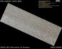
PSP_004687_0930_RED_abrowse.jpgSouth Polar Residual Cap Monitoring (Natural Colors; credits: Lunexit)77 visiteAs on Earth, the seasonal frost caps of Mars grow and recede each year. But seasonal frost on Mars is composed of Carbon Dioxide Ice (also known as Dry Ice), not water ice as on our Planet.
Near the South Pole of Mars, the seasonal CO2 frost never completely disappears, leaving a residual ice cap of CO2 ice throughout the Summer. This HiRISE image shows part of the South Polar Residual Cap, with many shallow Pits dubbed "Swiss Cheese Terrain". Because the Sun is always low in the sky at this latitude, the steep walls of the Pits receive more solar energy than the high-standing, flat areas between the Pits.
This causes the walls of the Pits to retreat several meters per year as Sunlight causes the CO2 ice to evaporate directly to gas, a process called "sublimation".
In some depressions, ridges or blocks of material a couple of meters (several feet) across are visible at the base of the depression walls, likely fallen from the walls during the sublimation and retreat process. At this rate, the layer of Carbon Dioxide ice could completely disappear in about 100 years from now, if not replenished.
Nota Lunexit: interessanti annotazioni. Peccato che la maggiore implicazione da esse derivante (quote: "...lo strato di CO2 che ricopre la Regione Sud Polare di Marte SCOMPARIRA' entro 100 anni da oggi, se non reintegrato...") non è stata minimamente toccata.
Stile NASA, of course. Nihil sub Sole novi, quindi...MareKromium
|
|
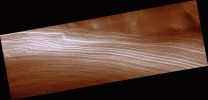
PSP_004708_1000_RED_browse-00.jpgFault in the South Polar Layered Deposits (CTX Frame - Extremely Enhanced Natural Colors; credits for the additional process. and color.: Dr Paolo C. Fienga - Lunexit Team)90 visiteThis image spans a section of the south polar layered deposits (SPLD). The SPLD are composed of layers of water ice mixed with impurities (mostly dust). The most similar terrestrial analog to the SPLD are ice sheets, like those covering most of Greenland and Antarctica.
Faults are created when rock (or, in this case, water ice) breaks due to some outside force and rocks (or ice) along either side of that break move in opposite directions. One of the most famous faults on Earth is the San Andreas Fault in California. There is a crack between the floor of the Pacific Ocean, plus a little bit of the California and Mexico coastline, and the rest of North America; the Pacific Ocean floor is moving northward along that crack, but North America is moving southward. Because the two sides are grinding against each other, they sometime stick together and then move again in jerky fashion, much like the way if you try to rub pieces of rough sand paper together. When movement along the fault occurs after a period of sticking together, this creates an earthquake.
For the case of this fault on Mars, it is unlikely that a "Marsquake" occurred when movement happened along this fault, because it is so small (over 1000 times shorter than the San Andreas Fault). This is interesting because faults are rare in the Martian polar layered deposits. The fault may have been created during widespread flow of the SPLD. Some of the stiffer ice could not flow and broke instead. Ice can only flow fast enough to create faults when it is relatively warm. Similarly, if you cool molasses enough, it becomes hard and doesn't flow. But the temperatures on Mars today are probably not warm enough to allow the creation of faults. This is why faults are so rare in the Martian ice. When were temperatures warm enough? This is still a mystery.
MareKromium
|
|
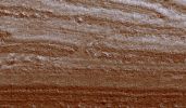
PSP_004708_1000_RED_browse-01.jpgFault in the South Polar Layered Deposits (EDM - Extremely Enhanced Natural Colors; credits for the additional process. and color.: Dr Paolo C. Fienga - Lunexit Team)88 visiteThe figure shown here is a cutout of the previous frame (1,8 Km across, or about 1,1 mile) showing a very interesting and smewhat rare feature: a fault. The fault is the thin, diagonal line that cuts through most of the image, from near the lower left corner to near the upper right corner. On each side of the fault, the layers that cross the fault are slightly off-set from one other; in other words, the layers don't line-up with each other anymore. The relationship between the angles at which the layers and fault are exposed and the movement along the fault is complex, but, in general, the layers on the left side of the fault are slightly lower than those on the right.MareKromium
|
|
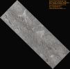
PSP_004739_0935_RED_browse.jpgSouth Pole Residual Cap - Swiss-Cheese Terrain Monitoring (Natural Colors; credits for the additional process. and color.: Dr Paolo C. Fienga - Lunexit Team)84 visitenessun commentoMareKromium
|
|
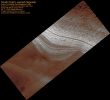
PSP_004742_0990_RED_browse.jpgGeologic History Recorded in the South Polar Layered Deposits (Extremely Enhanced Natural Colors; credits for the additional process. and color.: Dr Paolo C. Fienga - Lunexit Team)65 visiteThe Polar Layered Deposits on Mars are thought to be composed of varying amounts of water ice and dust. The variations in the relative amounts of ice and dust are probably caused by recent climate changes on Mars, similar to ice ages on Earth.
This image of the South Polar Layered Deposits shows many layers, some of which are cut off or truncated against other layers (near the center of the image). These truncations are probably due to periods of erosion separating periods of deposition.
After nearly horizontal layers are deposited, they can be partly eroded (perhaps by winds) before more layers are deposited over them. In this image, there is evidence for at least two such episodes of erosion and burial. These types of observations are useful to Mars scientists as they try to unravel the climate history of Mars. MareKromium
|
|
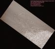
PSP_004765_0940_RED_browse.jpgSouth Pole Residual Cap - Swiss-Cheese Terrain Monitoring (Natural Colors; credits for the additional process. and color.: Dr Paolo C. Fienga - Lunexit Team)78 visiteLike Earth, Mars has concentrations of water ice at both Poles. Because Mars is so much colder however, CO2 ice is deposited at high latitudes in the Winter and is removed in the Spring, analogous to winter-time water ice/snow on Earth.
Around the South Pole there are areas of this CO2 ice that do not disappear every Spring, but rather survive Winter after Winter; this persistent CO2 ice is called the "South Pole Residual Cap". The retention of CO2 ice throughout the year by the Southern Polar Cap is one characteristic that distinguishes it significantly from Mars' North Polar Cap.
As can be seen in this HiRISE image of the South Pole Residual Cap, relatively high-standing smooth material is broken up by circular, oval, and blob-shaped depressions. This patterned terrain is called "Swiss Cheese" terrain.MareKromium
|
|
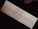
PSP_004778_0945_RED_browse.jpgSouth Pole Residual Cap - Swiss-Cheese Terrain Monitoring (Natural Colors; credits for the additional process. and color.: Dr Paolo C. Fienga - Lunexit Team)77 visitenessun commentoMareKromium
|
|

PSP_004804_1105_RED_abrowse.jpgGullies in Sisyphi Planum (Absolute Natural Colors; credits for the additional process. and color.: Dr Paolo C. Fienga - Lunexit Team)95 visiteImage PSP_004804_1105 shows the Walls of a large Pit inside Lyell Crater, near the South Polar Region.
This image was acquired during a period of elevated Atmospheric Dust, following a series of Dust Storms that encircled the Planet; this is the cause of the longitudinal bands of contrasting gray levels in the image. We can still see through the thick Atmosphere, though, Gullies and other subtle features which could have been produced by water and ice present at or near the Surface.
The otherwise subdued Surface in this Region is criss-crossed by numerous fissures, forming Polygons some 10 mt (9 yards) across. Similar features in both shape and scale can be found in terrestrial Periglacial Regions such as Antarctica, where ice is present at or near the Surface. Antarctica's features are the product of repeated expansion and contraction of the soil-ice mixture due to seasonal temperature oscillations. This results in Polygonal Networks of Stress Fractures. MareKromium
|
|
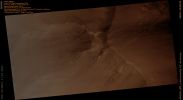
PSP_004805_1710_RED_abrowse.jpgOn the Edge of Ganges Chasma (Absolute Natural Colors; credits for the additional process. and color.: Dr Paolo C. Fienga - Lunexit Team)100 visiteThe Troughs and Chasms of the Valles Marineris Canyon System contain Light-Toned Deposits of enigmatic origin. The light materials, often layered, have variously been proposed to be Volcanic Ash or Sediments laid down by Rivers, Lakes or Sand Dunes.
One aspect of the Light-Toned material that has remained unclear is the timing of its deposition relative to canyon formation - was the material deposited in the Troughs, or does it crop out in the Walls, indicating that it existed before the Valles Marineris Canyon System formed?
This HiRISE image shows a part of the wall of Ganges Chasma. (This image, taken during the major Dust Storms which have raged through the summer of 2007, is grainy and low-contrast because of Dust in the Atmosphere). The Plateau above the Chasm is on the right side of the image, with the Wall of the Trough descending to the North. A few fine Layers, likely Basalt Flows, form the cap layers.
In the Spur, at the center of the image, light material appears to crop out, contrasting with the relatively dark material elsewhere in the Wall of the trough. At least some of this material is inherently lighter than other Wallrock; changes in tone occur at several sites where there are no breaks in Slope.
The light material appears be forming Spurs and Ridges similar to the surrounding rock, suggesting that it comprises at least some part of the Walls. However, darker, bouldery material occurs at the same level just to the West (up) of the light patch, indicating that the light outcrop may not extend very far.
Images like this provide clues to help unravel the history of deposition and deformation in Valles Marineris, and may eventually tell a complex story. In order to fully understand what this image means, several questions must be addressed: is this light material the same as intensively Layered Deposits observed elsewhere?
How extensive are light Wall Materials?
Are these materials conformable (part of a continuous sequence) with the rest of the Wall?
More HiRISE imaging will help address these questions. MareKromium
|
|
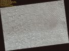
PSP_004820_0940_RED_browse.jpgFingerprint Terrain with Sawtooth Patterns in the South Polar Ice Cap (Natural Colors; credits for the additional process. and color.: Dr Paolo C. Fienga - Lunexit Team)75 visiteThis image shows a portion of the South Polar Ice Cap. The ice you see here is frozen CO2 rather than the frozen water you are used to here on Earth.
Even on Mars, where the temperatures are much lower than on Earth, CO2 ice is a volatile substance. As it is so unstable, large amounts can sublimate very quickly when heated. In this ice cap we can see icy features shrink in size by several meters per year as the ice that makes them up is removed by solar heating. Usually these icy features are almost circular as you get equal amounts of Sunlight from every direction when you are at the Pole.
However, in this location something strange has happened. Instead of the usual circular features we see features that are decidedly linear in shape. These sets of linear features have been dubbed "fingerprint terrain" by Planetary Scientists. They are seen in several locations in this ice cap and usually have a wavelength close to 90 mt (295 feet). It's hard to understand why linear features would form in this sort of environment by sublimation of ice alone.
It is possible that these features are formed instead by atmospheric processes. Either the features are sand dunes covered by a thin covering of frost or they might be made up of loose ice crystals that saltate like sand grains and have collected into ripples.
It would be a huge surprise to find sand dunes in this location, just as you wouldn't expect to see sand dunes on top of the Greenland ice sheet on Earth. To confirm that they are made of CO2 ice, HiRISE will image this location again at the end of the year and compare it to this image to look for changes.
Icy features should show large changes, but sand dunes move much more slowly. MareKromium
|
|
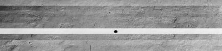
PSP_004847_1745-WFull.JPGThe "Martian Black Hole" (general context frame)79 visiteRingraziamo il Dr Gianluigi Barca per il lavoro svolto e per la pazienza avuta. Di che si tratta? Si tratta della ricostruzione, strip-by-strip, della Regione situata nei pressi del Grande Vulcano Arsia Mons laddove, come vedete bene, si trova il nostro "Martian Black Hole".
Come è facile notare, la striscia che comprende la voragine è stata processata (o ripresa?) in maniera tale da risultare, rispetto alle altre stripes che vanno a comporre l'interezza della Regione, completamente piallata e palesemente sovraesposta.
Il motivo (l'unico che ci viene in mente) potrebbe essere trovato nel tentativo di contrastare meglio quello che si vedeva "dentro" la voragine. Tuttavia, considerati i mezzi dei quali la NASA dispone, ci sentiamo pure di dire che quanto fatto NON è esattamente un "gran bel lavoro".
E allora?
E allora ribadiamo ed esplichiamo meglio quanto scritto in "Velvet Underground": o la NASA è in perfetta Buona Fede (però lavora - spesso - "in qualche modo"...), oppure la porzione di terreno che circonda la "voragine" è stata VOLUTAMENTE piallata, per motivi ignoti.
La Verità? Noi non la sappiamo, ma la nostra Coscienza e Professione ci spingono a proporre TUTTE le ipotesi che ci vengono in mente e che trovano una certa sostanza. Per il resto...dovete decidere Voi.MareKromium
|
|

PSP_004847_1745-WFull2.jpgThe "Martian Black Hole" (general context frame - False Colors; elab. Lunexit)83 visiteCon questa ricostruzione in colori "naturali" della Regione su cui si trova il nostro "Black Hole", forse riusciamo a rispondere (finalmente con chiarezza) a qualche Lettore il quale ci chiedeva come mai, a fronte di frames che inquadrano la stessa Regione Marziana, spesso le colorizzazioni che facciamo sono diverse. Ebbene la risposta è in questo frame-composite: la nostra colorizzazione RISENTE SEMPRE e COMUNQUE del tipo di filtro adottato dalla Sonda per effettuare la ripresa (nonchè delle effettive condizioni di illuminazione "locali")! Questo caso è eclatante e chiarificatore: diverse stripes, ottenute con diversi filtri, producono - anche a fronte dell'uso di un processo di colorizzazione omogeneo ed unitario - dei risultati MOLTO diversi (provate con JASC Paint Shop Pro, se volete - funziona egregiamente per le colorizzazioni, e verificate Voi stessi).MareKromium
|
|
| 2236 immagini su 187 pagina(e) |
 |
|
|
|
|
118 | |
|
|
|
|








