Mars Reconnaissance Orbiter (MRO)
|
|
|
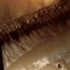
PSP_004071_1425_RED_browse-01.jpgMesas in Gorgonum Chaos (edm - possible True Colors; credits: Lunar Explorer Italia)80 visitePSP_004071_1425 shows mesas that are part of Gorgonum Chaos, a region of chaotic terrain, which is a jumble of mounds and mesas grouped together.
Chaotic terrain is most commonly found in Mars near the sources of the gigantic outflow channels. Gorgonum Chaos is one of the few exceptions.
Some of the troughs between the mesas appear to have V-shaped bottoms; there is no obvious flat floor in between. Others have dunes running down their centers probably indicating flat floors. It is possible that the mesas were once connected and that something caused fractures in the original mesa's surface that were then preferentially eroded.MareKromium
|
|

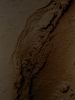
PSP_004072_1845_RED_abrowse-00.jpgThe "End" of Lethe Vallis (CTX Frame - Enhanced Natural Colors; credits for the additional process. and color.: Dr Paolo C. Fienga - Lunexit Team)123 visiteHiRISE image PSP_004072_1845 shows the funnel-shaped Terminus of Lethe Vallis, a winding Channel in the Elysium Planitia Region of Mars.
Lethe Vallis flows from South-West to North-East between 2 basins: Cerberus Palus and Eastern Elysium Plantia. Where it empties into the latter, the Channel abruptly widens (see the EDM n.1).
On the West side (up) of this HiRISE image, Lethe Vallis is approx. 800 mt wide; on the East side (down), it is more than 7 Km in width. As the fluid that carved the Channel spread out, its erosive power diminished. Thus, where the Channel is wider, it contains numerous high-standing Mesas that are primarily composed of pre-existing material that was not fully eroded away.
The Floor of Lethe Vallis is covered in solidified Lava and blanketed by a thin layer of light-toned Dust. The Lava has a rough, ridged appearance where its surface buckled as it cooled, and a smoother polygonal texture where it was not significantly deformed. Interestingly, Lava textures are visible high on the Banks and Terraces of the Lethe Vallis. Farther away from the Channel, the Terrain is older and more heavily cratered.MareKromium
|
|

PSP_004072_1845_RED_abrowse-01.jpgThe "End" of Lethe Vallis (EDM n.1 - Enhanced Natural Colors; credits for the additional process. and color.: Dr Paolo C. Fienga - Lunexit Team)119 visitenessun commentoMareKromium
|
|
PSP_004072_1845_RED_abrowse-03.jpgThe "End" of Lethe Vallis (EDM n.2 - Enhanced Absolute Natural Colors; credits for the additional process. and color.: Dr Paolo C. Fienga - Lunexit Team)118 visitenessun commentoMareKromium
|
|
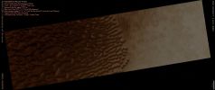
PSP_004077_1325_RED_abrowse-PCF-LXTT.jpgLarge Dunefield inside Proctor Crater (Absolute Natural Colors; credits for the additional process. and color.: Dr Paolo C. Fienga - Lunexit Team)99 visiteImage PSP_004077_1325 shows the edge of a Dark Dunefield on the Floor of Proctor Crater, an about 150 Km diameter Crater located in the Southern Highlands of Mars.
The Dark Dunes are composed of Basaltic Sand that has collected on the bottom of the Crater. Dark Dune "Slip Faces" - such as the steeper (---> più ripido) sides of the Dunes - are located on the Eastern side of the Dunes and are believed to have formed in response to Fall and Winter Westerly Winds caused by geostrophic forces (winds balanced by Coriolis and pressure gradient forces).
Superimposed on their Surface are smaller Secondary Dunes that are commonly seen on terrestrial Dunes of this size.
Many smaller and brighter bedforms, most likely small Dunes or granule Ripples, cover the substrate between the larger Dark Dunes as well as most of the Floor of Proctor Crater. The Dark Dunes overlie the small bright bedforms indicating that they formed more recently.
In several areas, however, the dark dunes appear to influence the orientation of the small bright Dunes, possibly by Wind flowing around the larger ones, suggesting that both dark and bright bedforms are coeval.
The Dunes in Proctor Crater may still be active today, moving in response to Martian Winds. MareKromium
|
|
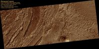
PSP_004078_2015_RED_browse-00.jpgLayered Deposits in Becquerel Crater (possible natural colors; credits: Lunar Explorer Italia)70 visiteImage PSP_004078_2015 shows light-toned layered deposits along the floor of Becquerel Crater, an impact crater in Arabia Terra. The deposits consist of stacked, repeating layers which consistently appear to be only a few meters thick.
The surface of the deposits also appears to be cracked into blocks a meter or so in length.
Layered deposits, such as these, form from sediments once deposited within the crater. Possible origins for the sediments include windblown debris, volcanic ash falling from the sky, or sediments that accumulated in a lake on the crater floor. The regular thickness of the layers suggests that they were most likely deposited in a water environment or by wind in a cyclic process.
Some of the layering has a dark appearance that produces an alternating bright-dark “zebra” banding. This may be the result of a thin surface layer of coarser and darker basalt sand collected on the more level surfaces, rather than indicating compositional differences in the eroded layered beds. Faults can also be seen displacing portions of the layered bed. An example of this can be seen just left of center in the bottom half of the subimage. The faulting indicates that the deposits have experienced disruption since their emplacement.
MareKromium
|
|
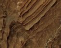
PSP_004078_2015_RED_browse-01.jpgLayered Rocks within Becquerel Crater (enhanced natural colors; credits: Lunar Explorer Italia)82 visiteRhythmic bedding in sedimentary bedrock within Becquerel Crater on Mars is suggested by the patterns in this image from the High Resolution Imaging Science Experiment (HiRISE) camera on NASA's Mars Reconnaissance Orbiter.
Three dimensional analysis based on stereo pairs of images confirmed the regularity of repetition in the thickness of the beds. In the left half of this image, some of the rhythm is apparent as a series of bundles of about 10 individual layers per bundle. By corresponding to a known 10-to-one pattern in changes in the tilt of Mars' Rotation Axis, this pattern suggests the periodicity in the rock layers results from cyclical changes in the Planet's tilt.
This view covers an area about 1150 meters (0,7 miles) wide. Individual layers in the scence average 3,6 meters (12 feet) thick. The view is presented in enhanced natural colors emphasizing the differing compositions of surface material. Sand trapped in relative low points in the terrain appears grey-blueish. Sedimentary rocks appear brown.
Faulting apparent in the image suggests that the deposits are hardened rock, not softer material. Tilting of the layers in different ways and the surface topography made the three-dimensional analysis necessary for determining the thickness of layers.
This image is a portion of the HiRISE image catalogued as PSP_004078_2015, taken on June 10, 2007.
The location of the imaged area is at 22° North Latitude, 352° East Longitude, within the Arabia Terra Region.MareKromium
|
|
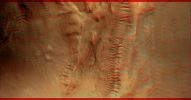
PSP_004085_1420_PSP_004019_1420_RED_browse.jpgMultiple Levels of Gullies (3D and possible True Colors; credits: NASA and Lunar Explorer Italia)80 visiteThis image shows groups of gullies at different elevations on the same crater wall. Although gullies are common in the mid-latitudes of Mars, they are rarely found to exist at such distinct elevations as visible here.
The mounds on the floor, one of which contains gullies, probably formed during a late stage of crater formation. Both levels of gullies appear to originate at layers. These layers might be ice-rich, or they might be capable of conducting water to the surface. The anaglyph image, providing a three-dimensional perspective, reveals the relative depth of the gullies in the crater walls and amount of alluvial material deposited at the bottom of the gullies.
The gullies visible here are good candidates for formation by subsurface water, as opposed to melting ice or snow originating on the surface. The rounded, theater-shaped alcove and tributary heads are typical of features formed by groundwater sapping on Earth. Surface runoff does not form this morphology.
This image contains possible evidence of subsurface piping, when soil pores connect to form a "pipe" that transports water. When piping occurs, water carries soil with it, leaving empty space beneath the surface. As this process continues, the overlying surface can no longer support itself, and it collapses to form a depression. Several depressions that could have formed this way are seen in this image. The depressions are also directly upslope of more developed alcoves. They also originate at upslope layers, and might be examples of developing alcoves.
Mars Local Time: 15:21 (early afternoon)
Coord. (centered): 37,9° South Lat. and 169,6° East Long.
Spacecraft altitude: 268,5 Km (such as about 167,8 miles)
Original image scale range: 26,9 cm/pixel (with 1 x 1 binning) so objects ~81 cm across are resolved
Map projected scale: 25 cm/pixel
Map projection: EQUIRECTANGULAR
Emission Angle: 20,6°
Phase Angle: 24,7°
Solar Incidence Angle: 45° (meaning that the Sun is about 45° above the Local Horizon)
Solar Longitude: 255,0° (Northern Autumn)
Credits: NASA/JPL/University of Arizona
Additional process. and coloring: Lunar Explorer ItaliaMareKromium
|
|
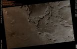
PSP_004091_1845_RED_abrowse.jpgRidges in Terra Meridiani (Absolute Natural Colors; credits for the additional process. and color.: Dr Paolo C. Fienga - Lunexit Team)116 visiteThis HiRISE image shows an arcuate ridge in Terra Meridiani. The ridge is most likely a former streambed, now exposed in inverted relief; the wandering path is not expected for an exhumed fault or volcanic dyke. The stream that formed this ridge must have been ancient as the ridge is buried by brighter rocks, which are themselves very old, having been thickly deposited and then heavily eroded.
The Mars Exploration Rover Opportunity landed in the same region of Mars, and the rocks it has examined are likely part of a sequence similar to that exposed here. The rocks exposed at the Opportunity landing site are mostly aeolian (wind-deposited) sandstone, but show evidence of past water, reaching the surface at times. Opportunity has access to only a few meters of a stack of sediments that is hundreds of meters thick.
Since water was present at times at the Opportunity landing site, surface water elsewhere in the sequence of sediments is perhaps not too surprising. However, evidence like this may indicate that sediments were deposited by a broader range of processes than just those inferred at the Opportunity site. This is important for unraveling the entire history of the region.
A stream channel could become inverted in several ways. Chemicals precipitating from the water could bind the streambed together, lava could fill the channel, or the bed could contain large boulders. In each case, the relatively resistant material of the stream channel could remain as the surrounding rock eroded. Here, the ridge is distant from any volcanic vent, and appears fractured, particularly in the southern portion. This indicates that the ridge material is consolidated and has some strength. Thus, the most likely mechanism for formation of this ridge is deposition of a chemical "cement" which hardened the streambed rock.
The plains surrounding the ridge are also fractured, indicating some degree of consolidation. These cracks could form by desiccation (water loss) from wet sediment or tensile fracturing as the weight of overlying rocks was removed. Cracks like this can also form in permafrost due to seasonal temperature changes; ground ice is unlikely this close to the equator, but it is possible that the cracks are a remnant of different climate conditions from the past.MareKromium
|
|
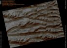
PSP_004230_1080_RED_abrowse.jpgDefrosting Dunefield inside Richardson Crater (Absolute Natural Colors; credits for the additional process. and color.: Dr Paolo C. Fienga - Lunexit Team)92 visiteCovered by Seasonal CO2 Frost, the Dunefield here in Richardson Crater has only partially defrosted, although the image was acquired late in Mars' Southern Spring.
Large patches of Carbon Dioxide Frost can be observed, linked in some places by Channels possibly carved into the ground by the erosion of CO2 gas, as blocks dry ice slide down slope and sublimate.
Numerous Dust Devil Tracks (or DDT for short) have left their mark.
MareKromium
|
|
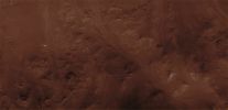
PSP_004277_1530_RED-PCF-LXTT-00.jpgFeatures of Holden Crater's Rim (CTX Frame "A" - Absolute Natural Colors; credits for the additional process. and color.: Dr Paolo C. Fienga - Lunexit Team)83 visiteHiRISE image PSP_004277_1530 covers a portion of the rim of Holden Crater, revealing breaches created when water over-topped the Rim and incised a series of Channels as it flowed down the Crater Wall.
The water responsible for the Channels was impounded outside of the rim of Holden in Uzboi Vallis (Holden Crater itself is approx. 150 Km in diameter).
Uzboi Vallis was interrupted when Holden Crater formed and the Rim formed an effective, temporary damn to flow farther to the North. Once the Uzboi Basin filled, water began flowing into Holden again, creating a series of low fan-shaped Deltas, alluvial deposits and a shallow, but relatively short-lived lake.
The Channels in this image were only active for a short time, as a Channel just to the East cut quickly into the Rim and became responsible for most of the drainage into the Crater.
The fact that most of the fan-shaped Deltas radiate from the Dominant Channel to the East rather than those in this image supports this scenario. MareKromium
|
|
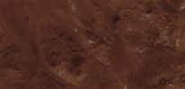
PSP_004277_1530_RED-PCF-LXTT-01.jpgFeatures of Holden Crater's Rim (CTX Frame "B" - Absolute Natural Colors; credits for the additional process. and color.: Dr Paolo C. Fienga - Lunexit Team)93 visiteHiRISE image PSP_004277_1530 covers a portion of the rim of Holden Crater, revealing breaches created when water over-topped the Rim and incised a series of Channels as it flowed down the Crater Wall.
The water responsible for the Channels was impounded outside of the rim of Holden in Uzboi Vallis (Holden Crater itself is approx. 150 Km in diameter).
Uzboi Vallis was interrupted when Holden Crater formed and the Rim formed an effective, temporary damn to flow farther to the North. Once the Uzboi Basin filled, water began flowing into Holden again, creating a series of low fan-shaped Deltas, alluvial deposits and a shallow, but relatively short-lived lake.
The Channels in this image were only active for a short time, as a Channel just to the East cut quickly into the Rim and became responsible for most of the drainage into the Crater.
The fact that most of the fan-shaped Deltas radiate from the Dominant Channel to the East rather than those in this image supports this scenario. MareKromium
|
|
| 2236 immagini su 187 pagina(e) |
 |
|
|
|
|
116 | |
|
|
|
|








