Mars Reconnaissance Orbiter (MRO)
|
|
|
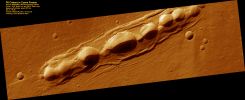
PSP_003370_2140_RED_browse.jpgPit Craters (or Collapse Pits) in Cyane Fossae75 visiteThis image shows several pits along the floor of Cyane Fossae, a set of fissures between the giant volcanoes of Olympus Mons and Alba Patera (North-East of Olympus Mons).
The fissures probably formed when the surface of the Planet was actively being stretched from the stresses of volcanic activity, causing the surface to split open along faults. There is no material piled up around the edges of the pits, as would be expected if these were impact craters or volcanic vents. Instead, parts of the Fossae floor likely collapsed into the void underlying Cyane Fossae, forming the pits.
This type of process, in which the crust is split open, has occurred here on Earth, and it created the geologic "basin and range" province of the western United States.
The walls of the pits are likely covered in dust and the few dark streaks along the walls are likely formed by avalanches of dust. Striations along the slope may be produced by the passage of DDs.
Dust also appears on the floors of the collapse pits and covered most of the plains nearby. Despite the presence of this layer of dust, bouldery outcrops occur in places along the wall, suggesting that the underlying material is hard and rocky.
MareKromium
|
|
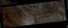
PSP_003379_1835_RED_abrowse.jpgMeridiani Planum (Natural Colors; credits for the additonal process. and color.: Dr Paolo C. Fienga - Lunexit Team)82 visitenessun commentoMareKromium
|
|
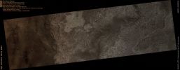
PSP_003392_1825_RED_abrowse.jpgMeridiani Planum (Natural Colors; credits for the additonal process. and color.: Dr Paolo C. Fienga - Lunexit Team)88 visitenessun commentoMareKromium
|
|
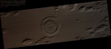
PSP_003398_1910_RED_browse-PCF-LXTT.jpgUnnamed Crater in Elysium Planitia (Absolute Natural Colors; credits for the additional process. and color.: Dr Paolo C. Fienga - Lunexit Team)120 visitenessun commentoMareKromium
|
|
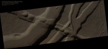
PSP_003426_2035_RED_abrowse-PCF-LXTT.jpgFaults and Channels in Elysium Mons (Absolute Natural Colors; credits for the additional process. and color.: Dr Paolo C. Fienga - Lunexit Team)126 visitenessun commentoMareKromium
|
|
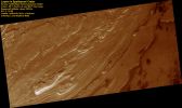
PSP_003442_1215_RED_browse-00.jpgLayers in Spallanzani Crater (context image)67 visiteThis image shows light-toned layered deposits along the floor of Spallanzani crater, a 72 Km (about 45 mile) diameter crater located just South-East of Hellas Planitia.
These layered deposits may be remnant sediments once deposited within the crater. Mechanisms for sediment deposition include windblown debris, airfall volcanic ash, or sediments that accumulated in a lake on the crater floor.
The slopes are covered in debris, and not fallen plates or blocks from the plateau edge.
This suggests that the layers are composed of weak materials that are protected by a stronger, more coherent surface.
The crater is named after the 18th Century Italian biologist, Lazzaro Spallanzani (1729-1799).
MareKromium
|
|
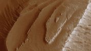
PSP_003442_1215_RED_browse-01.jpgLayers in Spallanzani Crater (extra-detail mgnf)110 visiteThe layers within Spallanzani Crater are eroding in a stair-stepped pattern.
Each layer appears as a sequence of a broad flat area or plateau, which drops off abruptly down to the next flat surface (see this extra-detail mgnf).
This stair-stepped pattern suggests that the layers have discreet boundaries that may be the result of differing compositions, time of deposition, or both. Near, but not at the edge of each plateau, the material is fracturing into polygonal plates or blocks that tilt downward away from the plateau center. MareKromium
|
|
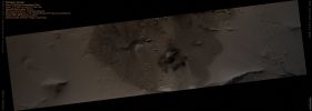
PSP_003450_1975_RED_abrowse-PCF-LXTT.jpgOlympus' Aureole (Absolute Natural Colors; credits for the additional process. and color.: Dr Paolo C. Fienga - Lunexit Team)103 visitenessun commentoMareKromium
|
|
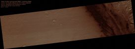
PSP_003453_1750_RED_browse-PCF-LXTT.jpgPossible MSL Landing Site inside Gale Crater (Absolute Natural Colors; credits for the additional process. and color.: Dr Paolo C. Fienga - Lunexit Team)354 visitenessun commentoMareKromium
|
|
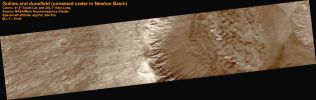
PSP_003464_1380_RED_browse-00.jpgGullies and Dunes in a Crater in Newton Basin (context image)63 visiteThis frame shows gullies associated with distinct layers located at multiple elevations along one crater wall as well as multiple generations of dunes that are eroding or covering a more coherent rock structure. The gullies in this crater appear to originate at the layers that cover a large extent of the slope. Gullies can be seen emanating from layers in two distinct sets, each at a different elevation. Gullies are often, but not always, form near layers.
Many of the gullies seen here have sinuous, or wavy, channels.
The bends are called meanders and, on Earth, meanders form in streams that have sustained and/or repeated flow. Not all of the gullies seen in this image extend the same distance downslope. This could result from differences in water supply, sediment supply, slope angle, and time of formation, among other factors.
Dunes are also visible in this image; they indicate the prevailing wind direction.
What is particularly interesting about this dune field is that there is exposed rock in the middle of it. This rock is either being exposed as the wind moves the dunes away from it or it is being covered. The dunes appear to outline the shape of the rock, which suggests that the rock has been uncovered long enough for dunes to form around it.
As the dunes shift over time, they will probably expose more of the underlying rock.MareKromium
|
|
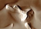
PSP_003464_1380_RED_browse-01.jpgGullies and Dunes in a Crater in Newton Basin (extra-detail mgnf)64 visiteThis extra-detail mgnf (~1 Km across) shows several generations of dunes interacting with the protruding rock.
MareKromium
|
|
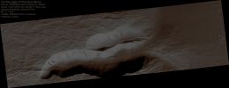
PSP_003476_1940_RED_abrowse-PCF-LXTT.jpgCollapse Feature at the Base of Olympus Mons (Absolute Natural Colors; credits for the additional process. and color.: Dr Paolo C. Fienga - Lunexit Team) 132 visitenessun commentoMareKromium
|
|
| 2236 immagini su 187 pagina(e) |
 |
|
|
|
|
110 | |
|
|
|
|








