Walking on Mars with Spirit and Opportunity
|
|
|
SOL758-9-2.jpgRocky Landscape - Sol 758 (possible True Colors; credits: Dr G. Barca & Lunexit)81 visitenessun commentoMareKromium
|
|
SOL758-9-3.jpgRocky Landscape - Sol 758 (possible True Colors; credits: Dr G. Barca & Lunexit)71 visitenessun commentoMareKromium
|
|

SOL758-Home Plate-PIA02688-1.jpgHome Plate: almost true colors and HR (1) - Sol 75872 visiteOn Feb. 19, 2006 - such as the 758th Martian day of exploration of the Red Planet by NASA's MER Spirit - the Rover acquired this panoramic view of the interior of Home Plate, a circular topographic feature amid the Columbia Hills.
This view, called the "Paige" panorama, is from the top of Home Plate. It shows layered rocks exposed at the edge as well as dark rocks exhibiting both smooth and sponge-like "scoriaceous" textures. To the East from this vantage point, McCool Hill looms on the horizon. At the base of McCool Hill is a reddish outcrop called Oberth, which Spirit may explore during the rapidly approaching Martian Winter. Von Braun and Goddard hills are partially visible beyond the opposite rim of Home Plate.
|
|

SOL758-Home Plate-PIA02688-2.jpgHome Plate: almost true colors and HR (2) - Sol 75889 visiteThe limited spatial coverage of this panorama is the result of steadily decreasing power available to the Rover for science activities as the Martian Winter arrives and the Sun traces a lower path across the sky. The Rover Team anticipates that the north-facing slopes of McCool Hill should sufficiently tilt the Rover's solar panels toward the Sun to allow Spirit to survive the winter.
The view covers about 230° of terrain around the Rover. Spirit's PanCam took 72 separate images of this scene with 4 different filters. This is an approximately true-color rendering using the Pancam's 75-, 535- and 432-nanometer filters. Image-to-image seams have been eliminated from the sky portion of the mosaic to better simulate the vista a person standing on Mars would see.
Cerchiatura Verde: non è un semplice difetto dell'incollatura fra le diverse fotografie. C'è effettivamente qualcosa di sfumato (ed in parte cancellato, ci sembra), quasi sul ciglio di McCool Hill.
|
|

SOL758-Home Plate-PIA02688-3.jpgHome Plate: almost true colors and HR (3) - Sol 75862 visitenessun commento
|
|

SOL758-Home Plate-PIA02688-5.jpgHome Plate: almost true colors and HR (4) - Sol 75871 visitenessun commento
|
|
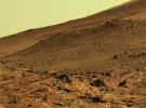
SOL758-Home Plate-PIA02688-6.jpgHome Plate: almost true colors and HR (5) - Sol 75862 visitenessun commento
|
|
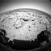
SOL759-2F193746982EFFAODGP1201R0M1.jpgFront-View (1) - Sol 75962 visiteSol 753: Spirit acquired images of a rock target dubbed Gray using the MI, brushed a surface target known as Manager using the RAT (Rock Abrasion Tool), and completed an 18-hour analysis of Manager using the Mössbauer Spectrometer. The Science Team opted to complete an overnight Mössbauer study before conducting an overnight APXRS (Alpha Particle X-Ray Spectrometer) study in order to decide how long to stay at this location. Because the Mössbauer spectrum was similar to that of an earlier un-brushed target nicknamed Barnhill, the Team directed the Rover to resume driving after collecting the APXRS data;
Sol 754: Spirit took after-brushing images of Manager with the MI, finished the analysis of Manager with the APXRS, and took PanCam images of Barnhill;
|
|
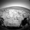
SOL759-2F193748136EFFAODOP1206R0M1.jpgFront-View (2) - Sol 75962 visiteSol 755 (Feb. 16, 2006): before moving on, Spirit rolled back from Manager and collected data from the site with the MTES (Miniature Thermal Emission Spectrometer). The Rover paused to take mid-drive images with the NavCam before "sliding into" Home Plate after driving 10 mt (about 33 feet) using visual odometery and 1,5 mt (about 4,9 feet) using autonomous navigation.
Odometry: as of Sol 755, Spirit's total odometry was 6.575 mt (such as 4,09 miles).
|
|
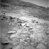
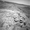
SOL759-2N193748574EFFAODQP0695R0M1~0.jpgHome Plate (1) - Sol 75992 visiteIn a race to collect as much scientific data as possible before the onset of Martian Winter, Spirit climbed to the top of "Home Plate" and acquired images of the surrounding terrain. Each day, Spirit logs a reduction in the total amount of solar energy collected as the Sun sinks lower on the Planet's Northern Horizon.
The Science Team's objective is to do as much science as possible while concentrating on a drive campaign that will move the Rover to the north-facing slopes of McCool Hill. The team has already begun mapping routes to McCool, where Spirit will attempt to survive a second Martian winter with its solar panels tilted toward the Sun.
|
|
SOL759-2N193748672EFFAODQP0695R0M1.jpgHome Plate (2) - Sol 75962 visitenessun commento
|
|
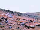
SOL759-HomePlate-MarsDaily.jpgHome Plate in false (but nice) colors - Sol 75982 visiteSpirit got its first view of Home Plate last August (2005), after cresting Husband Hill. It took the Rover 94 Martian Days, or Soles, to drive the 848 mt (about 2.782 feet, a little more than half a mile) of the formation. In all, the golf cart-sized Rover has driven about 4 miles across the surface at Gusev. The rocks and geologic characteristics of Home Plate are like no other found by either MER in the 25 months they have been rolling over the Red Planet.
Steve Squyres, the Mission's Principal Investigator, took time out from his hectic schedule to answer a few quick questions about the rock formation and about the overall status of the Rovers:
Space Daily:
The Home Plate rocks look like a volcano had rained down debris in the middle of water-sculpted strata.
Steve Squyres:
Well, that's an interesting interpretation, but we're a long way from having an answer yet.
SD:
Does anybody on the team have any idea how such markedly different rocks could lie in such close proximity?
SS:
There are a bunch of possibilities: Impact deposits, volcanic deposits, maybe wind- or water-lain sediments. In the images we have so far, the rocks look to some of us like they might be explosive volcanic deposits, but that's purely conjecture at this point - a working hypothesis. Everything is on the table until we've gotten more data down.
SD:
The rovers seem to be impervious to the Martian environment. Are they giving any signs of breaking down, or might they still be working when the Mars Science Laboratory lands in a few years?
SS:
They are not showing signs of breaking down. They are showing definite signs of age, but all the signs of age so far are ones that we can work around. So they're still very capable vehicles.
Of course, that could change at any time. We are 'waaay' past warranty on these vehicles, and there is no telling when they will die. It could be two years or now, or it could be tomorrow. So we treat each day as a gift.
As for the MSL, it's going to land in 2010 if all goes well, more than four years from now. If either MER rover is still alive when that happens, I will be very surprised.
|
|
| 5458 immagini su 455 pagina(e) |
 |
|
|
|
|
421 | |
|
|
|
|








